Property Record
32 Dansey Cir, Durham, NC 27713

Property Detail
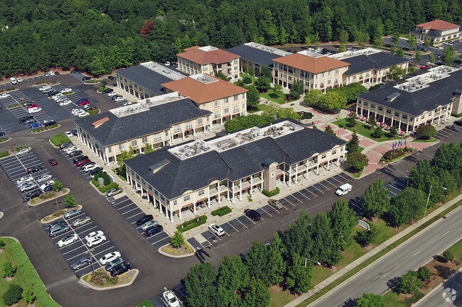
32 Dansey Cir
148179
PROP-TICON INC DBA/SUTTON PLACE APTS PL:000155-000259
Gardenaptcourtapt5plusunits
DURHAM
OI
North Carolina
B and X Area of moderate flood hazard, usually the area between the limits of the 100-year and 500-year floods.
8.67 AC
2025
South Durham
2025
Raleigh/Durham
002023
Durham-Chapel Hill, NC
65,979 SF
NEARBY LISTINGS FOR SALE OR LEASE
DEMOGRAPHICS near 32 Dansey Cir
1 mile
3 mile
5 mile
2024 Total Population
13,071
63,954
145,240
2029 Population
13,662
67,162
153,850
Pop Growth 2024-2029
+ 4.52%
+ 5.02%
+ 5.93%
Average Age
40
39
38
2024 Total Households
6,301
28,055
63,335
HH Growth 2024-2029
+ 4.84%
+ 5.17%
+ 6.14%
Median Household Inc
$104,635
$103,406
$91,149
Avg Household Size
2.00
2.20
2.20
2024 Avg HH Vehicles
2.00
2.00
2.00
Median Home Value
$393,089
$441,095
$457,432
Median Year Built
1992
1995
1996
Nearby Places
Map Layers
Map Styles
 Street
 Aerial
Transit
 Traffic
 Biking
Places
Listings with unknown addresses are not visible on the map
- Restaurants
- Banks
- Shops
- Fitness
- Groceries
PUBLIC TRANSPORTATION
COMMUTER RAIL
Durham Amtrak Station (Carolinian - Amtrak, Piedmont - Amtrak)
Drive
Walk
Distance
Durham Amtrak Station (Carolinian - Amtrak, Piedmont - Amtrak)
15 min
7.7 mi
AIRPORT
Raleigh-Durham International
Drive
Walk
Distance
Raleigh-Durham International
17 min
10.9 mi
Freight Ports
Port of Wilmington
Drive
Walk
Distance
Port of Wilmington
177 min
155.1 mi
SALE & LEASE HISTORY
LISTING DATE
SALE/LEASE

Sep 24, 2016
For Lease
Aug 22, 2019
For Lease
Nearby Properties
Address
Land Use
TOTAL SIZE
Lot Size
Zoning
Address
Land Use
TOTAL SIZE
Lot Size
Zoning
778,433 SF
90.38 AC
CC(D)
Address
Land Use
TOTAL SIZE
Lot Size
Zoning
11,568 SF
39.56 AC
RS-M(D)
Address
Land Use
TOTAL SIZE
Lot Size
Zoning
35.03 AC
RS-M(D)
Address
Land Use
TOTAL SIZE
Lot Size
Zoning
193,344 SF
10.96 AC
MU(D)
Address
Land Use
TOTAL SIZE
Lot Size
Zoning
23,889 SF
50.95 AC
OI
Address
Land Use
TOTAL SIZE
Lot Size
Zoning
7,080 SF
30.67 AC
OI,RS-M
Address
Land Use
TOTAL SIZE
Lot Size
Zoning
6,948 SF
21.22 AC
RS-M(D)
Address
Land Use
TOTAL SIZE
Lot Size
Zoning
10,143 SF
46.78 AC
PDR 5.940
Address
Land Use
TOTAL SIZE
Lot Size
Zoning
7,241 SF
25.34 AC
PDR 5.370
Address
Land Use
TOTAL SIZE
Lot Size
Zoning
8,199 SF
28.28 AC
PDR 12.000
Address
Land Use
TOTAL SIZE
Lot Size
Zoning
4,744 SF
12.90 AC
MU(D)
Address
Land Use
TOTAL SIZE
Lot Size
Zoning
280,771 SF
6.14 AC
RC(D)
Address
Land Use
TOTAL SIZE
Lot Size
Zoning
9,816 SF
26.57 AC
RS-M
Address
Land Use
TOTAL SIZE
Lot Size
Zoning
9,696 SF
20.94 AC
RS-M(D)
Address
Land Use
TOTAL SIZE
Lot Size
Zoning
13,634 SF
32.31 AC
RS-M
Address
Land Use
TOTAL SIZE
Lot Size
Zoning
12,864 SF
24.27 AC
RS-M
Address
Land Use
TOTAL SIZE
Lot Size
Zoning
240,537 SF
43.98 AC
IL
Address
Land Use
TOTAL SIZE
Lot Size
Zoning
217,507 SF
71.32 AC
CG(D)
Address
Land Use
TOTAL SIZE
Lot Size
Zoning
12,432 SF
26.15 AC
RS-M(D)
Address
Land Use
TOTAL SIZE
Lot Size
Zoning
11,748 SF
35.02 AC
PDR 8.130
Address
Land Use
TOTAL SIZE
Lot Size
Zoning
1,846 SF
31.05 AC
PDR 3.650
Address
Land Use
TOTAL SIZE
Lot Size
Zoning
105.27 AC
SRP
Address
Land Use
TOTAL SIZE
Lot Size
Zoning
6,000 SF
27.57 AC
RS-M
Address
Land Use
TOTAL SIZE
Lot Size
Zoning
199,294 SF
21.63 AC
MU(D)
Address
Land Use
TOTAL SIZE
Lot Size
Zoning
111,512 SF
5.17 AC
OI(D)
Address
Land Use
TOTAL SIZE
Lot Size
Zoning
4,074 SF
33.53 AC
RS-M(D)
Address
Land Use
TOTAL SIZE
Lot Size
Zoning
130,390 SF
7.98 AC
OI(D)
Address
Land Use
TOTAL SIZE
Lot Size
Zoning
214,678 SF
15.87 AC
MU(D)
Address
Land Use
TOTAL SIZE
Lot Size
Zoning
15,908 SF
24.38 AC
RS-M(D)
Address
Land Use
TOTAL SIZE
Lot Size
Zoning
344,809 SF
23.87 AC
IL(D)
The World's #1 Commercial Real Estate Marketplace
Connect with us
© 2026 CoStar Group
The information above has been obtained from sources believed reliable. While we do not doubt its accuracy we have not verified it and make no guarantee, warranty or representation about it. It is your responsibility to independently confirm its accuracy and completeness. Any projections, opinions, assumptions, or estimates used are for example only and do not represent the current or future performance of the property. The value of this transaction to you depends on tax and other factors which should be evaluated by your tax, financial, and legal advisors. You and your advisors should conduct a careful, independent investigation of the property to determine to your satisfaction the suitability of the property for your needs.