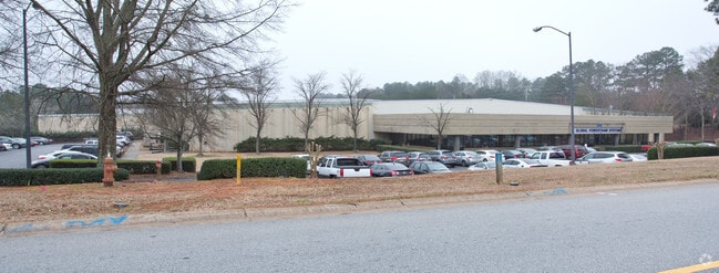
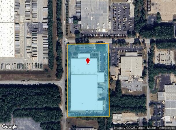
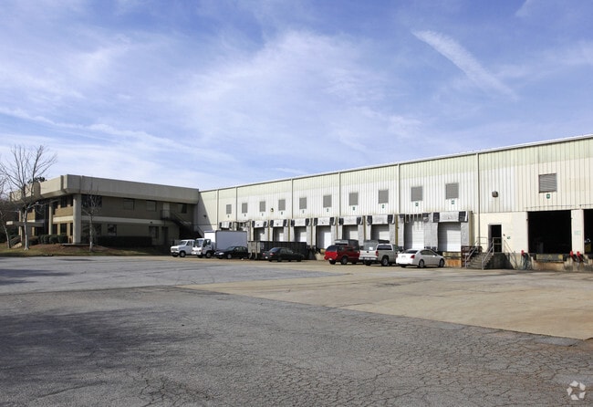
Property Record
32 Dart Rd, Newnan, GA 30265
NEARBY LISTINGS FOR SALE OR LEASE
Property Detail
32 Dart Rd
097-5084-003
BLDGS/8.666AC TR 3A BK I SH
Lightindustrial
Coweta
X
Georgia
13077C0142D
84
2025
8.67 AC
2025
Fayette/Coweta County
170308
Atlanta
200,800 SF
Atlanta-Sandy Springs-Roswell, GA
DEMOGRAPHICS near 32 Dart Rd
1 Mile
3 Mile
5 Mile
2024 Total Population
1,001
33,467
78,423
2029 Population
1,086
37,116
87,398
Pop Growth 2024-2029
+ 8.49%
+ 10.90%
+ 11.44%
Average Age
37
39
39
2024 Total Households
441
13,474
29,865
HH Growth 2024-2029
+ 8.62%
+ 10.93%
+ 11.47%
Median Household Inc
$54,400
$77,644
$82,650
Avg Household Size
2.30
2.50
2.60
2024 Avg HH Vehicles
2.00
2.00
2.00
Median Home Value
$258,571
$266,981
$271,632
Median Year Built
2000
2001
1998
Nearby Places
Map Layers
Map Styles
 Street
 Aerial
- Restaurants
- Banks
- Shops
- Fitness
- Groceries
PUBLIC TRANSPORTATION
AIRPORT
Hartsfield - Jackson Atlanta International
DRIVE
WALK
Distance
Hartsfield - Jackson Atlanta International
42 min
30.7 mi
Freight Ports
Georgia Ports - Savannah
DRIVE
WALK
Distance
Georgia Ports - Savannah
300 min
253.7 mi
Nearby Properties
Address
Land Use
TOTAL SIZE
Lot Size
Zoning
Address
Land Use
TOTAL SIZE
Lot Size
Zoning
286,548 SF
26.47 AC
ND
Address
Land Use
TOTAL SIZE
Lot Size
Zoning
269,327 SF
6.57 AC
ND
Address
Land Use
TOTAL SIZE
Lot Size
Zoning
449,108 SF
53.36 AC
C2
Address
Land Use
TOTAL SIZE
Lot Size
Zoning
208,092 SF
9.85 AC
R2
Address
Land Use
TOTAL SIZE
Lot Size
Zoning
1,001,000 SF
118.56 AC
R1
Address
Land Use
TOTAL SIZE
Lot Size
Zoning
1,955,650 SF
101.74 AC
M
Address
Land Use
TOTAL SIZE
Lot Size
Zoning
340,087 SF
24.91 AC
R1
Address
Land Use
TOTAL SIZE
Lot Size
Zoning
272,918 SF
24.21 AC
ND
Address
Land Use
TOTAL SIZE
Lot Size
Zoning
1,079,000 SF
73.44 AC
M
Address
Land Use
TOTAL SIZE
Lot Size
Zoning
1,206,927 SF
109.06 AC
R1
Address
Land Use
TOTAL SIZE
Lot Size
Zoning
1,206,927 SF
109.06 AC
R1
Address
Land Use
TOTAL SIZE
Lot Size
Zoning
323,991 SF
22.48 AC
001
Address
Land Use
TOTAL SIZE
Lot Size
Zoning
395,621 SF
35.51 AC
001
Address
Land Use
TOTAL SIZE
Lot Size
Zoning
403,472 SF
61.64 AC
M
Address
Land Use
TOTAL SIZE
Lot Size
Zoning
237,164 SF
16.85 AC
R1
Address
Land Use
TOTAL SIZE
Lot Size
Zoning
188,907 SF
25.22 AC
001
Address
Land Use
TOTAL SIZE
Lot Size
Zoning
252,746 SF
20.93 AC
M
Address
Land Use
TOTAL SIZE
Lot Size
Zoning
349,504 SF
26.40 AC
C2
Address
Land Use
TOTAL SIZE
Lot Size
Zoning
196,093 SF
17.31 AC
002
Address
Land Use
TOTAL SIZE
Lot Size
Zoning
446,159 SF
49.05 AC
M
Address
Land Use
TOTAL SIZE
Lot Size
Zoning
229,770 SF
30 AC
001
Address
Land Use
TOTAL SIZE
Lot Size
Zoning
770,898 SF
215.23 AC
M
Address
Land Use
TOTAL SIZE
Lot Size
Zoning
367,120 SF
28.64 AC
M
Address
Land Use
TOTAL SIZE
Lot Size
Zoning
230,359 SF
51.61 AC
R1
Address
Land Use
TOTAL SIZE
Lot Size
Zoning
102,007 SF
18.92 AC
002
Address
Land Use
TOTAL SIZE
Lot Size
Zoning
299,520 SF
32.45 AC
R1
Address
Land Use
TOTAL SIZE
Lot Size
Zoning
109,692 SF
10.94 AC
ND
Address
Land Use
TOTAL SIZE
Lot Size
Zoning
137,519 SF
30.65 AC
R2
Address
Land Use
TOTAL SIZE
Lot Size
Zoning
111,730 SF
23.33 AC
001
Address
Land Use
TOTAL SIZE
Lot Size
Zoning
80,744 SF
72.97 AC
R1
The World's #1 Commercial Real Estate Marketplace
Connect with us
© 2026 CoStar Group
The information above has been obtained from sources believed reliable. While we do not doubt its accuracy we have not verified it and make no guarantee, warranty or representation about it. It is your responsibility to independently confirm its accuracy and completeness. Any projections, opinions, assumptions, or estimates used are for example only and do not represent the current or future performance of the property. The value of this transaction to you depends on tax and other factors which should be evaluated by your tax, financial, and legal advisors. You and your advisors should conduct a careful, independent investigation of the property to determine to your satisfaction the suitability of the property for your needs.