Property Record
32 David Thompson Dr, Bonners Ferry, ID 83805

NEARBY LISTINGS FOR SALE OR LEASE
-
-
View all Bonners Ferry listings for sale on LoopNet.com
Property Detail
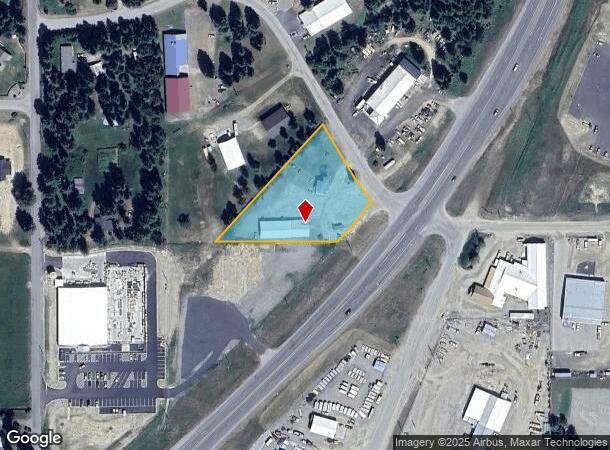
32 David Thompson Dr
Other Market Areas
Northland Woods Subdivision
003700030041
LOT 4 LESS US 95 R/W BLOCK 3 NORTHLAND WOODS SUBDIVISION SEC 14 T62N R1E
Storebuilding
Boundary
2025
Idaho
2025
4
970100
1.44 AC
1,600 SF
DEMOGRAPHICS near 32 David Thompson Dr
1 Mile
3 Mile
5 Mile
2024 Total Population
371
4,506
8,092
2029 Population
472
5,728
10,273
Pop Growth 2024-2029
+ 27.22%
+ 27.12%
+ 26.95%
Average Age
42
43
43
2024 Total Households
138
1,754
3,207
HH Growth 2024-2029
+ 26.81%
+ 26.68%
+ 26.47%
Median Household Inc
$65,250
$54,047
$54,653
Avg Household Size
2.60
2.50
2.50
2024 Avg HH Vehicles
3.00
2.00
2.00
Median Home Value
$325,000
$322,377
$326,876
Median Year Built
1993
1990
1991
Nearby Places
Map Layers
Map Styles
 Street
 Aerial
- Restaurants
- Banks
- Shops
- Fitness
- Groceries
Nearby Properties
Address
Land Use
TOTAL SIZE
Lot Size
Zoning
Address
Land Use
TOTAL SIZE
Lot Size
Zoning
1,600 SF
18.83 AC
Address
Land Use
TOTAL SIZE
Lot Size
Zoning
10,560 SF
4.21 AC
Address
Land Use
TOTAL SIZE
Lot Size
Zoning
5,415 SF
3.58 AC
Address
Land Use
TOTAL SIZE
Lot Size
Zoning
6,900 SF
4.65 AC
Address
Land Use
TOTAL SIZE
Lot Size
Zoning
14,560 SF
3.95 AC
Address
Land Use
TOTAL SIZE
Lot Size
Zoning
2,700 SF
22.62 AC
Address
Land Use
TOTAL SIZE
Lot Size
Zoning
9,408 SF
4.52 AC
Address
Land Use
TOTAL SIZE
Lot Size
Zoning
6,328 SF
4.12 AC
Address
Land Use
TOTAL SIZE
Lot Size
Zoning
18,092 SF
7.78 AC
Address
Land Use
TOTAL SIZE
Lot Size
Zoning
10,650 SF
1.72 AC
Address
Land Use
TOTAL SIZE
Lot Size
Zoning
13,802 SF
0.80 AC
Address
Land Use
TOTAL SIZE
Lot Size
Zoning
7,287 SF
0.94 AC
Address
Land Use
TOTAL SIZE
Lot Size
Zoning
10,416 SF
2.60 AC
Address
Land Use
TOTAL SIZE
Lot Size
Zoning
6,120 SF
0.96 AC
Address
Land Use
TOTAL SIZE
Lot Size
Zoning
Address
Land Use
TOTAL SIZE
Lot Size
Zoning
6,104 SF
0.83 AC
Address
Land Use
TOTAL SIZE
Lot Size
Zoning
3,504 SF
18.29 AC
Address
Land Use
TOTAL SIZE
Lot Size
Zoning
3,510 SF
0.63 AC
Address
Land Use
TOTAL SIZE
Lot Size
Zoning
20,000 SF
0.34 AC
Address
Land Use
TOTAL SIZE
Lot Size
Zoning
6,600 SF
2.29 AC
Address
Land Use
TOTAL SIZE
Lot Size
Zoning
5,400 SF
1.04 AC
Address
Land Use
TOTAL SIZE
Lot Size
Zoning
4,101 SF
0.47 AC
Address
Land Use
TOTAL SIZE
Lot Size
Zoning
4,000 SF
9.38 AC
Address
Land Use
TOTAL SIZE
Lot Size
Zoning
9,060 SF
0.59 AC
Address
Land Use
TOTAL SIZE
Lot Size
Zoning
14,600 SF
3.43 AC
Address
Land Use
TOTAL SIZE
Lot Size
Zoning
8,020 SF
5 AC
Address
Land Use
TOTAL SIZE
Lot Size
Zoning
9,200 SF
4.40 AC
Address
Land Use
TOTAL SIZE
Lot Size
Zoning
12,000 SF
0.14 AC
Address
Land Use
TOTAL SIZE
Lot Size
Zoning
11,200 SF
3.25 AC
The World's #1 Commercial Real Estate Marketplace
Connect with us
© 2026 CoStar Group
The information above has been obtained from sources believed reliable. While we do not doubt its accuracy we have not verified it and make no guarantee, warranty or representation about it. It is your responsibility to independently confirm its accuracy and completeness. Any projections, opinions, assumptions, or estimates used are for example only and do not represent the current or future performance of the property. The value of this transaction to you depends on tax and other factors which should be evaluated by your tax, financial, and legal advisors. You and your advisors should conduct a careful, independent investigation of the property to determine to your satisfaction the suitability of the property for your needs.