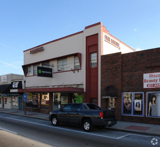
Property Record
32 E Main St, Apopka, FL 32703
Current Lease Availabilities
NEARBY LISTINGS FOR SALE OR LEASE
Property Detail
32 E Main St
Orlando-Kissimmee-Sanford, FL
Apopka Town Of (Champney Portion)
09-2128-0196-50-300
TOWN OF APOPKA A/109 LOT 30 BLK E
Storebuilding
Orange
X
Florida
12095C0120H
30
2024
0.20 AC
2025
Apopka
017600
Orlando
6,758 SF
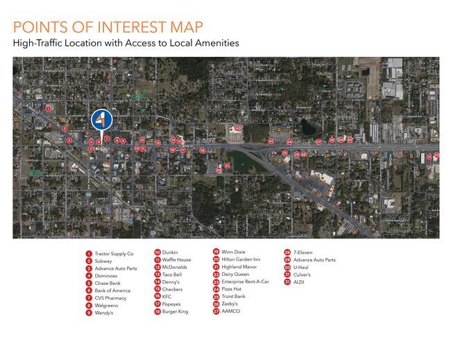
DEMOGRAPHICS near 32 E Main St
1 mile
3 mile
5 mile
2024 Total Population
7,678
66,609
134,298
2029 Population
7,980
68,937
138,860
Pop Growth 2024-2029
+ 3.93%
+ 3.50%
+ 3.40%
Average Age
37
39
40
2024 Total Households
2,467
22,512
46,326
HH Growth 2024-2029
+ 3.89%
+ 3.45%
+ 3.40%
Median Household Inc
$39,981
$59,904
$72,615
Avg Household Size
2.90
2.90
2.80
2024 Avg HH Vehicles
2.00
2.00
2.00
Median Home Value
$177,404
$276,506
$307,894
Median Year Built
1979
1993
1991
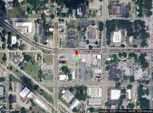
Nearby Places
Map Layers
Map Styles
 Street
 Aerial
Transit
 Traffic
 Biking
Places
Listings with unknown addresses are not visible on the map
- Restaurants
- Banks
- Shops
- Fitness
- Groceries
PUBLIC TRANSPORTATION
COMMUTER RAIL
Drive
Walk
Distance
18 min
9.7 mi
AIRPORT
Orlando Sanford International
Drive
Walk
Distance
Orlando Sanford International
39 min
22.6 mi
Orlando International
Drive
Walk
Distance
Orlando International
42 min
26.1 mi
Nearby Properties
Address
Land Use
TOTAL SIZE
Lot Size
Zoning
Address
Land Use
TOTAL SIZE
Lot Size
Zoning
467,248 SF
33.67 AC
PD
Address
Land Use
TOTAL SIZE
Lot Size
Zoning
792,152 SF
53.04 AC
O
Address
Land Use
TOTAL SIZE
Lot Size
Zoning
537,895 SF
55.19 AC
I-L
Address
Land Use
TOTAL SIZE
Lot Size
Zoning
272,340 SF
10.78 AC
PD
Address
Land Use
TOTAL SIZE
Lot Size
Zoning
361,418 SF
18.88 AC
MU-ES-GT
Address
Land Use
TOTAL SIZE
Lot Size
Zoning
343,587 SF
9.67 AC
MU-ES-GT
Address
Land Use
TOTAL SIZE
Lot Size
Zoning
314,897 SF
21.59 AC
PD
Address
Land Use
TOTAL SIZE
Lot Size
Zoning
265,125 SF
16.27 AC
MU-ES-GT
Address
Land Use
TOTAL SIZE
Lot Size
Zoning
348,560 SF
12.96 AC
PD
Address
Land Use
TOTAL SIZE
Lot Size
Zoning
299,743 SF
PD
Address
Land Use
TOTAL SIZE
Lot Size
Zoning
257,471 SF
38.42 AC
C-C
Address
Land Use
TOTAL SIZE
Lot Size
Zoning
268,195 SF
50.24 AC
O
Address
Land Use
TOTAL SIZE
Lot Size
Zoning
164,756 SF
132.88 AC
R-T
Address
Land Use
TOTAL SIZE
Lot Size
Zoning
278,981 SF
51.18 AC
I-L
Address
Land Use
TOTAL SIZE
Lot Size
Zoning
189,514 SF
12.70 AC
MU-ES-GT
Address
Land Use
TOTAL SIZE
Lot Size
Zoning
497,045 SF
22.03 AC
RMF
Address
Land Use
TOTAL SIZE
Lot Size
Zoning
341,131 SF
39.88 AC
O
Address
Land Use
TOTAL SIZE
Lot Size
Zoning
271,076 SF
19.31 AC
PUD
Address
Land Use
TOTAL SIZE
Lot Size
Zoning
342,011 SF
21.15 AC
I-L
Address
Land Use
TOTAL SIZE
Lot Size
Zoning
275,446 SF
12.81 AC
I-L
Address
Land Use
TOTAL SIZE
Lot Size
Zoning
193,525 SF
10.07 AC
D-APK-I-L
Address
Land Use
TOTAL SIZE
Lot Size
Zoning
503,677 SF
27.63 AC
I-L
Address
Land Use
TOTAL SIZE
Lot Size
Zoning
185,190 SF
12.82 AC
C-C
Address
Land Use
TOTAL SIZE
Lot Size
Zoning
184,786 SF
16.44 AC
I-L
Address
Land Use
TOTAL SIZE
Lot Size
Zoning
67,945 SF
18.66 AC
O
Address
Land Use
TOTAL SIZE
Lot Size
Zoning
107,978 SF
9.76 AC
MU-ES-GT
Address
Land Use
TOTAL SIZE
Lot Size
Zoning
406,432 SF
11.62 AC
I-L
Address
Land Use
TOTAL SIZE
Lot Size
Zoning
144,713 SF
10.10 AC
I-L
Address
Land Use
TOTAL SIZE
Lot Size
Zoning
242,916 SF
25.88 AC
C-C
Address
Land Use
TOTAL SIZE
Lot Size
Zoning
152,805 SF
8.85 AC
I-L
The World's #1 Commercial Real Estate Marketplace
Connect with us
© 2026 CoStar Group
The information above has been obtained from sources believed reliable. While we do not doubt its accuracy we have not verified it and make no guarantee, warranty or representation about it. It is your responsibility to independently confirm its accuracy and completeness. Any projections, opinions, assumptions, or estimates used are for example only and do not represent the current or future performance of the property. The value of this transaction to you depends on tax and other factors which should be evaluated by your tax, financial, and legal advisors. You and your advisors should conduct a careful, independent investigation of the property to determine to your satisfaction the suitability of the property for your needs.