Property Record
32 Hertel Ave, Buffalo, NY 14207


NEARBY LISTINGS FOR SALE OR LEASE
Property Detail
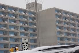
32 Hertel Ave
Buffalo-Cheektowaga-Niagara Falls, NY
Bird Farm
140200-088-240-0004-001-000
395 W NIAGARA 350.53 N OF 390 WL
Apartment
Erie
AE
New York
36029C0183J
1.000
0
5.88 AC
2024
Black Rock
005700
Buffalo/Niagara Falls
94,040 SF
DEMOGRAPHICS near 32 Hertel Ave
1 Mile
3 Mile
5 Mile
2024 Total Population
10,891
98,186
250,899
2029 Population
10,417
95,352
246,111
Pop Growth 2024-2029
(4.35%)
(2.89%)
(1.91%)
Average Age
34
38
39
2024 Total Households
4,113
44,221
110,818
HH Growth 2024-2029
(4.35%)
(2.84%)
(1.86%)
Median Household Inc
$27,272
$50,623
$49,198
Avg Household Size
2.50
2.10
2.10
2024 Avg HH Vehicles
1.00
1.00
1.00
Median Home Value
$64,096
$187,725
$172,408
Median Year Built
1946
1946
1947
Nearby Places
Map Layers
Map Styles
 Street
 Aerial
- Restaurants
- Banks
- Shops
- Fitness
- Groceries
PUBLIC TRANSPORTATION
COMMUTER RAIL
Buffalo (Exchange) (Empire Service - Amtrak, Maple Leaf - Amtrak, Toronto - New York - Amtrak)
DRIVE
WALK
Distance
Buffalo (Exchange) (Empire Service - Amtrak, Maple Leaf - Amtrak, Toronto - New York - Amtrak)
10 min
5.8 mi
AIRPORT
Buffalo Niagara International
DRIVE
WALK
Distance
Buffalo Niagara International
25 min
12.7 mi
Niagara Falls International
DRIVE
WALK
Distance
Niagara Falls International
24 min
15.6 mi
Freight Ports
Port of Toledo
DRIVE
WALK
Distance
Port of Toledo
366 min
308.4 mi
Nearby Properties
Address
Land Use
TOTAL SIZE
Lot Size
Zoning
Address
Land Use
TOTAL SIZE
Lot Size
Zoning
6,120 SF
87.10 AC
D-IL
Address
Land Use
TOTAL SIZE
Lot Size
Zoning
8,317 SF
39.03 AC
SPLIT ZONE
Address
Land Use
TOTAL SIZE
Lot Size
Zoning
80,927 SF
28.20 AC
WID
Address
Land Use
TOTAL SIZE
Lot Size
Zoning
121,015 SF
92.60 AC
D-E
Address
Land Use
TOTAL SIZE
Lot Size
Zoning
21,200 SF
20.94 AC
D-IL
Address
Land Use
TOTAL SIZE
Lot Size
Zoning
239,735 SF
17.73 AC
TND
Address
Land Use
TOTAL SIZE
Lot Size
Zoning
12,641 SF
0.56 AC
N-2C
Address
Land Use
TOTAL SIZE
Lot Size
Zoning
94,680 SF
175.90 AC
D-OG
Address
Land Use
TOTAL SIZE
Lot Size
Zoning
312,340 SF
3.83 AC
N-2R
Address
Land Use
TOTAL SIZE
Lot Size
Zoning
59,670 SF
911.28 AC
OS
Address
Land Use
TOTAL SIZE
Lot Size
Zoning
119,851 SF
1.35 AC
N-2R
Address
Land Use
TOTAL SIZE
Lot Size
Zoning
80,502 SF
3.25 AC
D-E
Address
Land Use
TOTAL SIZE
Lot Size
Zoning
650,000 SF
42.15 AC
G-1
Address
Land Use
TOTAL SIZE
Lot Size
Zoning
61,327 SF
175 AC
D-OG
Address
Land Use
TOTAL SIZE
Lot Size
Zoning
67,666 SF
17.43 AC
G-1
Address
Land Use
TOTAL SIZE
Lot Size
Zoning
3.20 AC
G-1
Address
Land Use
TOTAL SIZE
Lot Size
Zoning
29,776 SF
13.70 AC
DEL-C-H
Address
Land Use
TOTAL SIZE
Lot Size
Zoning
73,128 SF
3.11 AC
N-2R
Address
Land Use
TOTAL SIZE
Lot Size
Zoning
11,808 SF
11.93 AC
N-3R
Address
Land Use
TOTAL SIZE
Lot Size
Zoning
192,811 SF
3.30 AC
D-E
Address
Land Use
TOTAL SIZE
Lot Size
Zoning
120,954 SF
9.74 AC
D-S
Address
Land Use
TOTAL SIZE
Lot Size
Zoning
16 AC
G-1
Address
Land Use
TOTAL SIZE
Lot Size
Zoning
118,080 SF
2.77 AC
D-R
Address
Land Use
TOTAL SIZE
Lot Size
Zoning
80,369 SF
1.16 AC
N-2R
Address
Land Use
TOTAL SIZE
Lot Size
Zoning
41,752 SF
8.95 AC
SPLIT ZONE
Address
Land Use
TOTAL SIZE
Lot Size
Zoning
151,641 SF
1.53 AC
N-1S
Address
Land Use
TOTAL SIZE
Lot Size
Zoning
43,219 SF
4.64 AC
D-E
Address
Land Use
TOTAL SIZE
Lot Size
Zoning
138,000 SF
7.30 AC
P-S
Address
Land Use
TOTAL SIZE
Lot Size
Zoning
55,419 SF
14.78 AC
SPLIT ZONE
Address
Land Use
TOTAL SIZE
Lot Size
Zoning
49,114 SF
2.06 AC
N-1S
The World's #1 Commercial Real Estate Marketplace
Connect with us
© 2025 CoStar Group
The information above has been obtained from sources believed reliable. While we do not doubt its accuracy we have not verified it and make no guarantee, warranty or representation about it. It is your responsibility to independently confirm its accuracy and completeness. Any projections, opinions, assumptions, or estimates used are for example only and do not represent the current or future performance of the property. The value of this transaction to you depends on tax and other factors which should be evaluated by your tax, financial, and legal advisors. You and your advisors should conduct a careful, independent investigation of the property to determine to your satisfaction the suitability of the property for your needs.