Property Record
32 Kingshighway, Eureka Springs, AR 72632
NEARBY LISTINGS FOR SALE OR LEASE
-
-
View all Eureka Springs listings for sale on LoopNet.com
Property Detail
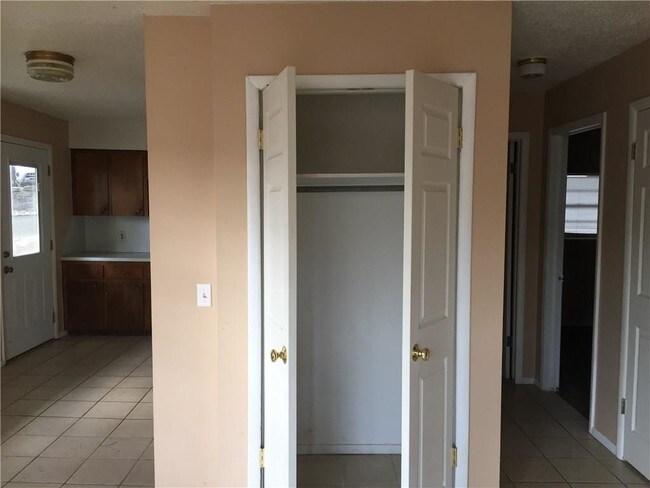
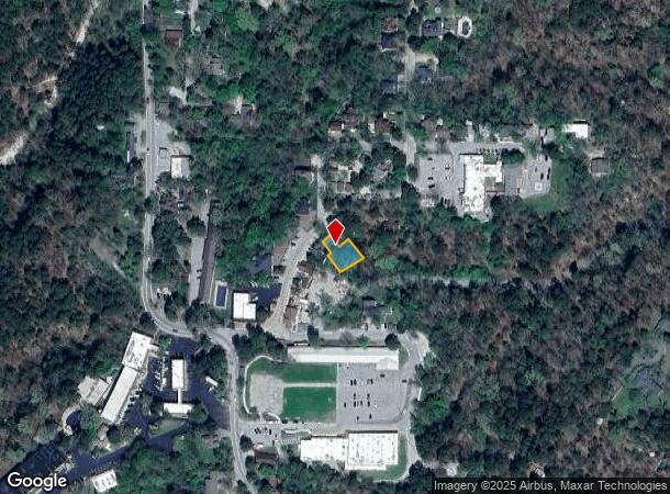
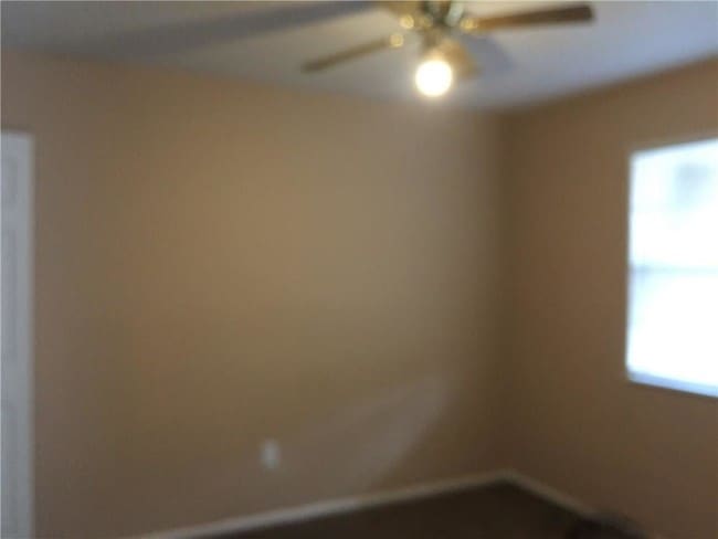
32 Kingshighway
925-00196-001
Freeman-Esc
Apartment
PT LOT 2
X
Carroll
05015C0065B
Arkansas
2025
2
2025
0.28 AC
950100
Arkansas North Area
2,808 SF
Other Market Areas
DEMOGRAPHICS near 32 Kingshighway
1 mile
3 mile
5 mile
2024 Total Population
1,886
3,333
5,380
2029 Population
1,942
3,433
5,570
Pop Growth 2024-2029
+ 2.97%
+ 3.00%
+ 3.53%
Average Age
49
50
51
2024 Total Households
997
1,709
2,726
HH Growth 2024-2029
+ 2.71%
+ 2.75%
+ 3.30%
Median Household Inc
$43,361
$44,897
$47,622
Avg Household Size
1.90
1.90
1.90
2024 Avg HH Vehicles
2.00
2.00
2.00
Median Home Value
$220,652
$211,276
$197,735
Median Year Built
1970
1976
1987
Nearby Places
Map Layers
Map Styles
 Street
 Aerial
Transit
 Traffic
 Biking
Places
Listings with unknown addresses are not visible on the map
- Restaurants
- Banks
- Shops
- Fitness
- Groceries
SALE & LEASE HISTORY
LISTING DATE
SALE/LEASE

Mar 06, 2018
For Sale
Nearby Properties
Address
Land Use
TOTAL SIZE
Lot Size
Zoning
Address
Land Use
TOTAL SIZE
Lot Size
Zoning
11,144 SF
5.57 AC
Address
Land Use
TOTAL SIZE
Lot Size
Zoning
52,388 SF
3 AC
Address
Land Use
TOTAL SIZE
Lot Size
Zoning
46,090 SF
Address
Land Use
TOTAL SIZE
Lot Size
Zoning
39,349 SF
3.32 AC
Address
Land Use
TOTAL SIZE
Lot Size
Zoning
40,536 SF
6 AC
Address
Land Use
TOTAL SIZE
Lot Size
Zoning
13,478 SF
0.67 AC
Address
Land Use
TOTAL SIZE
Lot Size
Zoning
23,493 SF
2.77 AC
Address
Land Use
TOTAL SIZE
Lot Size
Zoning
23,600 SF
3 AC
Address
Land Use
TOTAL SIZE
Lot Size
Zoning
20,457 SF
8.28 AC
Address
Land Use
TOTAL SIZE
Lot Size
Zoning
2,384 SF
6.43 AC
Address
Land Use
TOTAL SIZE
Lot Size
Zoning
16,521 SF
0.11 AC
Address
Land Use
TOTAL SIZE
Lot Size
Zoning
28,799 SF
37.44 AC
Address
Land Use
TOTAL SIZE
Lot Size
Zoning
12,677 SF
1.45 AC
Address
Land Use
TOTAL SIZE
Lot Size
Zoning
17,154 SF
2.13 AC
Address
Land Use
TOTAL SIZE
Lot Size
Zoning
2,732 SF
0.69 AC
Address
Land Use
TOTAL SIZE
Lot Size
Zoning
27,972 SF
8.82 AC
Address
Land Use
TOTAL SIZE
Lot Size
Zoning
23,979 SF
4.33 AC
Address
Land Use
TOTAL SIZE
Lot Size
Zoning
23,910 SF
2.75 AC
Address
Land Use
TOTAL SIZE
Lot Size
Zoning
30,000 SF
32.84 AC
Address
Land Use
TOTAL SIZE
Lot Size
Zoning
4,887 SF
3.41 AC
Address
Land Use
TOTAL SIZE
Lot Size
Zoning
27,152 SF
2.07 AC
Address
Land Use
TOTAL SIZE
Lot Size
Zoning
12,016 SF
1.90 AC
Address
Land Use
TOTAL SIZE
Lot Size
Zoning
12,730 SF
0.04 AC
Address
Land Use
TOTAL SIZE
Lot Size
Zoning
5,695 SF
0.18 AC
Address
Land Use
TOTAL SIZE
Lot Size
Zoning
6,916 SF
468.46 AC
Address
Land Use
TOTAL SIZE
Lot Size
Zoning
23,600 SF
0.09 AC
Address
Land Use
TOTAL SIZE
Lot Size
Zoning
2,836 SF
118.25 AC
Address
Land Use
TOTAL SIZE
Lot Size
Zoning
13,770 SF
0.14 AC
Address
Land Use
TOTAL SIZE
Lot Size
Zoning
4,908 SF
1.69 AC
Address
Land Use
TOTAL SIZE
Lot Size
Zoning
6,511 SF
1.34 AC
The World's #1 Commercial Real Estate Marketplace
Connect with us
© 2026 CoStar Group
The information above has been obtained from sources believed reliable. While we do not doubt its accuracy we have not verified it and make no guarantee, warranty or representation about it. It is your responsibility to independently confirm its accuracy and completeness. Any projections, opinions, assumptions, or estimates used are for example only and do not represent the current or future performance of the property. The value of this transaction to you depends on tax and other factors which should be evaluated by your tax, financial, and legal advisors. You and your advisors should conduct a careful, independent investigation of the property to determine to your satisfaction the suitability of the property for your needs.