Property Record
32 Louck St, Oxford, MI 48371


NEARBY LISTINGS FOR SALE OR LEASE
Property Detail
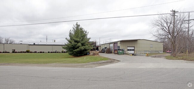
32 Louck St
Detroit-Warren-Dearborn, MI
Powells Addition
04-22-458-007
T5N, R10E, SEC 22 THAT PART OF S 1/2 OF SE 1/4 LYING BETW NLY & SLY LINES OF CHURCH ST AS EXT FROM E LINE LOUCKS ST TO CORP
Manufacturinglight
Oakland
X
Michigan
26125C0210F
1-5
2024
3.57 AC
2025
Auburn Hills, Pontiac & Rochester
121500
Detroit
42,101 SF
DEMOGRAPHICS near 32 Louck St
1 Mile
3 Mile
5 Mile
2024 Total Population
5,507
22,278
44,224
2029 Population
5,453
22,151
43,920
Pop Growth 2024-2029
(0.98%)
(0.57%)
(0.69%)
Average Age
40
40
41
2024 Total Households
2,166
8,306
16,624
HH Growth 2024-2029
(1.02%)
(0.60%)
(0.70%)
Median Household Inc
$92,513
$97,201
$100,940
Avg Household Size
2.50
2.60
2.60
2024 Avg HH Vehicles
2.00
2.00
2.00
Median Home Value
$308,551
$334,726
$334,046
Median Year Built
1984
1992
1986
Nearby Places
Map Layers
Map Styles
 Street
 Aerial
- Restaurants
- Banks
- Shops
- Fitness
- Groceries
PUBLIC TRANSPORTATION
AIRPORT
Bishop International
DRIVE
WALK
Distance
Bishop International
59 min
41.9 mi
Nearby Properties
Address
Land Use
TOTAL SIZE
Lot Size
Zoning
Address
Land Use
TOTAL SIZE
Lot Size
Zoning
172,881 SF
16.51 AC
Address
Land Use
TOTAL SIZE
Lot Size
Zoning
148,898 SF
14.55 AC
BI
Address
Land Use
TOTAL SIZE
Lot Size
Zoning
188,367 SF
Address
Land Use
TOTAL SIZE
Lot Size
Zoning
188,367 SF
26.37 AC
Address
Land Use
TOTAL SIZE
Lot Size
Zoning
4,670 SF
81.02 AC
MM
Address
Land Use
TOTAL SIZE
Lot Size
Zoning
207,073 SF
19.74 AC
Address
Land Use
TOTAL SIZE
Lot Size
Zoning
65,459 SF
5.65 AC
BI
Address
Land Use
TOTAL SIZE
Lot Size
Zoning
187,506 SF
19.19 AC
AI
Address
Land Use
TOTAL SIZE
Lot Size
Zoning
81,921 SF
9.08 AC
BI
Address
Land Use
TOTAL SIZE
Lot Size
Zoning
4,717 SF
73 AC
MM
Address
Land Use
TOTAL SIZE
Lot Size
Zoning
53,715 SF
4.28 AC
ME
Address
Land Use
TOTAL SIZE
Lot Size
Zoning
58,009 SF
168.28 AC
BI
Address
Land Use
TOTAL SIZE
Lot Size
Zoning
187,573 SF
12.29 AC
II
Address
Land Use
TOTAL SIZE
Lot Size
Zoning
10,920 SF
494.26 AC
SV
Address
Land Use
TOTAL SIZE
Lot Size
Zoning
78,297 SF
7.53 AC
II
Address
Land Use
TOTAL SIZE
Lot Size
Zoning
39,217 SF
4.39 AC
BI
Address
Land Use
TOTAL SIZE
Lot Size
Zoning
38,468 SF
5.16 AC
BI
Address
Land Use
TOTAL SIZE
Lot Size
Zoning
61,936 SF
4.71 AC
II
Address
Land Use
TOTAL SIZE
Lot Size
Zoning
29,026 SF
2.66 AC
BI
Address
Land Use
TOTAL SIZE
Lot Size
Zoning
52,208 SF
2.64 AC
II
Address
Land Use
TOTAL SIZE
Lot Size
Zoning
49,731 SF
5.75 AC
II
Address
Land Use
TOTAL SIZE
Lot Size
Zoning
26,073 SF
63.54 AC
MM
Address
Land Use
TOTAL SIZE
Lot Size
Zoning
52,000 SF
5.13 AC
II
Address
Land Use
TOTAL SIZE
Lot Size
Zoning
11,483 SF
10.56 AC
BI
Address
Land Use
TOTAL SIZE
Lot Size
Zoning
68,162 SF
4.97 AC
II
Address
Land Use
TOTAL SIZE
Lot Size
Zoning
504 SF
18.16 AC
MM
Address
Land Use
TOTAL SIZE
Lot Size
Zoning
58,082 SF
2.75 AC
II
The World's #1 Commercial Real Estate Marketplace
Connect with us
© 2025 CoStar Group
The information above has been obtained from sources believed reliable. While we do not doubt its accuracy we have not verified it and make no guarantee, warranty or representation about it. It is your responsibility to independently confirm its accuracy and completeness. Any projections, opinions, assumptions, or estimates used are for example only and do not represent the current or future performance of the property. The value of this transaction to you depends on tax and other factors which should be evaluated by your tax, financial, and legal advisors. You and your advisors should conduct a careful, independent investigation of the property to determine to your satisfaction the suitability of the property for your needs.