Property Record
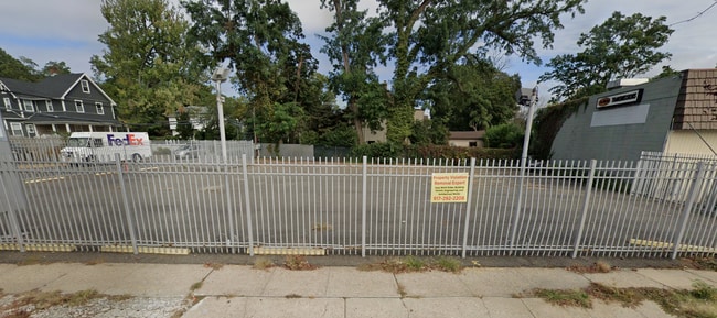
32 Mineola Ave, Roslyn, NY 11576
NEARBY LISTINGS FOR SALE OR LEASE
Property Detail
32 Mineola Ave
Nassau County-Suffolk County, NY
Map No 2 Of Roslyn Heights Property Of T
2289-07-024-00-0027-0
TOWN #2 SCH DIST 003
Vehiclerentalsvehiclesales
Nassau
X
New York
36059C0117G
27
2025
0.06 AC
2025
Western Nassau
302000
Long Island (New York)
600 SF
DEMOGRAPHICS near 32 Mineola Ave
1 Mile
3 Mile
5 Mile
2024 Total Population
13,886
94,935
323,068
2029 Population
13,754
93,751
316,638
Pop Growth 2024-2029
(0.95%)
(1.25%)
(1.99%)
Average Age
43
43
43
2024 Total Households
4,822
31,632
111,591
HH Growth 2024-2029
(1.02%)
(1.36%)
(2.12%)
Median Household Inc
$155,282
$163,663
$131,924
Avg Household Size
2.80
2.90
2.80
2024 Avg HH Vehicles
2.00
2.00
2.00
Median Home Value
$924,779
$903,379
$814,539
Median Year Built
1957
1954
1954
Nearby Places
- Restaurants
- Banks
- Shops
- Fitness
- Groceries
PUBLIC TRANSPORTATION
COMMUTER RAIL
Roslyn Station (Oyster Bay Branch - Long Island Rail Road)
DRIVE
WALK
Distance
Roslyn Station (Oyster Bay Branch - Long Island Rail Road)
2 min
11 min
0.6 mi
Albertson Station (Oyster Bay Branch - Long Island Rail Road)
DRIVE
WALK
Distance
Albertson Station (Oyster Bay Branch - Long Island Rail Road)
5 min
2.0 mi
AIRPORT
LaGuardia
DRIVE
WALK
Distance
LaGuardia
24 min
15.0 mi
John F Kennedy International
DRIVE
WALK
Distance
John F Kennedy International
27 min
17.9 mi
Westchester County
DRIVE
WALK
Distance
Westchester County
54 min
35.4 mi
Freight Ports
NY - Red Hook Container Terminal
DRIVE
WALK
Distance
NY - Red Hook Container Terminal
35 min
23.1 mi
Nearby Properties
Address
Land Use
TOTAL SIZE
Lot Size
Zoning
Address
Land Use
TOTAL SIZE
Lot Size
Zoning
275,334 SF
9.04 AC
Address
Land Use
TOTAL SIZE
Lot Size
Zoning
375,331 SF
14.83 AC
Address
Land Use
TOTAL SIZE
Lot Size
Zoning
152,926 SF
30 AC
Address
Land Use
TOTAL SIZE
Lot Size
Zoning
152,783 SF
51.20 AC
Address
Land Use
TOTAL SIZE
Lot Size
Zoning
158,725 SF
24.46 AC
Address
Land Use
TOTAL SIZE
Lot Size
Zoning
148,942 SF
34.17 AC
Address
Land Use
TOTAL SIZE
Lot Size
Zoning
401,583 SF
17.93 AC
Address
Land Use
TOTAL SIZE
Lot Size
Zoning
50,252 SF
143.04 AC
Address
Land Use
TOTAL SIZE
Lot Size
Zoning
147,148 SF
8.39 AC
Address
Land Use
TOTAL SIZE
Lot Size
Zoning
49,950 SF
51.02 AC
Address
Land Use
TOTAL SIZE
Lot Size
Zoning
171,770 SF
5.95 AC
Address
Land Use
TOTAL SIZE
Lot Size
Zoning
84,966 SF
18.74 AC
Address
Land Use
TOTAL SIZE
Lot Size
Zoning
179,365 SF
6.05 AC
Address
Land Use
TOTAL SIZE
Lot Size
Zoning
45,898 SF
85.13 AC
Address
Land Use
TOTAL SIZE
Lot Size
Zoning
98,439 SF
8.94 AC
Address
Land Use
TOTAL SIZE
Lot Size
Zoning
165,793 SF
18.61 AC
Address
Land Use
TOTAL SIZE
Lot Size
Zoning
56,663 SF
388.75 AC
Address
Land Use
TOTAL SIZE
Lot Size
Zoning
109,503 SF
12.88 AC
Address
Land Use
TOTAL SIZE
Lot Size
Zoning
140,916 SF
3.14 AC
Address
Land Use
TOTAL SIZE
Lot Size
Zoning
Address
Land Use
TOTAL SIZE
Lot Size
Zoning
47,328 SF
11.84 AC
Address
Land Use
TOTAL SIZE
Lot Size
Zoning
80,013 SF
51.03 AC
Address
Land Use
TOTAL SIZE
Lot Size
Zoning
64,700 SF
2.51 AC
Address
Land Use
TOTAL SIZE
Lot Size
Zoning
530,907 SF
21.69 AC
Address
Land Use
TOTAL SIZE
Lot Size
Zoning
130,665 SF
9.91 AC
Address
Land Use
TOTAL SIZE
Lot Size
Zoning
187,419 SF
3.57 AC
Address
Land Use
TOTAL SIZE
Lot Size
Zoning
51,868 SF
44.24 AC
Address
Land Use
TOTAL SIZE
Lot Size
Zoning
193,470 SF
4.77 AC
Address
Land Use
TOTAL SIZE
Lot Size
Zoning
246,555 SF
1.93 AC
Address
Land Use
TOTAL SIZE
Lot Size
Zoning
171,503 SF
6.87 AC
The World's #1 Commercial Real Estate Marketplace
Connect with us
© 2025 CoStar Group
The information above has been obtained from sources believed reliable. While we do not doubt its accuracy we have not verified it and make no guarantee, warranty or representation about it. It is your responsibility to independently confirm its accuracy and completeness. Any projections, opinions, assumptions, or estimates used are for example only and do not represent the current or future performance of the property. The value of this transaction to you depends on tax and other factors which should be evaluated by your tax, financial, and legal advisors. You and your advisors should conduct a careful, independent investigation of the property to determine to your satisfaction the suitability of the property for your needs.