Property Record
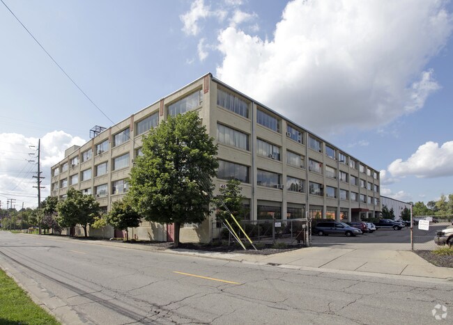
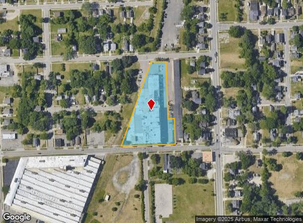
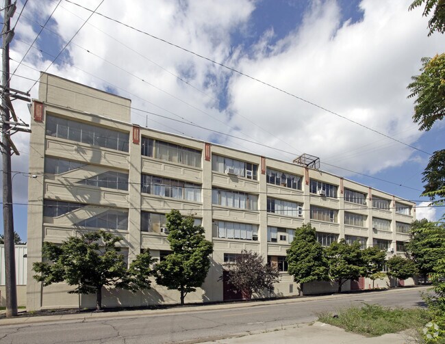
32 W Howard St, Pontiac, MI 48342
NEARBY LISTINGS FOR SALE OR LEASE
Property Detail
32 W Howard St
Detroit-Warren-Dearborn, MI
Stockwell & Tregent's Add
14-29-204-013
T3N, R10E, SEC 29 STOCKWELL & TREGENT'S ADD PART OF LOT 5, ALSO ALL OF LOTS 6 TO 12 INCL, ALSO PART OF LOTS 13 & 19, ALSO ALL OF LOT 20 BLK 1 ALL DESC AS BEG AT PT DIST S 89-40-00 W 257.40 FT FROM SW COR OF SAGINAW ST & TREGENT ST, TH S 00-33-24 E 33
Loftbuilding
Oakland
X
Michigan
26125C0368F
5
2024
2.15 AC
2024
Auburn Hills, Pontiac & Rochester
141600
Detroit
162,018 SF
DEMOGRAPHICS near 32 W Howard St
1 Mile
3 Mile
5 Mile
2024 Total Population
11,064
77,447
159,409
2029 Population
11,133
77,474
158,987
Pop Growth 2024-2029
+ 0.62%
+ 0.03%
(0.26%)
Average Age
36
38
40
2024 Total Households
3,966
31,602
65,835
HH Growth 2024-2029
+ 0.58%
0.00%
(0.32%)
Median Household Inc
$35,604
$42,574
$59,975
Avg Household Size
2.50
2.30
2.30
2024 Avg HH Vehicles
2.00
2.00
2.00
Median Home Value
$78,402
$109,236
$202,914
Median Year Built
1949
1961
1968
Nearby Places
Map Layers
Map Styles
 Street
 Aerial
- Restaurants
- Banks
- Shops
- Fitness
- Groceries
PUBLIC TRANSPORTATION
COMMUTER RAIL
Pontiac Amtrak Station (Wolverine - Amtrak)
DRIVE
WALK
Distance
Pontiac Amtrak Station (Wolverine - Amtrak)
4 min
1.5 mi
Freight Ports
Port of Toledo
DRIVE
WALK
Distance
Port of Toledo
110 min
83.3 mi
SALE & LEASE HISTORY
LISTING DATE
SALE/LEASE

Sep 25, 2016
For Lease
Nov 01, 2017
For Lease
Nearby Properties
Address
Land Use
TOTAL SIZE
Lot Size
Zoning
Address
Land Use
TOTAL SIZE
Lot Size
Zoning
2,734,739 SF
80.39 AC
Address
Land Use
TOTAL SIZE
Lot Size
Zoning
526,398 SF
32.99 AC
Address
Land Use
TOTAL SIZE
Lot Size
Zoning
1,771,589 SF
96.73 AC
Address
Land Use
TOTAL SIZE
Lot Size
Zoning
608,251 SF
50.49 AC
II
Address
Land Use
TOTAL SIZE
Lot Size
Zoning
374,400 SF
4.10 AC
Address
Land Use
TOTAL SIZE
Lot Size
Zoning
426,034 SF
24.99 AC
AI
Address
Land Use
TOTAL SIZE
Lot Size
Zoning
601,151 SF
Address
Land Use
TOTAL SIZE
Lot Size
Zoning
221,340 SF
26.88 AC
Address
Land Use
TOTAL SIZE
Lot Size
Zoning
156,668 SF
13.19 AC
BI
Address
Land Use
TOTAL SIZE
Lot Size
Zoning
23.28 AC
AI
Address
Land Use
TOTAL SIZE
Lot Size
Zoning
199,125 SF
47.43 AC
Address
Land Use
TOTAL SIZE
Lot Size
Zoning
97,172 SF
13.82 AC
BI
Address
Land Use
TOTAL SIZE
Lot Size
Zoning
205,703 SF
21.63 AC
B2
Address
Land Use
TOTAL SIZE
Lot Size
Zoning
101,320 SF
28.20 AC
Address
Land Use
TOTAL SIZE
Lot Size
Zoning
79,263 SF
22.27 AC
Address
Land Use
TOTAL SIZE
Lot Size
Zoning
903,018 SF
73.92 AC
II
Address
Land Use
TOTAL SIZE
Lot Size
Zoning
87,560 SF
7.94 AC
BI
Address
Land Use
TOTAL SIZE
Lot Size
Zoning
288,124 SF
15.76 AC
Address
Land Use
TOTAL SIZE
Lot Size
Zoning
186,197 SF
12.11 AC
TR
Address
Land Use
TOTAL SIZE
Lot Size
Zoning
1,870,974 SF
61.73 AC
Address
Land Use
TOTAL SIZE
Lot Size
Zoning
152,346 SF
14.07 AC
TR
Address
Land Use
TOTAL SIZE
Lot Size
Zoning
92,524 SF
14.62 AC
TR
Address
Land Use
TOTAL SIZE
Lot Size
Zoning
100,169 SF
9.74 AC
TR
Address
Land Use
TOTAL SIZE
Lot Size
Zoning
88,734 SF
16 AC
TR
Address
Land Use
TOTAL SIZE
Lot Size
Zoning
109,556 SF
7.21 AC
Address
Land Use
TOTAL SIZE
Lot Size
Zoning
94,184 SF
12 AC
TR
Address
Land Use
TOTAL SIZE
Lot Size
Zoning
55,912 SF
1.11 AC
Address
Land Use
TOTAL SIZE
Lot Size
Zoning
150,090 SF
11.74 AC
I1
Address
Land Use
TOTAL SIZE
Lot Size
Zoning
128,010 SF
9.56 AC
TR
Address
Land Use
TOTAL SIZE
Lot Size
Zoning
1 SF
65.92 AC
MHP
The World's #1 Commercial Real Estate Marketplace
Connect with us
© 2025 CoStar Group
The information above has been obtained from sources believed reliable. While we do not doubt its accuracy we have not verified it and make no guarantee, warranty or representation about it. It is your responsibility to independently confirm its accuracy and completeness. Any projections, opinions, assumptions, or estimates used are for example only and do not represent the current or future performance of the property. The value of this transaction to you depends on tax and other factors which should be evaluated by your tax, financial, and legal advisors. You and your advisors should conduct a careful, independent investigation of the property to determine to your satisfaction the suitability of the property for your needs.