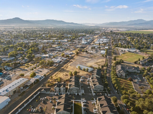
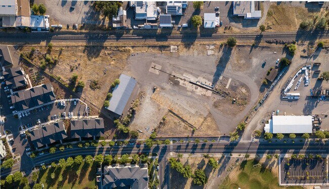
Property Record
320 N Haskell St, Central Point, OR 97502

Property Detail
320 N Haskell St
10140157
JACKSON
Industrialgeneral
Oregon
HMR
29
B and X Area of moderate flood hazard, usually the area between the limits of the 100-year and 500-year floods.
2.24 AC
2025
Medford/Grants Pass
2026
Other Market Areas
001002
Medford, OR
NEARBY LISTINGS FOR SALE OR LEASE
DEMOGRAPHICS near 320 N Haskell St
1 mile
3 mile
5 mile
2025 Total Population
12,346
31,698
86,052
2030 Population
12,143
31,016
84,138
Pop Growth 2025-2030
(1.64%)
(2.15%)
(2.22%)
Average Age
41
41
41
2025 Total Households
4,826
12,016
33,433
HH Growth 2025-2030
(1.68%)
(2.24%)
(2.35%)
Median Household Inc
$80,500
$74,968
$69,764
Avg Household Size
2.50
2.50
2.50
2025 Avg HH Vehicles
2.00
2.00
2.00
Median Home Value
$372,645
$367,140
$382,046
Median Year Built
1990
1990
1981
Nearby Places
Map Layers
Map Styles
 Street
 Aerial
Transit
 Traffic
 Biking
Places
Listings with unknown addresses are not visible on the map
- Restaurants
- Banks
- Shops
- Fitness
- Groceries
PUBLIC TRANSPORTATION
AIRPORT
Rogue Valley International - Medford
Drive
Walk
Distance
Rogue Valley International - Medford
7 min
3.2 mi
Freight Ports
Port of Coos Bay, OR
Drive
Walk
Distance
Port of Coos Bay, OR
212 min
160.9 mi
SALE & LEASE HISTORY
LISTING DATE
SALE/LEASE

Jul 25, 2023
For Sale
Nearby Properties
Address
Land Use
TOTAL SIZE
Lot Size
Zoning
Address
Land Use
TOTAL SIZE
Lot Size
Zoning
290.83 AC
I-L
Address
Land Use
TOTAL SIZE
Lot Size
Zoning
22.07 AC
GI
Address
Land Use
TOTAL SIZE
Lot Size
Zoning
600,000 SF
18.27 AC
M-1
Address
Land Use
TOTAL SIZE
Lot Size
Zoning
31.96 AC
GI
Address
Land Use
TOTAL SIZE
Lot Size
Zoning
176,910 SF
17.78 AC
C-R
Address
Land Use
TOTAL SIZE
Lot Size
Zoning
11,180 SF
1.58 AC
MFR-20
Address
Land Use
TOTAL SIZE
Lot Size
Zoning
30.87 AC
CIVIC
Address
Land Use
TOTAL SIZE
Lot Size
Zoning
88.67 AC
I-L
Address
Land Use
TOTAL SIZE
Lot Size
Zoning
109,042 SF
7.06 AC
C-R
Address
Land Use
TOTAL SIZE
Lot Size
Zoning
15.97 AC
GI
Address
Land Use
TOTAL SIZE
Lot Size
Zoning
6,039 SF
5.26 AC
MMR
Address
Land Use
TOTAL SIZE
Lot Size
Zoning
13.49 AC
M-1
Address
Land Use
TOTAL SIZE
Lot Size
Zoning
31,283 SF
2.95 AC
I-L
Address
Land Use
TOTAL SIZE
Lot Size
Zoning
164,324 SF
7.40 AC
C-R
Address
Land Use
TOTAL SIZE
Lot Size
Zoning
102,184 SF
5.82 AC
I-L
Address
Land Use
TOTAL SIZE
Lot Size
Zoning
164,324 SF
6.42 AC
C-R
Address
Land Use
TOTAL SIZE
Lot Size
Zoning
80,753 SF
7.68 AC
C-R
Address
Land Use
TOTAL SIZE
Lot Size
Zoning
98,547 SF
4.36 AC
I-L
Address
Land Use
TOTAL SIZE
Lot Size
Zoning
62.39 AC
GI
Address
Land Use
TOTAL SIZE
Lot Size
Zoning
60,561 SF
2.72 AC
HMR
Address
Land Use
TOTAL SIZE
Lot Size
Zoning
32,614 SF
8.27 AC
M-1
Address
Land Use
TOTAL SIZE
Lot Size
Zoning
32,240 SF
20.24 AC
M-2
Address
Land Use
TOTAL SIZE
Lot Size
Zoning
1,170 SF
4.25 AC
MMR
Address
Land Use
TOTAL SIZE
Lot Size
Zoning
106,894 SF
7.34 AC
C-R
Address
Land Use
TOTAL SIZE
Lot Size
Zoning
46,624 SF
3.29 AC
MMR
Address
Land Use
TOTAL SIZE
Lot Size
Zoning
100,000 SF
5.77 AC
I-G
Address
Land Use
TOTAL SIZE
Lot Size
Zoning
117,062 SF
5.13 AC
C-R
Address
Land Use
TOTAL SIZE
Lot Size
Zoning
56,962 SF
2.71 AC
C-R
Address
Land Use
TOTAL SIZE
Lot Size
Zoning
13.58 AC
CIVIC
The World's #1 Commercial Real Estate Marketplace
Connect with us
© 2026 CoStar Group
The information above has been obtained from sources believed reliable. While we do not doubt its accuracy we have not verified it and make no guarantee, warranty or representation about it. It is your responsibility to independently confirm its accuracy and completeness. Any projections, opinions, assumptions, or estimates used are for example only and do not represent the current or future performance of the property. The value of this transaction to you depends on tax and other factors which should be evaluated by your tax, financial, and legal advisors. You and your advisors should conduct a careful, independent investigation of the property to determine to your satisfaction the suitability of the property for your needs.