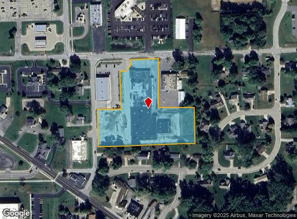
Property Record
320 N Kingston Rd, Plymouth, IN 46563

NEARBY LISTINGS FOR SALE OR LEASE
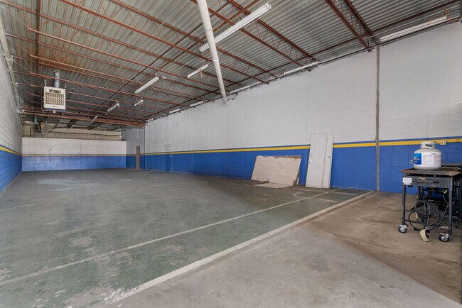
Property Detail
320 N Kingston Rd
Other Market Areas
Dear Born Minor Subdivision
Plymouth, IN
LOT 2 DEARBORN MINOR SUB
50-32-93-202-100.000-019
Marshall
Regionalshoppingcenterormallwithanchorstore
Indiana
2023
2
2024
4.56 AC
020400
Indiana North Area
59,778 SF
DEMOGRAPHICS near 320 N Kingston Rd
1 Mile
3 Mile
5 Mile
2024 Total Population
5,305
14,429
17,981
2029 Population
5,368
14,559
18,113
Pop Growth 2024-2029
+ 1.19%
+ 0.90%
+ 0.73%
Average Age
40
39
40
2024 Total Households
2,257
5,527
6,847
HH Growth 2024-2029
+ 0.93%
+ 0.71%
+ 0.55%
Median Household Inc
$49,603
$49,699
$53,609
Avg Household Size
2.30
2.50
2.50
2024 Avg HH Vehicles
2.00
2.00
2.00
Median Home Value
$117,132
$148,544
$159,949
Median Year Built
1972
1979
1978
Nearby Places
Map Layers
Map Styles
 Street
 Aerial
- Restaurants
- Banks
- Shops
- Fitness
- Groceries
PUBLIC TRANSPORTATION
AIRPORT
South Bend International
DRIVE
WALK
Distance
South Bend International
53 min
31.9 mi
SALE & LEASE HISTORY
LISTING DATE
SALE/LEASE

Jan 19, 2023
For Sale
Apr 15, 2024
For Sale
Nearby Properties
Address
Land Use
TOTAL SIZE
Lot Size
Zoning
Address
Land Use
TOTAL SIZE
Lot Size
Zoning
171,942 SF
44 SF
Address
Land Use
TOTAL SIZE
Lot Size
Zoning
204,629 SF
87 SF
Address
Land Use
TOTAL SIZE
Lot Size
Zoning
217,471 SF
87 SF
Address
Land Use
TOTAL SIZE
Lot Size
Zoning
263,135 SF
0.01 AC
Address
Land Use
TOTAL SIZE
Lot Size
Zoning
74,399 SF
1.05 AC
Address
Land Use
TOTAL SIZE
Lot Size
Zoning
48,984 SF
44 SF
Address
Land Use
TOTAL SIZE
Lot Size
Zoning
158,300 SF
44 SF
Address
Land Use
TOTAL SIZE
Lot Size
Zoning
190,984 SF
87 SF
Address
Land Use
TOTAL SIZE
Lot Size
Zoning
31,394 SF
3.46 AC
Address
Land Use
TOTAL SIZE
Lot Size
Zoning
98,274 SF
87 SF
Address
Land Use
TOTAL SIZE
Lot Size
Zoning
370,763 SF
131 SF
Address
Land Use
TOTAL SIZE
Lot Size
Zoning
108,888 SF
44 SF
Address
Land Use
TOTAL SIZE
Lot Size
Zoning
48,592 SF
2.07 AC
Address
Land Use
TOTAL SIZE
Lot Size
Zoning
172,804 SF
131 SF
Address
Land Use
TOTAL SIZE
Lot Size
Zoning
43,200 SF
44 SF
Address
Land Use
TOTAL SIZE
Lot Size
Zoning
46,342 SF
12.60 AC
Address
Land Use
TOTAL SIZE
Lot Size
Zoning
189,238 SF
44 SF
Address
Land Use
TOTAL SIZE
Lot Size
Zoning
76,161 SF
44 SF
Address
Land Use
TOTAL SIZE
Lot Size
Zoning
125,584 SF
15.51 AC
Address
Land Use
TOTAL SIZE
Lot Size
Zoning
431,326 SF
44 SF
Address
Land Use
TOTAL SIZE
Lot Size
Zoning
283,680 SF
87 SF
Address
Land Use
TOTAL SIZE
Lot Size
Zoning
41,217 SF
1.63 AC
Address
Land Use
TOTAL SIZE
Lot Size
Zoning
133,975 SF
9.08 AC
Address
Land Use
TOTAL SIZE
Lot Size
Zoning
62,460 SF
44 SF
Address
Land Use
TOTAL SIZE
Lot Size
Zoning
53,370 SF
1.90 AC
Address
Land Use
TOTAL SIZE
Lot Size
Zoning
31,360 SF
3.42 AC
Address
Land Use
TOTAL SIZE
Lot Size
Zoning
16,960 SF
1.95 AC
Address
Land Use
TOTAL SIZE
Lot Size
Zoning
29,411 SF
44 SF
Address
Land Use
TOTAL SIZE
Lot Size
Zoning
24,888 SF
2.90 AC
Address
Land Use
TOTAL SIZE
Lot Size
Zoning
40,546 SF
2.75 AC
The World's #1 Commercial Real Estate Marketplace
Connect with us
© 2025 CoStar Group
The information above has been obtained from sources believed reliable. While we do not doubt its accuracy we have not verified it and make no guarantee, warranty or representation about it. It is your responsibility to independently confirm its accuracy and completeness. Any projections, opinions, assumptions, or estimates used are for example only and do not represent the current or future performance of the property. The value of this transaction to you depends on tax and other factors which should be evaluated by your tax, financial, and legal advisors. You and your advisors should conduct a careful, independent investigation of the property to determine to your satisfaction the suitability of the property for your needs.