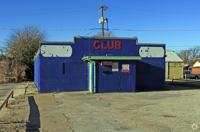
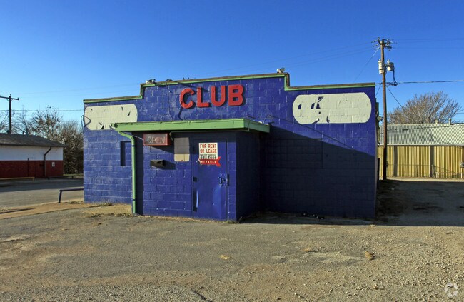
Property Record
320 N Scott Ave, Wichita Falls, TX 76306
NEARBY LISTINGS FOR SALE OR LEASE
Property Detail
320 N Scott Ave
Wichita Falls, TX
Montgomery
138627
LOTS 3&4 BLK I MONTGOMERY
Bartavern
Wichita
AE
Texas
48485C0340G
3,4
2024
0.17 AC
2025
North Wichita Falls
011100
Other Market Areas
2,236 SF
DEMOGRAPHICS near 320 N Scott Ave
1 Mile
3 Mile
5 Mile
2024 Total Population
4,015
36,672
80,817
2029 Population
4,197
38,028
82,915
Pop Growth 2024-2029
+ 4.53%
+ 3.70%
+ 2.60%
Average Age
37
38
37
2024 Total Households
1,565
14,765
31,116
HH Growth 2024-2029
+ 4.73%
+ 3.83%
+ 2.77%
Median Household Inc
$21,022
$38,848
$47,853
Avg Household Size
2.30
2.30
2.30
2024 Avg HH Vehicles
1.00
2.00
2.00
Median Home Value
$65,104
$77,168
$117,660
Median Year Built
1956
1957
1967
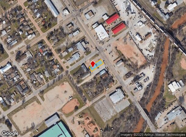
Nearby Places
Map Layers
Map Styles
 Street
 Aerial
- Restaurants
- Banks
- Shops
- Fitness
- Groceries
Nearby Properties
Address
Land Use
TOTAL SIZE
Lot Size
Zoning
Address
Land Use
TOTAL SIZE
Lot Size
Zoning
400,968 SF
123.30 AC
Address
Land Use
TOTAL SIZE
Lot Size
Zoning
164,255 SF
5.23 AC
Address
Land Use
TOTAL SIZE
Lot Size
Zoning
398,646 SF
7.51 AC
GC
Address
Land Use
TOTAL SIZE
Lot Size
Zoning
203,569 SF
27.74 AC
Address
Land Use
TOTAL SIZE
Lot Size
Zoning
245,152 SF
5.12 AC
GC
Address
Land Use
TOTAL SIZE
Lot Size
Zoning
233,084 SF
44.31 AC
SF2
Address
Land Use
TOTAL SIZE
Lot Size
Zoning
24,741 SF
37.75 AC
Address
Land Use
TOTAL SIZE
Lot Size
Zoning
266,509 SF
14.25 AC
SF2
Address
Land Use
TOTAL SIZE
Lot Size
Zoning
200,421 SF
18.57 AC
MFR
Address
Land Use
TOTAL SIZE
Lot Size
Zoning
167,247 SF
2.61 AC
CBD
Address
Land Use
TOTAL SIZE
Lot Size
Zoning
51,240 SF
3.46 AC
GC
Address
Land Use
TOTAL SIZE
Lot Size
Zoning
125,992 SF
4.22 AC
Address
Land Use
TOTAL SIZE
Lot Size
Zoning
80,294 SF
9.17 AC
Address
Land Use
TOTAL SIZE
Lot Size
Zoning
120,073 SF
17.43 AC
Address
Land Use
TOTAL SIZE
Lot Size
Zoning
136,522 SF
4.11 AC
Address
Land Use
TOTAL SIZE
Lot Size
Zoning
95,926 SF
1.21 AC
CBD
Address
Land Use
TOTAL SIZE
Lot Size
Zoning
179,865 SF
11.46 AC
Address
Land Use
TOTAL SIZE
Lot Size
Zoning
125,809 SF
2.01 AC
GC
Address
Land Use
TOTAL SIZE
Lot Size
Zoning
109,536 SF
27.02 AC
Address
Land Use
TOTAL SIZE
Lot Size
Zoning
108,972 SF
1.41 AC
CBD
Address
Land Use
TOTAL SIZE
Lot Size
Zoning
183,184 SF
21.89 AC
GC
Address
Land Use
TOTAL SIZE
Lot Size
Zoning
115,350 SF
4.86 AC
SF2
Address
Land Use
TOTAL SIZE
Lot Size
Zoning
34,268 SF
1.27 AC
Address
Land Use
TOTAL SIZE
Lot Size
Zoning
143,878 SF
20.85 AC
MFR
Address
Land Use
TOTAL SIZE
Lot Size
Zoning
64,637 SF
25.40 AC
Address
Land Use
TOTAL SIZE
Lot Size
Zoning
81,007 SF
23.24 AC
GC
Address
Land Use
TOTAL SIZE
Lot Size
Zoning
115,934 SF
2.63 AC
RDD
Address
Land Use
TOTAL SIZE
Lot Size
Zoning
138,450 SF
2.61 AC
CBD
Address
Land Use
TOTAL SIZE
Lot Size
Zoning
78,016 SF
16.97 AC
Address
Land Use
TOTAL SIZE
Lot Size
Zoning
57,771 SF
7.56 AC
The World's #1 Commercial Real Estate Marketplace
Connect with us
© 2025 CoStar Group
The information above has been obtained from sources believed reliable. While we do not doubt its accuracy we have not verified it and make no guarantee, warranty or representation about it. It is your responsibility to independently confirm its accuracy and completeness. Any projections, opinions, assumptions, or estimates used are for example only and do not represent the current or future performance of the property. The value of this transaction to you depends on tax and other factors which should be evaluated by your tax, financial, and legal advisors. You and your advisors should conduct a careful, independent investigation of the property to determine to your satisfaction the suitability of the property for your needs.