Property Record
320 Phillips St, North Kingstown, RI 02852

NEARBY LISTINGS FOR SALE OR LEASE
Property Detail
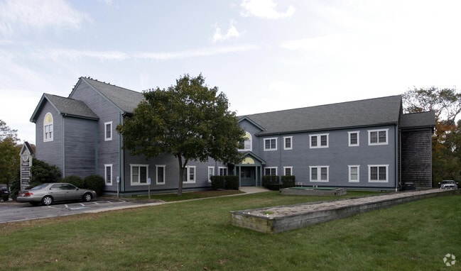
320 Phillips St
Officecondo
Washington
X
Rhode Island
44009C0104J
Washington County
2025
Providence
2025
Providence-Warwick, RI-MA
050302
NKIN-000092-000234
1,367 SF
DEMOGRAPHICS near 320 Phillips St
1 Mile
3 Mile
5 Mile
2024 Total Population
3,565
15,533
33,230
2029 Population
3,537
15,435
33,013
Pop Growth 2024-2029
(0.79%)
(0.63%)
(0.65%)
Average Age
45
44
44
2024 Total Households
1,544
6,415
13,320
HH Growth 2024-2029
(1.10%)
(0.86%)
(0.92%)
Median Household Inc
$88,970
$98,319
$101,862
Avg Household Size
2.20
2.40
2.40
2024 Avg HH Vehicles
2.00
2.00
2.00
Median Home Value
$488,508
$471,616
$469,275
Median Year Built
1951
1973
1974
Nearby Places
Map Layers
Map Styles
 Street
 Aerial
- Restaurants
- Banks
- Shops
- Fitness
- Groceries
PUBLIC TRANSPORTATION
COMMUTER RAIL
DRIVE
WALK
Distance
4 min
2.1 mi
AIRPORT
Rhode Island Tf Green International
DRIVE
WALK
Distance
Rhode Island Tf Green International
28 min
16.5 mi
SALE & LEASE HISTORY
LISTING DATE
SALE/LEASE

Sep 12, 2024
For Sale
Nov 06, 2017
For Sale
Feb 16, 2024
For Lease
Feb 15, 2024
For Sale
Dec 27, 2023
For Sale
Apr 17, 2024
For Lease
Apr 05, 2024
For Sale
Nearby Properties
Address
Land Use
TOTAL SIZE
Lot Size
Zoning
Address
Land Use
TOTAL SIZE
Lot Size
Zoning
39.12 AC
P
Address
Land Use
TOTAL SIZE
Lot Size
Zoning
32.58 AC
QBPD
Address
Land Use
TOTAL SIZE
Lot Size
Zoning
461,128 SF
21.54 AC
QBPD
Address
Land Use
TOTAL SIZE
Lot Size
Zoning
39.16 AC
QBPD
Address
Land Use
TOTAL SIZE
Lot Size
Zoning
61,984 SF
14.46 AC
QBPD
Address
Land Use
TOTAL SIZE
Lot Size
Zoning
466,871 SF
17.96 AC
QBPD
Address
Land Use
TOTAL SIZE
Lot Size
Zoning
8.10 AC
PR
Address
Land Use
TOTAL SIZE
Lot Size
Zoning
196,759 SF
33.67 AC
QBPD
Address
Land Use
TOTAL SIZE
Lot Size
Zoning
27.90 AC
QBPD
Address
Land Use
TOTAL SIZE
Lot Size
Zoning
121,016 SF
13.50 AC
QBPD
Address
Land Use
TOTAL SIZE
Lot Size
Zoning
4,288 SF
33.30 AC
PVD
Address
Land Use
TOTAL SIZE
Lot Size
Zoning
141,701 SF
12 AC
WJ
Address
Land Use
TOTAL SIZE
Lot Size
Zoning
13.28 AC
GB
Address
Land Use
TOTAL SIZE
Lot Size
Zoning
125,393 SF
15.33 AC
GB
Address
Land Use
TOTAL SIZE
Lot Size
Zoning
92,700 SF
9.90 AC
QBPD
Address
Land Use
TOTAL SIZE
Lot Size
Zoning
8.92 AC
PR
Address
Land Use
TOTAL SIZE
Lot Size
Zoning
25.10 AC
QBPD
Address
Land Use
TOTAL SIZE
Lot Size
Zoning
12.68 AC
PR
Address
Land Use
TOTAL SIZE
Lot Size
Zoning
237,726 SF
3.36 AC
WJ
Address
Land Use
TOTAL SIZE
Lot Size
Zoning
15.50 AC
PVD
Address
Land Use
TOTAL SIZE
Lot Size
Zoning
8.85 AC
PR
Address
Land Use
TOTAL SIZE
Lot Size
Zoning
25.97 AC
QBPD
Address
Land Use
TOTAL SIZE
Lot Size
Zoning
15.90 AC
QBPD
Address
Land Use
TOTAL SIZE
Lot Size
Zoning
110,435 SF
11.84 AC
QBPD
Address
Land Use
TOTAL SIZE
Lot Size
Zoning
62,949 SF
12.28 AC
P
Address
Land Use
TOTAL SIZE
Lot Size
Zoning
20.81 AC
QBPD
Address
Land Use
TOTAL SIZE
Lot Size
Zoning
4,586 SF
38.76 AC
PVD
Address
Land Use
TOTAL SIZE
Lot Size
Zoning
91,280 SF
Address
Land Use
TOTAL SIZE
Lot Size
Zoning
48,661 SF
7.08 AC
P
Address
Land Use
TOTAL SIZE
Lot Size
Zoning
41,456 SF
5.08 AC
PR
The World's #1 Commercial Real Estate Marketplace
Connect with us
© 2026 CoStar Group
The information above has been obtained from sources believed reliable. While we do not doubt its accuracy we have not verified it and make no guarantee, warranty or representation about it. It is your responsibility to independently confirm its accuracy and completeness. Any projections, opinions, assumptions, or estimates used are for example only and do not represent the current or future performance of the property. The value of this transaction to you depends on tax and other factors which should be evaluated by your tax, financial, and legal advisors. You and your advisors should conduct a careful, independent investigation of the property to determine to your satisfaction the suitability of the property for your needs.