Property Record
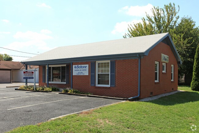
320 Robin Rd, Henderson, KY 42420


Property Detail
320 Robin Rd
55G-28
GENERAL OFFICE
Officebuilding
Henderson
B and X Area of moderate flood hazard, usually the area between the limits of the 100-year and 500-year floods.
Kentucky
2025
0.15 AC
2025
Henderson County
020604
Evansville
1,065 SF
Henderson, KY
NEARBY LISTINGS FOR SALE OR LEASE
DEMOGRAPHICS near 320 Robin Rd
1 mile
3 mile
5 mile
2025 Total Population
5,340
18,224
30,342
2030 Population
5,340
18,221
30,279
Pop Growth 2025-2030
0.00%
(0.02%)
(0.21%)
Average Age
42
42
41
2025 Total Households
2,491
8,085
12,820
HH Growth 2025-2030
+ 0.12%
(0.02%)
(0.21%)
Median Household Inc
$44,450
$47,187
$50,837
Avg Household Size
2.00
2.20
2.20
2025 Avg HH Vehicles
1.00
2.00
2.00
Median Home Value
$174,930
$193,403
$181,675
Median Year Built
1981
1976
1974
Nearby Places
Map Layers
Map Styles
 Street
 Aerial
Transit
 Traffic
 Biking
Places
Listings with unknown addresses are not visible on the map
- Restaurants
- Banks
- Shops
- Fitness
- Groceries
PUBLIC TRANSPORTATION
AIRPORT
Evansville Regional
Drive
Walk
Distance
Evansville Regional
22 min
12.4 mi
Freight Ports
Port of Toledo
Drive
Walk
Distance
Port of Toledo
467 min
402.2 mi
SALE & LEASE HISTORY
LISTING DATE
SALE/LEASE

Sep 25, 2016
For Lease
Nearby Properties
Address
Land Use
TOTAL SIZE
Lot Size
Zoning
Address
Land Use
TOTAL SIZE
Lot Size
Zoning
321,460 SF
75.59 AC
Address
Land Use
TOTAL SIZE
Lot Size
Zoning
524,000 SF
20.76 AC
Address
Land Use
TOTAL SIZE
Lot Size
Zoning
110,917 SF
25.76 AC
Address
Land Use
TOTAL SIZE
Lot Size
Zoning
16.35 AC
Address
Land Use
TOTAL SIZE
Lot Size
Zoning
20.87 AC
Address
Land Use
TOTAL SIZE
Lot Size
Zoning
53,803 SF
4 AC
Address
Land Use
TOTAL SIZE
Lot Size
Zoning
4.90 AC
Address
Land Use
TOTAL SIZE
Lot Size
Zoning
25.17 AC
COMMERCIAL
Address
Land Use
TOTAL SIZE
Lot Size
Zoning
Address
Land Use
TOTAL SIZE
Lot Size
Zoning
Address
Land Use
TOTAL SIZE
Lot Size
Zoning
110,917 SF
2.90 AC
Address
Land Use
TOTAL SIZE
Lot Size
Zoning
126.50 AC
Address
Land Use
TOTAL SIZE
Lot Size
Zoning
21,336 SF
0.36 AC
Address
Land Use
TOTAL SIZE
Lot Size
Zoning
83,956 SF
8.85 AC
Address
Land Use
TOTAL SIZE
Lot Size
Zoning
13.71 AC
COMMERCIAL
Address
Land Use
TOTAL SIZE
Lot Size
Zoning
12,996 SF
1.97 AC
COMMERCIAL
Address
Land Use
TOTAL SIZE
Lot Size
Zoning
5,472 SF
10.66 AC
Address
Land Use
TOTAL SIZE
Lot Size
Zoning
10.31 AC
Address
Land Use
TOTAL SIZE
Lot Size
Zoning
Address
Land Use
TOTAL SIZE
Lot Size
Zoning
89,082 SF
4.39 AC
Address
Land Use
TOTAL SIZE
Lot Size
Zoning
21,500 SF
1.25 AC
COMMERCIAL
Address
Land Use
TOTAL SIZE
Lot Size
Zoning
15,872 SF
12.11 AC
Address
Land Use
TOTAL SIZE
Lot Size
Zoning
1,872 SF
517.96 AC
Address
Land Use
TOTAL SIZE
Lot Size
Zoning
29,896 SF
1.32 AC
Address
Land Use
TOTAL SIZE
Lot Size
Zoning
1,473 SF
4 AC
Address
Land Use
TOTAL SIZE
Lot Size
Zoning
62,600 SF
5.65 AC
Address
Land Use
TOTAL SIZE
Lot Size
Zoning
11.79 AC
COMMERCIAL
Address
Land Use
TOTAL SIZE
Lot Size
Zoning
97,350 SF
4.76 AC
COMMERCIAL
Address
Land Use
TOTAL SIZE
Lot Size
Zoning
14,000 SF
1.49 AC
Address
Land Use
TOTAL SIZE
Lot Size
Zoning
1.55 AC
The World's #1 Commercial Real Estate Marketplace
Connect with us
© 2026 CoStar Group
The information above has been obtained from sources believed reliable. While we do not doubt its accuracy we have not verified it and make no guarantee, warranty or representation about it. It is your responsibility to independently confirm its accuracy and completeness. Any projections, opinions, assumptions, or estimates used are for example only and do not represent the current or future performance of the property. The value of this transaction to you depends on tax and other factors which should be evaluated by your tax, financial, and legal advisors. You and your advisors should conduct a careful, independent investigation of the property to determine to your satisfaction the suitability of the property for your needs.