Property Record
320 Stanton Rd, Mobile, AL 36617
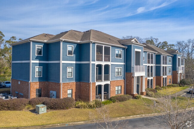

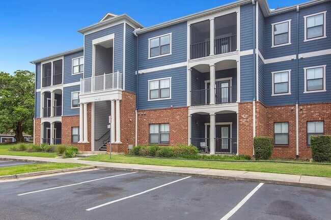
Property Detail
320 Stanton Rd
Mobile, AL
LOT 1 THE VILLAGE AT MIDTOWN S/D MBK 122/106
29-07-42-0-004-287
Mobile
Apartment
Alabama
AE The base floodplain where base flood elevations are provided. AE Zones are now used on new format FIRMs instead of A1-A30 Zones.
1
2025
16.45 AC
2025
Midtown Mobile
000801
Mobile
30,504 SF
NEARBY LISTINGS FOR SALE OR LEASE
DEMOGRAPHICS near 320 Stanton Rd
1 mile
3 mile
5 mile
2025 Total Population
10,072
73,524
129,517
2030 Population
10,214
74,915
131,057
Pop Growth 2025-2030
+ 1.41%
+ 1.89%
+ 1.19%
Average Age
42
41
40
2025 Total Households
4,286
30,847
53,293
HH Growth 2025-2030
+ 1.24%
+ 1.86%
+ 1.14%
Median Household Inc
$47,027
$40,022
$42,098
Avg Household Size
2.20
2.20
2.30
2025 Avg HH Vehicles
2.00
1.00
2.00
Median Home Value
$134,623
$117,536
$128,030
Median Year Built
1958
1961
1965
Nearby Places
Map Layers
Map Styles
 Street
 Aerial
Transit
 Traffic
 Biking
Places
Listings with unknown addresses are not visible on the map
- Restaurants
- Banks
- Shops
- Fitness
- Groceries
PUBLIC TRANSPORTATION
AIRPORT
Mobile International
Drive
Walk
Distance
Mobile International
14 min
5.9 mi
Mobile Regional
Drive
Walk
Distance
Mobile Regional
28 min
12.4 mi
Nearby Properties
Address
Land Use
TOTAL SIZE
Lot Size
Zoning
Address
Land Use
TOTAL SIZE
Lot Size
Zoning
62,699 SF
2.47 AC
Address
Land Use
TOTAL SIZE
Lot Size
Zoning
410,802 SF
109.06 AC
Address
Land Use
TOTAL SIZE
Lot Size
Zoning
171,670 SF
20.19 AC
Address
Land Use
TOTAL SIZE
Lot Size
Zoning
8,000 SF
0.90 AC
Address
Land Use
TOTAL SIZE
Lot Size
Zoning
109,359 SF
1.67 AC
Address
Land Use
TOTAL SIZE
Lot Size
Zoning
296,060 SF
40.49 AC
Address
Land Use
TOTAL SIZE
Lot Size
Zoning
339,141 SF
7.18 AC
Address
Land Use
TOTAL SIZE
Lot Size
Zoning
224,336 SF
2.43 AC
Address
Land Use
TOTAL SIZE
Lot Size
Zoning
141,209 SF
10.20 AC
Address
Land Use
TOTAL SIZE
Lot Size
Zoning
318,096 SF
6.80 AC
Address
Land Use
TOTAL SIZE
Lot Size
Zoning
32,556 SF
11.38 AC
Address
Land Use
TOTAL SIZE
Lot Size
Zoning
118,712 SF
9.90 AC
Address
Land Use
TOTAL SIZE
Lot Size
Zoning
359,478 SF
3.69 AC
Address
Land Use
TOTAL SIZE
Lot Size
Zoning
104,160 SF
2.20 AC
Address
Land Use
TOTAL SIZE
Lot Size
Zoning
139,460 SF
27.51 AC
Address
Land Use
TOTAL SIZE
Lot Size
Zoning
272,912 SF
3.32 AC
Address
Land Use
TOTAL SIZE
Lot Size
Zoning
58,192 SF
1.81 AC
Address
Land Use
TOTAL SIZE
Lot Size
Zoning
334,636 SF
38 AC
Address
Land Use
TOTAL SIZE
Lot Size
Zoning
91,391 SF
14.93 AC
Address
Land Use
TOTAL SIZE
Lot Size
Zoning
102,380 SF
12.24 AC
Address
Land Use
TOTAL SIZE
Lot Size
Zoning
46,557 SF
14.66 AC
Address
Land Use
TOTAL SIZE
Lot Size
Zoning
228,018 SF
4.80 AC
Address
Land Use
TOTAL SIZE
Lot Size
Zoning
40,060 SF
1.15 AC
Address
Land Use
TOTAL SIZE
Lot Size
Zoning
9,104 SF
13.52 AC
Address
Land Use
TOTAL SIZE
Lot Size
Zoning
208,683 SF
11.68 AC
Address
Land Use
TOTAL SIZE
Lot Size
Zoning
65,296 SF
3.74 AC
Address
Land Use
TOTAL SIZE
Lot Size
Zoning
551,664 SF
2.65 AC
Address
Land Use
TOTAL SIZE
Lot Size
Zoning
12.97 AC
Address
Land Use
TOTAL SIZE
Lot Size
Zoning
7,920 SF
0.34 AC
The World's #1 Commercial Real Estate Marketplace
Connect with us
© 2026 CoStar Group
The information above has been obtained from sources believed reliable. While we do not doubt its accuracy we have not verified it and make no guarantee, warranty or representation about it. It is your responsibility to independently confirm its accuracy and completeness. Any projections, opinions, assumptions, or estimates used are for example only and do not represent the current or future performance of the property. The value of this transaction to you depends on tax and other factors which should be evaluated by your tax, financial, and legal advisors. You and your advisors should conduct a careful, independent investigation of the property to determine to your satisfaction the suitability of the property for your needs.