Property Record
320 Tyler Rd S, Red Wing, MN 55066
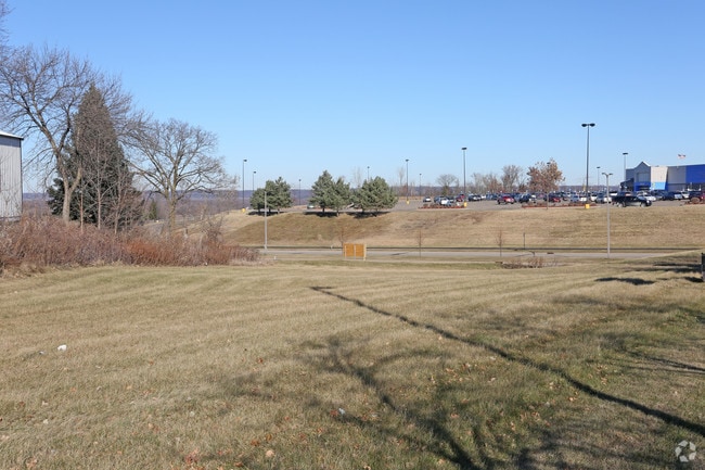


Property Detail
320 Tyler Rd S
Red Wing, MN
MED TECH PARK SUBD 4TH ADD LOT-002 BLOCK-001 LOT 2 BLOCK 1
55.903.0020
Goodhue
Storebuilding
Minnesota
2026
2
2025
17.94 AC
080202
Minnesota South Area
173,191 SF
Other Market Areas
NEARBY LISTINGS FOR SALE OR LEASE
-
-
View all Red Wing listings for sale on LoopNet.com
DEMOGRAPHICS near 320 Tyler Rd S
1 mile
3 mile
5 mile
2025 Total Population
1,989
13,338
18,847
2030 Population
2,039
13,328
18,869
Pop Growth 2025-2030
+ 2.51%
(0.07%)
+ 0.12%
Average Age
45
43
43
2025 Total Households
873
5,828
8,050
HH Growth 2025-2030
+ 2.52%
(0.15%)
+ 0.02%
Median Household Inc
$101,267
$63,192
$68,224
Avg Household Size
2.20
2.20
2.30
2025 Avg HH Vehicles
2.00
2.00
2.00
Median Home Value
$319,159
$252,834
$256,998
Median Year Built
1997
1972
1972
Nearby Places
Map Layers
Map Styles
 Street
 Aerial
Layers
 Traffic
 Biking
Places
Listings with unknown addresses are not visible on the map
- Restaurants
- Banks
- Shops
- Fitness
- Groceries
PUBLIC TRANSPORTATION
COMMUTER RAIL
Red Wing Amtrak Station (Empire Builder - Amtrak)
Drive
Walk
Distance
Red Wing Amtrak Station (Empire Builder - Amtrak)
6 min
2.8 mi
Freight Ports
Port Milwaukee
Drive
Walk
Distance
Port Milwaukee
343 min
299.8 mi
SALE & LEASE HISTORY
LISTING DATE
SALE/LEASE

Sep 24, 2016
For Sale
Nearby Properties
Address
Land Use
TOTAL SIZE
Lot Size
Zoning
Address
Land Use
TOTAL SIZE
Lot Size
Zoning
194,165 SF
24.87 AC
Address
Land Use
TOTAL SIZE
Lot Size
Zoning
156,208 SF
3.99 AC
Address
Land Use
TOTAL SIZE
Lot Size
Zoning
88,787 SF
19.15 AC
Address
Land Use
TOTAL SIZE
Lot Size
Zoning
136,318 SF
4.30 AC
Address
Land Use
TOTAL SIZE
Lot Size
Zoning
82,695 SF
13.84 AC
Address
Land Use
TOTAL SIZE
Lot Size
Zoning
102,996 SF
0.74 AC
Address
Land Use
TOTAL SIZE
Lot Size
Zoning
192,379 SF
22.63 AC
Address
Land Use
TOTAL SIZE
Lot Size
Zoning
83,007 SF
0.76 AC
Address
Land Use
TOTAL SIZE
Lot Size
Zoning
102,896 SF
0.82 AC
Address
Land Use
TOTAL SIZE
Lot Size
Zoning
119,200 SF
3.45 AC
Address
Land Use
TOTAL SIZE
Lot Size
Zoning
111,223 SF
Address
Land Use
TOTAL SIZE
Lot Size
Zoning
193,336 SF
15.04 AC
Address
Land Use
TOTAL SIZE
Lot Size
Zoning
120,692 SF
21.92 AC
Address
Land Use
TOTAL SIZE
Lot Size
Zoning
172,140 SF
0.60 AC
Address
Land Use
TOTAL SIZE
Lot Size
Zoning
875,200 SF
1.95 AC
Address
Land Use
TOTAL SIZE
Lot Size
Zoning
53,808 SF
1.47 AC
Address
Land Use
TOTAL SIZE
Lot Size
Zoning
87,184 SF
4.96 AC
Address
Land Use
TOTAL SIZE
Lot Size
Zoning
205,520 SF
16.43 AC
Address
Land Use
TOTAL SIZE
Lot Size
Zoning
14,268 SF
11.72 AC
Address
Land Use
TOTAL SIZE
Lot Size
Zoning
18,818 SF
7.91 AC
Address
Land Use
TOTAL SIZE
Lot Size
Zoning
68,142 SF
9.04 AC
Address
Land Use
TOTAL SIZE
Lot Size
Zoning
223,377 SF
0.39 AC
Address
Land Use
TOTAL SIZE
Lot Size
Zoning
77,616 SF
100 AC
Address
Land Use
TOTAL SIZE
Lot Size
Zoning
58,552 SF
2.21 AC
Address
Land Use
TOTAL SIZE
Lot Size
Zoning
1,824 SF
3.87 AC
Address
Land Use
TOTAL SIZE
Lot Size
Zoning
51,952 SF
2.96 AC
Address
Land Use
TOTAL SIZE
Lot Size
Zoning
62,100 SF
4.03 AC
The World's #1 Commercial Real Estate Marketplace
Connect with us
© 2026 CoStar Group
The information above has been obtained from sources believed reliable. While we do not doubt its accuracy we have not verified it and make no guarantee, warranty or representation about it. It is your responsibility to independently confirm its accuracy and completeness. Any projections, opinions, assumptions, or estimates used are for example only and do not represent the current or future performance of the property. The value of this transaction to you depends on tax and other factors which should be evaluated by your tax, financial, and legal advisors. You and your advisors should conduct a careful, independent investigation of the property to determine to your satisfaction the suitability of the property for your needs.