Property Record
320 Upper Valley Falls Rd, Boiling Springs, SC 29316


NEARBY LISTINGS FOR SALE OR LEASE
Property Detail
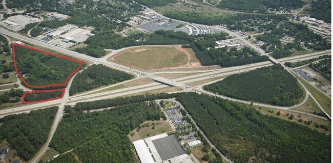
320 Upper Valley Falls Rd
Spartanburg, SC
Frank Mcdowell Sub
2-55-00-055.08
W SIDE TENOSHA DR & E SIDE UPPER VALLEY FALLS RD PB 7-122 PB 181-801 DB 146J-554
Commercialacreage
Spartanburg
X
South Carolina
45083C0251D
39
2024
16.40 AC
2025
North Side/Rt 9 Corridor
021600
Greenville/Spartanburg
DEMOGRAPHICS near 320 Upper Valley Falls Rd
1 mile
3 mile
5 mile
2024 Total Population
6,219
37,789
91,535
2029 Population
6,927
42,674
103,817
Pop Growth 2024-2029
+ 11.38%
+ 12.93%
+ 13.42%
Average Age
33
36
37
2024 Total Households
2,128
13,792
34,382
HH Growth 2024-2029
+ 11.80%
+ 13.33%
+ 13.96%
Median Household Inc
$36,404
$49,516
$51,193
Avg Household Size
2.40
2.50
2.50
2024 Avg HH Vehicles
2.00
2.00
2.00
Median Home Value
$133,233
$165,052
$169,027
Median Year Built
1993
1991
1987
Nearby Places
Map Layers
Map Styles
 Street
 Aerial
Transit
 Traffic
 Biking
Places
Listings with unknown addresses are not visible on the map
- Restaurants
- Banks
- Shops
- Fitness
- Groceries
PUBLIC TRANSPORTATION
COMMUTER RAIL
Spartanburg Amtrak Station (Crescent - Amtrak)
Drive
Walk
Distance
Spartanburg Amtrak Station (Crescent - Amtrak)
10 min
5.1 mi
AIRPORT
Greenville Spartanburg International
Drive
Walk
Distance
Greenville Spartanburg International
25 min
17.6 mi
Freight Ports
North Charleston Terminal
Drive
Walk
Distance
North Charleston Terminal
222 min
198.1 mi
SALE & LEASE HISTORY
LISTING DATE
SALE/LEASE

Sep 24, 2016
For Sale
Oct 27, 2016
For Sale
Jun 05, 2017
For Sale
Jul 06, 2023
For Sale
Jan 31, 2017
For Sale
Feb 28, 2017
For Sale
Nearby Properties
Address
Land Use
TOTAL SIZE
Lot Size
Zoning
Address
Land Use
TOTAL SIZE
Lot Size
Zoning
4,172 SF
15.98 AC
Address
Land Use
TOTAL SIZE
Lot Size
Zoning
27,491 SF
2.95 AC
Address
Land Use
TOTAL SIZE
Lot Size
Zoning
5,547 SF
6.58 AC
Address
Land Use
TOTAL SIZE
Lot Size
Zoning
141,112 SF
3.38 AC
Address
Land Use
TOTAL SIZE
Lot Size
Zoning
100,000 SF
8.29 AC
Address
Land Use
TOTAL SIZE
Lot Size
Zoning
22,955 SF
5.05 AC
Address
Land Use
TOTAL SIZE
Lot Size
Zoning
19,876 SF
0.03 AC
Address
Land Use
TOTAL SIZE
Lot Size
Zoning
239,095 SF
22.41 AC
Address
Land Use
TOTAL SIZE
Lot Size
Zoning
12,740 SF
1.48 AC
Address
Land Use
TOTAL SIZE
Lot Size
Zoning
13,160 SF
1.62 AC
Address
Land Use
TOTAL SIZE
Lot Size
Zoning
12,069 SF
0.03 AC
Address
Land Use
TOTAL SIZE
Lot Size
Zoning
Address
Land Use
TOTAL SIZE
Lot Size
Zoning
64,092 SF
30.61 AC
Address
Land Use
TOTAL SIZE
Lot Size
Zoning
122,626 SF
7.70 AC
Address
Land Use
TOTAL SIZE
Lot Size
Zoning
8,872 SF
0.03 AC
Address
Land Use
TOTAL SIZE
Lot Size
Zoning
5,034 SF
17.60 AC
Address
Land Use
TOTAL SIZE
Lot Size
Zoning
37.35 AC
Address
Land Use
TOTAL SIZE
Lot Size
Zoning
1,221,473 SF
36.50 AC
Address
Land Use
TOTAL SIZE
Lot Size
Zoning
341,895 SF
31.62 AC
Address
Land Use
TOTAL SIZE
Lot Size
Zoning
83,698 SF
18.14 AC
Address
Land Use
TOTAL SIZE
Lot Size
Zoning
81,040 SF
15.39 AC
Address
Land Use
TOTAL SIZE
Lot Size
Zoning
89,435 SF
5.33 AC
Address
Land Use
TOTAL SIZE
Lot Size
Zoning
33,550 SF
3.77 AC
Address
Land Use
TOTAL SIZE
Lot Size
Zoning
101,622 SF
19.63 AC
Address
Land Use
TOTAL SIZE
Lot Size
Zoning
20,976 SF
23.72 AC
Address
Land Use
TOTAL SIZE
Lot Size
Zoning
41,694 SF
4.01 AC
Address
Land Use
TOTAL SIZE
Lot Size
Zoning
2,328 SF
16.99 AC
Address
Land Use
TOTAL SIZE
Lot Size
Zoning
3,112 SF
20.17 AC
Address
Land Use
TOTAL SIZE
Lot Size
Zoning
8,911 SF
23.64 AC
Address
Land Use
TOTAL SIZE
Lot Size
Zoning
6,816 SF
14.16 AC
The World's #1 Commercial Real Estate Marketplace
Connect with us
© 2026 CoStar Group
The information above has been obtained from sources believed reliable. While we do not doubt its accuracy we have not verified it and make no guarantee, warranty or representation about it. It is your responsibility to independently confirm its accuracy and completeness. Any projections, opinions, assumptions, or estimates used are for example only and do not represent the current or future performance of the property. The value of this transaction to you depends on tax and other factors which should be evaluated by your tax, financial, and legal advisors. You and your advisors should conduct a careful, independent investigation of the property to determine to your satisfaction the suitability of the property for your needs.