Property Record
320 W Summit Ave, Wales, WI 53183
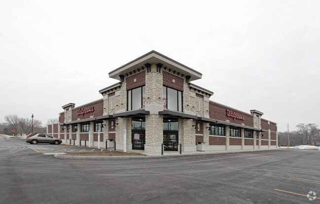

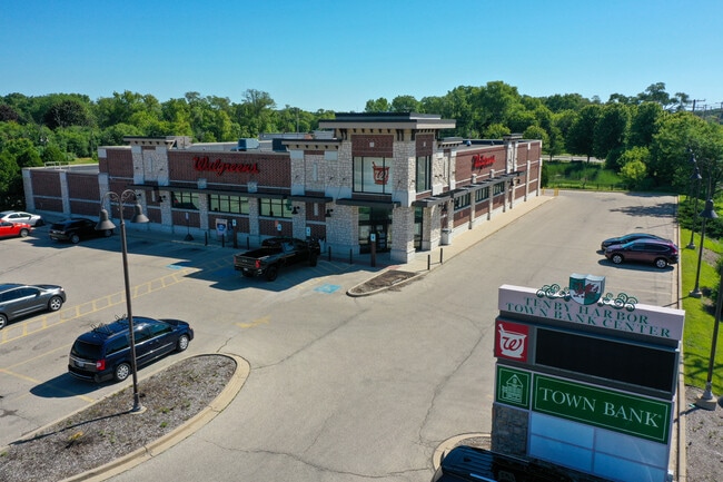

Property Detail
320 W Summit Ave
Milwaukee-Waukesha, WI
LOT 3 CERT SURV 10636 VOL 102/176 PT NE1/4 SEC 5 T6N R18E :: EX PARCEL 85 TRANSPORTATION PROJECT PLAT 1330-18-20 4.19 DOC# 3754093
WLSV-1457-996-003
Waukesha
Commercialnec
Wisconsin
B and X Area of moderate flood hazard, usually the area between the limits of the 100-year and 500-year floods.
3
2024
2.01 AC
2024
NE/Delafield
203702
Milwaukee/Madison
NEARBY LISTINGS FOR SALE OR LEASE
-
-
View all Wales listings for sale on LoopNet.com
DEMOGRAPHICS near 320 W Summit Ave
1 mile
3 mile
5 mile
2025 Total Population
2,769
9,521
30,519
2030 Population
2,823
9,632
31,163
Pop Growth 2025-2030
+ 1.95%
+ 1.17%
+ 2.11%
Average Age
44
45
45
2025 Total Households
1,073
3,703
11,726
HH Growth 2025-2030
+ 1.86%
+ 1.19%
+ 2.17%
Median Household Inc
$116,316
$120,507
$124,671
Avg Household Size
2.60
2.60
2.50
2025 Avg HH Vehicles
2.00
2.00
2.00
Median Home Value
$441,769
$456,139
$473,368
Median Year Built
1980
1979
1987
Nearby Places
Map Layers
Map Styles
 Street
 Aerial
Layers
 Traffic
 Biking
Places
Listings with unknown addresses are not visible on the map
- Restaurants
- Banks
- Shops
- Fitness
- Groceries
PUBLIC TRANSPORTATION
AIRPORT
General Mitchell International
Drive
Walk
Distance
General Mitchell International
47 min
33.3 mi
Freight Ports
Port Milwaukee
Drive
Walk
Distance
Port Milwaukee
40 min
29.8 mi
SALE & LEASE HISTORY
LISTING DATE
SALE/LEASE

Jun 21, 2024
For Sale
Nearby Properties
Address
Land Use
TOTAL SIZE
Lot Size
Zoning
Address
Land Use
TOTAL SIZE
Lot Size
Zoning
8.48 AC
Address
Land Use
TOTAL SIZE
Lot Size
Zoning
6.33 AC
Address
Land Use
TOTAL SIZE
Lot Size
Zoning
7.66 AC
Address
Land Use
TOTAL SIZE
Lot Size
Zoning
59.06 AC
Address
Land Use
TOTAL SIZE
Lot Size
Zoning
12.98 AC
Address
Land Use
TOTAL SIZE
Lot Size
Zoning
4.32 AC
Address
Land Use
TOTAL SIZE
Lot Size
Zoning
183.31 AC
Address
Land Use
TOTAL SIZE
Lot Size
Zoning
3.94 AC
Address
Land Use
TOTAL SIZE
Lot Size
Zoning
Address
Land Use
TOTAL SIZE
Lot Size
Zoning
2.18 AC
Address
Land Use
TOTAL SIZE
Lot Size
Zoning
Address
Land Use
TOTAL SIZE
Lot Size
Zoning
Address
Land Use
TOTAL SIZE
Lot Size
Zoning
21.70 AC
Address
Land Use
TOTAL SIZE
Lot Size
Zoning
4.77 AC
Address
Land Use
TOTAL SIZE
Lot Size
Zoning
Address
Land Use
TOTAL SIZE
Lot Size
Zoning
1.20 AC
Address
Land Use
TOTAL SIZE
Lot Size
Zoning
75.05 AC
Address
Land Use
TOTAL SIZE
Lot Size
Zoning
Address
Land Use
TOTAL SIZE
Lot Size
Zoning
82.42 AC
Address
Land Use
TOTAL SIZE
Lot Size
Zoning
Address
Land Use
TOTAL SIZE
Lot Size
Zoning
285.58 AC
Address
Land Use
TOTAL SIZE
Lot Size
Zoning
Address
Land Use
TOTAL SIZE
Lot Size
Zoning
1.95 AC
Address
Land Use
TOTAL SIZE
Lot Size
Zoning
1.35 AC
Address
Land Use
TOTAL SIZE
Lot Size
Zoning
Address
Land Use
TOTAL SIZE
Lot Size
Zoning
12.77 AC
Address
Land Use
TOTAL SIZE
Lot Size
Zoning
Address
Land Use
TOTAL SIZE
Lot Size
Zoning
1.34 AC
Address
Land Use
TOTAL SIZE
Lot Size
Zoning
245.11 AC
The World's #1 Commercial Real Estate Marketplace
Connect with us
© 2026 CoStar Group
The information above has been obtained from sources believed reliable. While we do not doubt its accuracy we have not verified it and make no guarantee, warranty or representation about it. It is your responsibility to independently confirm its accuracy and completeness. Any projections, opinions, assumptions, or estimates used are for example only and do not represent the current or future performance of the property. The value of this transaction to you depends on tax and other factors which should be evaluated by your tax, financial, and legal advisors. You and your advisors should conduct a careful, independent investigation of the property to determine to your satisfaction the suitability of the property for your needs.