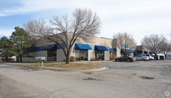
Property Record
3200 Haskell Ave, Lawrence, KS 66046

Property Detail
3200 Haskell Ave
023-104-17-0-00-00-011.00-0
3100 HASKELL ADD LT 4-A DESC AS:BEG AT NW COR LT 4 TH N89 54'18"E ALONG N LINE SD LT 207 FT;TH N44 14'08"E 105.1 FT;TH S00
Officebuilding
Douglas
M2
Kansas
AE The base floodplain where base flood elevations are provided. AE Zones are now used on new format FIRMs instead of A1-A30 Zones.
118,285
2025
2.10 AC
2025
Lawrence
001002
Kansas City
15,816 SF
Lawrence, KS
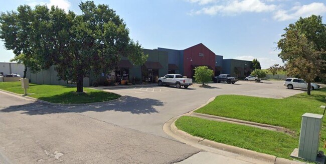
NEARBY LISTINGS FOR SALE OR LEASE
DEMOGRAPHICS near 3200 Haskell Ave
1 mile
3 mile
5 mile
2025 Total Population
2,899
44,313
83,448
2030 Population
3,013
45,699
85,595
Pop Growth 2025-2030
+ 3.93%
+ 3.13%
+ 2.57%
Average Age
38
33
36
2025 Total Households
1,077
16,959
34,450
HH Growth 2025-2030
+ 3.90%
+ 3.52%
+ 2.83%
Median Household Inc
$87,739
$54,410
$58,342
Avg Household Size
2.50
2.20
2.20
2025 Avg HH Vehicles
2.00
2.00
2.00
Median Home Value
$220,629
$229,756
$268,177
Median Year Built
1995
1977
1981
Nearby Places
Map Layers
Map Styles
 Street
 Aerial
Layers
 Traffic
 Biking
Places
Listings with unknown addresses are not visible on the map
- Restaurants
- Banks
- Shops
- Fitness
- Groceries
PUBLIC TRANSPORTATION
COMMUTER RAIL
Drive
Walk
Distance
9 min
3.6 mi
SALE & LEASE HISTORY
LISTING DATE
SALE/LEASE

Sep 24, 2016
For Lease
Oct 11, 2018
For Lease
Jun 27, 2022
For Lease
Nearby Properties
Address
Land Use
TOTAL SIZE
Lot Size
Zoning
Address
Land Use
TOTAL SIZE
Lot Size
Zoning
1,709,524 SF
32.03 AC
RD
Address
Land Use
TOTAL SIZE
Lot Size
Zoning
1,258,819 SF
106.65 AC
RD
Address
Land Use
TOTAL SIZE
Lot Size
Zoning
1,264,810 SF
129.10 AC
RD
Address
Land Use
TOTAL SIZE
Lot Size
Zoning
632,738 SF
292.10 AC
RS2
Address
Land Use
TOTAL SIZE
Lot Size
Zoning
335,349 SF
3.17 AC
RD
Address
Land Use
TOTAL SIZE
Lot Size
Zoning
112,168 SF
38.08 AC
RD
Address
Land Use
TOTAL SIZE
Lot Size
Zoning
200,960 SF
9.20 AC
RD
Address
Land Use
TOTAL SIZE
Lot Size
Zoning
160,881 SF
20.50 AC
PID2
Address
Land Use
TOTAL SIZE
Lot Size
Zoning
249,773 SF
34.84 AC
RS2
Address
Land Use
TOTAL SIZE
Lot Size
Zoning
336,701 SF
5.20 AC
RD
Address
Land Use
TOTAL SIZE
Lot Size
Zoning
220,557 SF
8.90 AC
RD
Address
Land Use
TOTAL SIZE
Lot Size
Zoning
162,086 SF
3 AC
RD
Address
Land Use
TOTAL SIZE
Lot Size
Zoning
67,500 SF
4.03 AC
RM1
Address
Land Use
TOTAL SIZE
Lot Size
Zoning
186,889 SF
3.60 AC
RD
Address
Land Use
TOTAL SIZE
Lot Size
Zoning
92,295 SF
10.40 AC
RS1
Address
Land Use
TOTAL SIZE
Lot Size
Zoning
143,467 SF
2.80 AC
RM1
Address
Land Use
TOTAL SIZE
Lot Size
Zoning
125,214 SF
20 AC
RS1
Address
Land Use
TOTAL SIZE
Lot Size
Zoning
104,785 SF
105.60 AC
RS1
Address
Land Use
TOTAL SIZE
Lot Size
Zoning
78,051 SF
37.20 AC
RS2
Address
Land Use
TOTAL SIZE
Lot Size
Zoning
5,984 SF
142.30 AC
M2
Address
Land Use
TOTAL SIZE
Lot Size
Zoning
52,000 SF
36 AC
RS1
Address
Land Use
TOTAL SIZE
Lot Size
Zoning
19,985 SF
103.37 AC
RS1
Address
Land Use
TOTAL SIZE
Lot Size
Zoning
337,280 SF
0.60 AC
RD
Address
Land Use
TOTAL SIZE
Lot Size
Zoning
52,028 SF
11.07 AC
Address
Land Use
TOTAL SIZE
Lot Size
Zoning
34,479 SF
1.08 AC
C4
Address
Land Use
TOTAL SIZE
Lot Size
Zoning
131,625 SF
2.32 AC
C3
Address
Land Use
TOTAL SIZE
Lot Size
Zoning
79,784 SF
3.46 AC
RM2
Address
Land Use
TOTAL SIZE
Lot Size
Zoning
56,388 SF
15.40 AC
RS1
Address
Land Use
TOTAL SIZE
Lot Size
Zoning
22,774 SF
3.49 AC
RD
Address
Land Use
TOTAL SIZE
Lot Size
Zoning
11,324 SF
27.83 AC
The World's #1 Commercial Real Estate Marketplace
Connect with us
© 2026 CoStar Group
The information above has been obtained from sources believed reliable. While we do not doubt its accuracy we have not verified it and make no guarantee, warranty or representation about it. It is your responsibility to independently confirm its accuracy and completeness. Any projections, opinions, assumptions, or estimates used are for example only and do not represent the current or future performance of the property. The value of this transaction to you depends on tax and other factors which should be evaluated by your tax, financial, and legal advisors. You and your advisors should conduct a careful, independent investigation of the property to determine to your satisfaction the suitability of the property for your needs.