Property Record
3200 Southpark Blvd, Ellenwood, GA 30294

NEARBY LISTINGS FOR SALE OR LEASE
Property Detail
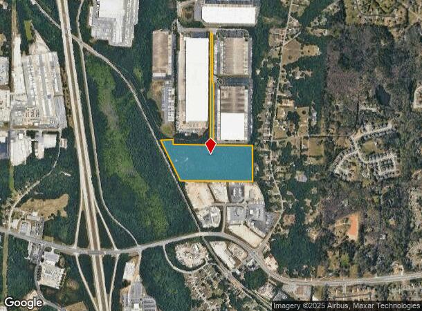
3200 Southpark Blvd
12-0202D-00B-004
INDUSTRIAL
Industrialacreage
Clayton
X
Georgia
13063C0081F
25.47 AC
2024
Airport/North Clayton
2024
Atlanta
070127
Atlanta-Sandy Springs-Roswell, GA
DEMOGRAPHICS near 3200 Southpark Blvd
1 Mile
3 Mile
5 Mile
2024 Total Population
2,310
47,951
147,625
2029 Population
2,297
48,377
149,117
Pop Growth 2024-2029
(0.56%)
+ 0.89%
+ 1.01%
Average Age
37
37
37
2024 Total Households
780
16,347
51,148
HH Growth 2024-2029
(0.64%)
+ 1.12%
+ 1.12%
Median Household Inc
$79,517
$60,791
$57,992
Avg Household Size
2.90
2.80
2.80
2024 Avg HH Vehicles
2.00
2.00
2.00
Median Home Value
$226,666
$181,421
$179,604
Median Year Built
2001
1993
1990
Nearby Places
Map Layers
Map Styles
 Street
 Aerial
- Restaurants
- Banks
- Shops
- Fitness
- Groceries
PUBLIC TRANSPORTATION
AIRPORT
Hartsfield - Jackson Atlanta International
DRIVE
WALK
Distance
Hartsfield - Jackson Atlanta International
26 min
10.1 mi
SALE & LEASE HISTORY
LISTING DATE
SALE/LEASE

Sep 25, 2016
For Lease
Nearby Properties
Address
Land Use
TOTAL SIZE
Lot Size
Zoning
Address
Land Use
TOTAL SIZE
Lot Size
Zoning
873,223 SF
60.88 AC
I
Address
Land Use
TOTAL SIZE
Lot Size
Zoning
42,671 SF
56.11 AC
I
Address
Land Use
TOTAL SIZE
Lot Size
Zoning
20,964 SF
70.93 AC
I
Address
Land Use
TOTAL SIZE
Lot Size
Zoning
797,738 SF
54.98 AC
WH
Address
Land Use
TOTAL SIZE
Lot Size
Zoning
848,420 SF
48.96 AC
I
Address
Land Use
TOTAL SIZE
Lot Size
Zoning
264 SF
25.80 AC
RM
Address
Land Use
TOTAL SIZE
Lot Size
Zoning
659,547 SF
31.20 AC
HI
Address
Land Use
TOTAL SIZE
Lot Size
Zoning
200 SF
19 AC
RM
Address
Land Use
TOTAL SIZE
Lot Size
Zoning
371,336 SF
29.50 AC
I
Address
Land Use
TOTAL SIZE
Lot Size
Zoning
321,464 SF
23.11 AC
HI
Address
Land Use
TOTAL SIZE
Lot Size
Zoning
272,376 SF
17.73 AC
MXI
Address
Land Use
TOTAL SIZE
Lot Size
Zoning
229,829 SF
24.15 AC
HI
Address
Land Use
TOTAL SIZE
Lot Size
Zoning
365,298 SF
22.51 AC
I
Address
Land Use
TOTAL SIZE
Lot Size
Zoning
332,442 SF
28.80 AC
HI
Address
Land Use
TOTAL SIZE
Lot Size
Zoning
240 SF
25.09 AC
RM
Address
Land Use
TOTAL SIZE
Lot Size
Zoning
399,000 SF
30.50 AC
WH
Address
Land Use
TOTAL SIZE
Lot Size
Zoning
343,585 SF
24.04 AC
LI
Address
Land Use
TOTAL SIZE
Lot Size
Zoning
400,000 SF
42.87 AC
HI
Address
Land Use
TOTAL SIZE
Lot Size
Zoning
169,832 SF
13.35 AC
I
Address
Land Use
TOTAL SIZE
Lot Size
Zoning
232 SF
21.38 AC
C
Address
Land Use
TOTAL SIZE
Lot Size
Zoning
142,742 SF
27.10 AC
RS110
Address
Land Use
TOTAL SIZE
Lot Size
Zoning
312,798 SF
21.38 AC
HI
Address
Land Use
TOTAL SIZE
Lot Size
Zoning
214,055 SF
55.08 AC
HI
Address
Land Use
TOTAL SIZE
Lot Size
Zoning
196 SF
18.30 AC
RM
Address
Land Use
TOTAL SIZE
Lot Size
Zoning
7,967 SF
7.84 AC
HI
Address
Land Use
TOTAL SIZE
Lot Size
Zoning
222.93 AC
I
Address
Land Use
TOTAL SIZE
Lot Size
Zoning
188,589 SF
27.76 AC
PUD
Address
Land Use
TOTAL SIZE
Lot Size
Zoning
23,169 SF
21.09 AC
PUD
Address
Land Use
TOTAL SIZE
Lot Size
Zoning
271,919 SF
17.89 AC
HI
Address
Land Use
TOTAL SIZE
Lot Size
Zoning
12.23 AC
I
The World's #1 Commercial Real Estate Marketplace
Connect with us
© 2025 CoStar Group
The information above has been obtained from sources believed reliable. While we do not doubt its accuracy we have not verified it and make no guarantee, warranty or representation about it. It is your responsibility to independently confirm its accuracy and completeness. Any projections, opinions, assumptions, or estimates used are for example only and do not represent the current or future performance of the property. The value of this transaction to you depends on tax and other factors which should be evaluated by your tax, financial, and legal advisors. You and your advisors should conduct a careful, independent investigation of the property to determine to your satisfaction the suitability of the property for your needs.