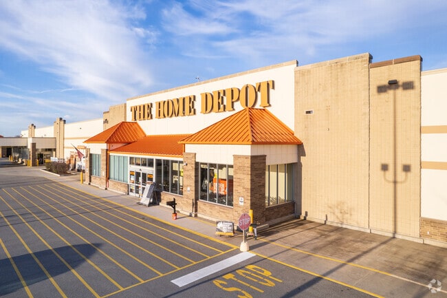
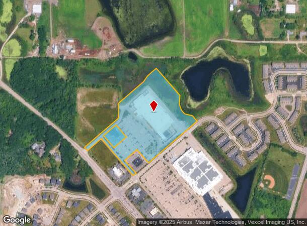
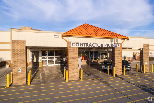
Property Record
3200 W Il Route 60, Mundelein, IL 60060
NEARBY LISTINGS FOR SALE OR LEASE
Property Detail
3200 W Il Route 60
Chicago-Naperville-Elgin, IL-IN-WI
Mundelein Crossing Second Resub
10-15-403-010
MUNDELEIN CROSSING SECOND RESUB; LOT 1 (EX PT BEG AT MOST SL Y COR OF SD LOT, N41D0146W 47, N48D5814E 150, N59D565 9E 62.56, N48D5814E 907.22 TO NELY LN OF SD LOT, S41D01
Commercialbuilding
Lake
A
Illinois
17097C0141L
1
2023
14.42 AC
2024
Central Northwest
864110
Chicago
107,049 SF
DEMOGRAPHICS near 3200 W Il Route 60
1 Mile
3 Mile
5 Mile
2024 Total Population
2,148
27,437
110,536
2029 Population
2,125
27,077
109,109
Pop Growth 2024-2029
(1.07%)
(1.31%)
(1.29%)
Average Age
51
44
41
2024 Total Households
922
10,231
39,990
HH Growth 2024-2029
(1.19%)
(1.38%)
(1.38%)
Median Household Inc
$106,051
$102,797
$106,238
Avg Household Size
2.30
2.60
2.70
2024 Avg HH Vehicles
2.00
2.00
2.00
Median Home Value
$367,952
$293,022
$309,199
Median Year Built
2000
1991
1988
Nearby Places
Map Layers
Map Styles
 Street
 Aerial
- Restaurants
- Banks
- Shops
- Fitness
- Groceries
PUBLIC TRANSPORTATION
COMMUTER RAIL
Mundelein Station (North Central Service - Northeast Illinois Regional Commuter Railroad (Metra))
DRIVE
WALK
Distance
Mundelein Station (North Central Service - Northeast Illinois Regional Commuter Railroad (Metra))
10 min
3.7 mi
Prairie Crossing Station (NCS) (North Central Service - Northeast Illinois Regional Commuter Railroad (Metra))
DRIVE
WALK
Distance
Prairie Crossing Station (NCS) (North Central Service - Northeast Illinois Regional Commuter Railroad (Metra))
10 min
4.3 mi
AIRPORT
Chicago O'Hare International
DRIVE
WALK
Distance
Chicago O'Hare International
45 min
28.8 mi
Nearby Properties
Address
Land Use
TOTAL SIZE
Lot Size
Zoning
Address
Land Use
TOTAL SIZE
Lot Size
Zoning
1,401,971 SF
85.78 AC
Address
Land Use
TOTAL SIZE
Lot Size
Zoning
Address
Land Use
TOTAL SIZE
Lot Size
Zoning
596,712 SF
35.56 AC
Address
Land Use
TOTAL SIZE
Lot Size
Zoning
Address
Land Use
TOTAL SIZE
Lot Size
Zoning
298,181 SF
20.41 AC
Address
Land Use
TOTAL SIZE
Lot Size
Zoning
2.60 AC
Address
Land Use
TOTAL SIZE
Lot Size
Zoning
340,535 SF
19.01 AC
Address
Land Use
TOTAL SIZE
Lot Size
Zoning
177,993 SF
10 AC
Address
Land Use
TOTAL SIZE
Lot Size
Zoning
135,180 SF
22.05 AC
Address
Land Use
TOTAL SIZE
Lot Size
Zoning
217,620 SF
13.07 AC
Address
Land Use
TOTAL SIZE
Lot Size
Zoning
Address
Land Use
TOTAL SIZE
Lot Size
Zoning
Address
Land Use
TOTAL SIZE
Lot Size
Zoning
192,330 SF
10.23 AC
Address
Land Use
TOTAL SIZE
Lot Size
Zoning
786,312 SF
14.74 AC
Address
Land Use
TOTAL SIZE
Lot Size
Zoning
175,833 SF
7.70 AC
Address
Land Use
TOTAL SIZE
Lot Size
Zoning
175,818 SF
18 AC
Address
Land Use
TOTAL SIZE
Lot Size
Zoning
324,153 SF
12.88 AC
Address
Land Use
TOTAL SIZE
Lot Size
Zoning
428,703 SF
24.63 AC
Address
Land Use
TOTAL SIZE
Lot Size
Zoning
71,320 SF
26.33 AC
Address
Land Use
TOTAL SIZE
Lot Size
Zoning
Address
Land Use
TOTAL SIZE
Lot Size
Zoning
Address
Land Use
TOTAL SIZE
Lot Size
Zoning
95,180 SF
12.40 AC
Address
Land Use
TOTAL SIZE
Lot Size
Zoning
Address
Land Use
TOTAL SIZE
Lot Size
Zoning
142,290 SF
10.56 AC
Address
Land Use
TOTAL SIZE
Lot Size
Zoning
12.81 AC
Address
Land Use
TOTAL SIZE
Lot Size
Zoning
6.04 AC
Address
Land Use
TOTAL SIZE
Lot Size
Zoning
Address
Land Use
TOTAL SIZE
Lot Size
Zoning
129,075 SF
8.79 AC
Address
Land Use
TOTAL SIZE
Lot Size
Zoning
79,136 SF
30.10 AC
Address
Land Use
TOTAL SIZE
Lot Size
Zoning
71,064 SF
29.20 AC
The World's #1 Commercial Real Estate Marketplace
Connect with us
© 2025 CoStar Group
The information above has been obtained from sources believed reliable. While we do not doubt its accuracy we have not verified it and make no guarantee, warranty or representation about it. It is your responsibility to independently confirm its accuracy and completeness. Any projections, opinions, assumptions, or estimates used are for example only and do not represent the current or future performance of the property. The value of this transaction to you depends on tax and other factors which should be evaluated by your tax, financial, and legal advisors. You and your advisors should conduct a careful, independent investigation of the property to determine to your satisfaction the suitability of the property for your needs.