Property Record
3200 W Washington St, Broken Arrow, OK 74012
NEARBY LISTINGS FOR SALE OR LEASE
Property Detail
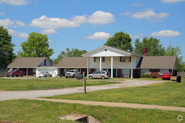
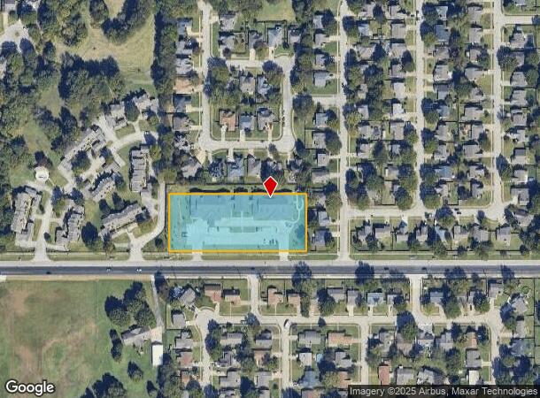
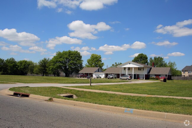
3200 W Washington St
Tulsa, OK
Gilgal Addn, The
83580-84-16-01360
LT 1 BLK 1
Multifamilydwelling
Tulsa
X
Oklahoma
40143C0387L
1
2025
2.32 AC
2025
Southeast
007519
Tulsa
26,652 SF
DEMOGRAPHICS near 3200 W Washington St
1 Mile
3 Mile
5 Mile
2024 Total Population
10,771
74,991
176,106
2029 Population
10,983
77,110
182,295
Pop Growth 2024-2029
+ 1.97%
+ 2.83%
+ 3.51%
Average Age
39
39
39
2024 Total Households
3,663
28,648
69,706
HH Growth 2024-2029
+ 2.05%
+ 2.90%
+ 3.53%
Median Household Inc
$92,425
$74,662
$74,143
Avg Household Size
2.90
2.50
2.50
2024 Avg HH Vehicles
2.00
2.00
2.00
Median Home Value
$205,369
$196,999
$220,882
Median Year Built
1986
1989
1989
Nearby Places
Map Layers
Map Styles
 Street
 Aerial
- Restaurants
- Banks
- Shops
- Fitness
- Groceries
PUBLIC TRANSPORTATION
AIRPORT
Tulsa International
DRIVE
WALK
Distance
Tulsa International
26 min
17.5 mi
Freight Ports
Tulsa Port Of Catoosa
DRIVE
WALK
Distance
Tulsa Port Of Catoosa
28 min
21.3 mi
SALE & LEASE HISTORY
LISTING DATE
SALE/LEASE

Sep 24, 2016
For Sale
Nearby Properties
Address
Land Use
TOTAL SIZE
Lot Size
Zoning
Address
Land Use
TOTAL SIZE
Lot Size
Zoning
323,882 SF
20 AC
CO
Address
Land Use
TOTAL SIZE
Lot Size
Zoning
157,138 SF
9.28 AC
CO
Address
Land Use
TOTAL SIZE
Lot Size
Zoning
435,822 SF
43.42 AC
R1
Address
Land Use
TOTAL SIZE
Lot Size
Zoning
390,154 SF
52.94 AC
A1
Address
Land Use
TOTAL SIZE
Lot Size
Zoning
134,232 SF
28.52 AC
R2
Address
Land Use
TOTAL SIZE
Lot Size
Zoning
90,533 SF
29.41 AC
A1
Address
Land Use
TOTAL SIZE
Lot Size
Zoning
84,927 SF
4.81 AC
RM2
Address
Land Use
TOTAL SIZE
Lot Size
Zoning
152,422 SF
44.60 AC
AG
Address
Land Use
TOTAL SIZE
Lot Size
Zoning
77,260 SF
0.58 AC
R3
Address
Land Use
TOTAL SIZE
Lot Size
Zoning
21,301 SF
3.94 AC
CN
Address
Land Use
TOTAL SIZE
Lot Size
Zoning
56,526 SF
25.18 AC
AG
Address
Land Use
TOTAL SIZE
Lot Size
Zoning
84,314 SF
12.05 AC
A1
Address
Land Use
TOTAL SIZE
Lot Size
Zoning
68,478 SF
9.27 AC
R1
Address
Land Use
TOTAL SIZE
Lot Size
Zoning
67,149 SF
28.56 AC
R2
Address
Land Use
TOTAL SIZE
Lot Size
Zoning
58,627 SF
6.07 AC
CG
Address
Land Use
TOTAL SIZE
Lot Size
Zoning
Address
Land Use
TOTAL SIZE
Lot Size
Zoning
260,059 SF
19.99 AC
CO
Address
Land Use
TOTAL SIZE
Lot Size
Zoning
71,362 SF
14.08 AC
RD
Address
Land Use
TOTAL SIZE
Lot Size
Zoning
22,594 SF
2.07 AC
ON
Address
Land Use
TOTAL SIZE
Lot Size
Zoning
39,733 SF
9.36 AC
A1
Address
Land Use
TOTAL SIZE
Lot Size
Zoning
20,292 SF
48.11 AC
CO
Address
Land Use
TOTAL SIZE
Lot Size
Zoning
60,790 SF
10.84 AC
R1
Address
Land Use
TOTAL SIZE
Lot Size
Zoning
330,744 SF
17.43 AC
RM3
Address
Land Use
TOTAL SIZE
Lot Size
Zoning
11,601 SF
38.18 AC
RS1
Address
Land Use
TOTAL SIZE
Lot Size
Zoning
346,535 SF
19.58 AC
RS3
Address
Land Use
TOTAL SIZE
Lot Size
Zoning
356,659 SF
14.18 AC
CO
Address
Land Use
TOTAL SIZE
Lot Size
Zoning
37,750 SF
10.06 AC
CO
Address
Land Use
TOTAL SIZE
Lot Size
Zoning
268,496 SF
19.31 AC
CN
Address
Land Use
TOTAL SIZE
Lot Size
Zoning
288,501 SF
19.31 AC
CN
Address
Land Use
TOTAL SIZE
Lot Size
Zoning
178,999 SF
23.87 AC
CO
The World's #1 Commercial Real Estate Marketplace
Connect with us
© 2025 CoStar Group
The information above has been obtained from sources believed reliable. While we do not doubt its accuracy we have not verified it and make no guarantee, warranty or representation about it. It is your responsibility to independently confirm its accuracy and completeness. Any projections, opinions, assumptions, or estimates used are for example only and do not represent the current or future performance of the property. The value of this transaction to you depends on tax and other factors which should be evaluated by your tax, financial, and legal advisors. You and your advisors should conduct a careful, independent investigation of the property to determine to your satisfaction the suitability of the property for your needs.