Property Record
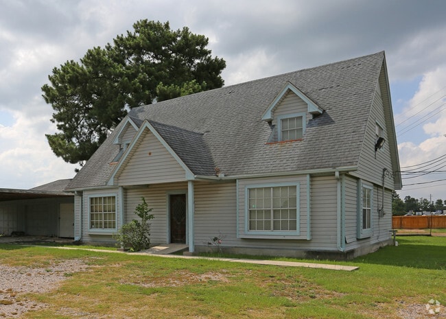
32007 State Highway 249, Pinehurst, TX 77362


Property Detail
32007 State Highway 249
3758-00-10015
DECKER PRAIRIE IND PARK PARCEL A, ACRES 1.080
Commercialnec
Montgomery
2
Texas
B and X Area of moderate flood hazard, usually the area between the limits of the 100-year and 500-year floods.
1.08 AC
2024
Northwest Outlier
2025
Houston
690207
Houston-Pasadena-The Woodlands, TX
13,288 SF
NEARBY LISTINGS FOR SALE OR LEASE
DEMOGRAPHICS near 32007 State Highway 249
1 mile
3 mile
5 mile
2025 Total Population
3,898
22,993
59,734
2030 Population
4,567
26,334
68,434
Pop Growth 2025-2030
+ 17.16%
+ 14.53%
+ 14.56%
Average Age
37
40
39
2025 Total Households
1,307
8,127
21,013
HH Growth 2025-2030
+ 17.67%
+ 14.63%
+ 14.64%
Median Household Inc
$78,776
$101,727
$96,383
Avg Household Size
2.90
2.80
2.80
2025 Avg HH Vehicles
2.00
2.00
2.00
Median Home Value
$287,818
$396,317
$396,954
Median Year Built
2007
2001
2005
Nearby Places
Map Layers
Map Styles
 Street
 Aerial
Transit
 Traffic
 Biking
Places
Listings with unknown addresses are not visible on the map
- Restaurants
- Banks
- Shops
- Fitness
- Groceries
PUBLIC TRANSPORTATION
AIRPORT
George Bush Intcntl/Houston
Drive
Walk
Distance
George Bush Intcntl/Houston
37 min
30.3 mi
Freight Ports
Port of Houston
Drive
Walk
Distance
Port of Houston
57 min
41.0 mi
SALE & LEASE HISTORY
LISTING DATE
SALE/LEASE

Jun 19, 2017
For Lease
Apr 10, 2024
For Lease
Nearby Properties
Address
Land Use
TOTAL SIZE
Lot Size
Zoning
Address
Land Use
TOTAL SIZE
Lot Size
Zoning
176,180 SF
7.28 AC
Address
Land Use
TOTAL SIZE
Lot Size
Zoning
146,990 SF
7.02 AC
Address
Land Use
TOTAL SIZE
Lot Size
Zoning
112,854 SF
5.80 AC
Address
Land Use
TOTAL SIZE
Lot Size
Zoning
118,004 SF
5.55 AC
Address
Land Use
TOTAL SIZE
Lot Size
Zoning
135,804 SF
15.33 AC
Address
Land Use
TOTAL SIZE
Lot Size
Zoning
65,475 SF
7.84 AC
Address
Land Use
TOTAL SIZE
Lot Size
Zoning
104,859 SF
5.29 AC
Address
Land Use
TOTAL SIZE
Lot Size
Zoning
73,992 SF
7.21 AC
Address
Land Use
TOTAL SIZE
Lot Size
Zoning
122,970 SF
11.79 AC
Address
Land Use
TOTAL SIZE
Lot Size
Zoning
81,277 SF
4.43 AC
Address
Land Use
TOTAL SIZE
Lot Size
Zoning
14,865 SF
1.98 AC
2
Address
Land Use
TOTAL SIZE
Lot Size
Zoning
90,311 SF
10 AC
Address
Land Use
TOTAL SIZE
Lot Size
Zoning
7,800 SF
18.47 AC
Address
Land Use
TOTAL SIZE
Lot Size
Zoning
100,389 SF
5.47 AC
2
Address
Land Use
TOTAL SIZE
Lot Size
Zoning
1,184 SF
27.54 AC
Address
Land Use
TOTAL SIZE
Lot Size
Zoning
48,896 SF
2 AC
Address
Land Use
TOTAL SIZE
Lot Size
Zoning
67,125 SF
10.41 AC
Address
Land Use
TOTAL SIZE
Lot Size
Zoning
20,994 SF
1.27 AC
Address
Land Use
TOTAL SIZE
Lot Size
Zoning
1,722 SF
31.19 AC
2
Address
Land Use
TOTAL SIZE
Lot Size
Zoning
25,050 SF
2.16 AC
Address
Land Use
TOTAL SIZE
Lot Size
Zoning
12,276 SF
4.81 AC
Address
Land Use
TOTAL SIZE
Lot Size
Zoning
40.23 AC
Address
Land Use
TOTAL SIZE
Lot Size
Zoning
43,400 SF
6.05 AC
2
Address
Land Use
TOTAL SIZE
Lot Size
Zoning
22,650 SF
2.03 AC
Address
Land Use
TOTAL SIZE
Lot Size
Zoning
28,400 SF
3.85 AC
Address
Land Use
TOTAL SIZE
Lot Size
Zoning
4,365 SF
0.99 AC
Address
Land Use
TOTAL SIZE
Lot Size
Zoning
29,682 SF
2.41 AC
Address
Land Use
TOTAL SIZE
Lot Size
Zoning
13,545 SF
4.56 AC
2
Address
Land Use
TOTAL SIZE
Lot Size
Zoning
5,252 SF
1.20 AC
Address
Land Use
TOTAL SIZE
Lot Size
Zoning
2,566 SF
31.34 AC
The World's #1 Commercial Real Estate Marketplace
Connect with us
© 2026 CoStar Group
The information above has been obtained from sources believed reliable. While we do not doubt its accuracy we have not verified it and make no guarantee, warranty or representation about it. It is your responsibility to independently confirm its accuracy and completeness. Any projections, opinions, assumptions, or estimates used are for example only and do not represent the current or future performance of the property. The value of this transaction to you depends on tax and other factors which should be evaluated by your tax, financial, and legal advisors. You and your advisors should conduct a careful, independent investigation of the property to determine to your satisfaction the suitability of the property for your needs.