Property Record
3201 Devils Glen Rd, Bettendorf, IA 52722

Save to a Folder
{{folder.Name}}
{{folder.ListingIds.length}} Properties
{{folder.ListingIds.length}} Property
Create a New Folder
Property Detail
3201 Devils Glen Rd
Davenport-Moline-Rock Island, IA-IL
HARTZ 5TH ADD LOT: 002 HARTZ 5TH ADD LOT 2 &PT LOT 1 HARTZ 1STADD PER SURVEY09-27674
8415536021
Scott
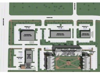
Stripcommercialcenter
Iowa
B and X Area of moderate flood hazard, usually the area between the limits of the 100-year and 500-year floods.
1,2
2025
1.59 AC
2025
Outlying Scott County
013706
Davenport/Moline/Rock Island
6,600 SF
NEARBY LISTINGS FOR SALE OR LEASE
DEMOGRAPHICS near 3201 Devils Glen Rd
1 mile
3 mile
5 mile
2025 Total Population
9,235
49,944
128,822
2030 Population
9,384
50,588
129,700
Pop Growth 2025-2030
+ 1.61%
+ 1.29%
+ 0.68%
Average Age
42
41
40
2025 Total Households
4,068
20,252
53,380
HH Growth 2025-2030
+ 1.62%
+ 1.19%
+ 0.66%
Median Household Inc
$94,147
$99,104
$74,132
Avg Household Size
2.20
2.40
2.30
2025 Avg HH Vehicles
2.00
2.00
2.00
Median Home Value
$301,544
$327,494
$210,887
Median Year Built
1979
1979
1965
Nearby Places
Map Layers
Map Styles
 Street
 Aerial
Layers
 Traffic
 Biking
Places
Listings with unknown addresses are not visible on the map
- Restaurants
- Banks
- Shops
- Fitness
- Groceries
PUBLIC TRANSPORTATION
AIRPORT
Quad Cities International
Drive
Walk
Distance
Quad Cities International
31 min
17.0 mi
Freight Ports
Port Milwaukee
Drive
Walk
Distance
Port Milwaukee
237 min
207.2 mi
Nearby Properties
Address
Land Use
TOTAL SIZE
Lot Size
Zoning
Address
Land Use
TOTAL SIZE
Lot Size
Zoning
157,798 SF
25.37 AC
Address
Land Use
TOTAL SIZE
Lot Size
Zoning
157,587 SF
33.92 AC
Address
Land Use
TOTAL SIZE
Lot Size
Zoning
247,196 SF
13.39 AC
Address
Land Use
TOTAL SIZE
Lot Size
Zoning
9,000 SF
408.98 AC
Address
Land Use
TOTAL SIZE
Lot Size
Zoning
2,045 SF
29.48 AC
Address
Land Use
TOTAL SIZE
Lot Size
Zoning
5,400 SF
76.68 AC
Address
Land Use
TOTAL SIZE
Lot Size
Zoning
4,518 SF
6.27 AC
Address
Land Use
TOTAL SIZE
Lot Size
Zoning
50,882 SF
5.10 AC
Address
Land Use
TOTAL SIZE
Lot Size
Zoning
5,296 SF
67.13 AC
Address
Land Use
TOTAL SIZE
Lot Size
Zoning
1,800 SF
60.86 AC
Address
Land Use
TOTAL SIZE
Lot Size
Zoning
133,809 SF
8.26 AC
Address
Land Use
TOTAL SIZE
Lot Size
Zoning
4,944 SF
17.91 AC
Address
Land Use
TOTAL SIZE
Lot Size
Zoning
26,472 SF
17.67 AC
Address
Land Use
TOTAL SIZE
Lot Size
Zoning
76,808 SF
1.94 AC
Address
Land Use
TOTAL SIZE
Lot Size
Zoning
111,979 SF
6.86 AC
Address
Land Use
TOTAL SIZE
Lot Size
Zoning
71,820 SF
5.71 AC
Address
Land Use
TOTAL SIZE
Lot Size
Zoning
64,661 SF
147.01 AC
Address
Land Use
TOTAL SIZE
Lot Size
Zoning
3,543 SF
14.79 AC
Address
Land Use
TOTAL SIZE
Lot Size
Zoning
65,958 SF
15.04 AC
Address
Land Use
TOTAL SIZE
Lot Size
Zoning
84,002 SF
21.76 AC
Address
Land Use
TOTAL SIZE
Lot Size
Zoning
115,968 SF
2.93 AC
Address
Land Use
TOTAL SIZE
Lot Size
Zoning
226,764 SF
23.52 AC
Address
Land Use
TOTAL SIZE
Lot Size
Zoning
69,519 SF
5.49 AC
Address
Land Use
TOTAL SIZE
Lot Size
Zoning
118,130 SF
9.32 AC
Address
Land Use
TOTAL SIZE
Lot Size
Zoning
67,813 SF
2.56 AC
Address
Land Use
TOTAL SIZE
Lot Size
Zoning
165,770 SF
13.77 AC
Address
Land Use
TOTAL SIZE
Lot Size
Zoning
54,606 SF
7.68 AC
Address
Land Use
TOTAL SIZE
Lot Size
Zoning
15,353 SF
3.73 AC
Address
Land Use
TOTAL SIZE
Lot Size
Zoning
61,794 SF
8.83 AC
The World's #1 Commercial Real Estate Marketplace
Connect with us
© 2026 CoStar Group
The information above has been obtained from sources believed reliable. While we do not doubt its accuracy we have not verified it and make no guarantee, warranty or representation about it. It is your responsibility to independently confirm its accuracy and completeness. Any projections, opinions, assumptions, or estimates used are for example only and do not represent the current or future performance of the property. The value of this transaction to you depends on tax and other factors which should be evaluated by your tax, financial, and legal advisors. You and your advisors should conduct a careful, independent investigation of the property to determine to your satisfaction the suitability of the property for your needs.