Property Record
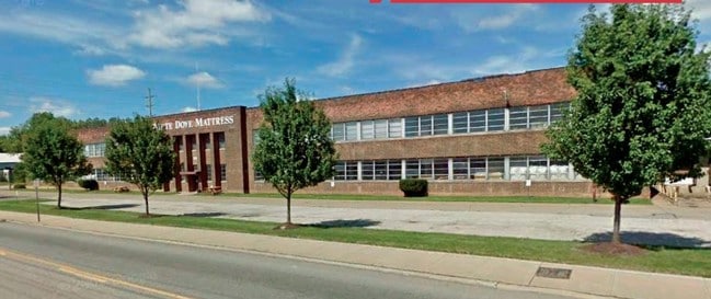
3201 Harvard Ave, Newburgh Heights, OH 44105

NEARBY LISTINGS FOR SALE OR LEASE
Property Detail
3201 Harvard Ave
511-07-049
455 WOODBRIDGE S/L23 ALL BUT SP TRI
Industrialgeneral
Cuyahoga
X
Ohio
39035C0183E
455
2024
10.17 AC
2024
Downtown Southeast
115800
Cleveland
78,084 SF
Cleveland-Elyria, OH
DEMOGRAPHICS near 3201 Harvard Ave
1 Mile
3 Mile
5 Mile
2024 Total Population
4,062
90,226
310,199
2029 Population
3,885
87,249
302,417
Pop Growth 2024-2029
(4.36%)
(3.30%)
(2.51%)
Average Age
39
38
39
2024 Total Households
1,747
38,375
138,479
HH Growth 2024-2029
(4.75%)
(3.52%)
(2.49%)
Median Household Inc
$35,223
$37,797
$40,953
Avg Household Size
2.30
2.20
2.10
2024 Avg HH Vehicles
2.00
1.00
1.00
Median Home Value
$67,990
$87,781
$105,958
Median Year Built
1946
1947
1949
Nearby Places
Map Layers
Map Styles
 Street
 Aerial
- Restaurants
- Banks
- Shops
- Fitness
- Groceries
PUBLIC TRANSPORTATION
COMMUTER RAIL
Rockside (National Park Scenic Railway - Cuyahoga Valley Scenic Railroad)
DRIVE
WALK
Distance
Rockside (National Park Scenic Railway - Cuyahoga Valley Scenic Railroad)
13 min
5.7 mi
Cleveland Lakefront Station (Blue Line - Greater Cleveland Regional Transit Authority Rapid Transit (The Rapid), Green Line - Greater Cleveland Regional Transit Authority Rapid Transit (The Rapid))
DRIVE
WALK
Distance
Cleveland Lakefront Station (Blue Line - Greater Cleveland Regional Transit Authority Rapid Transit (The Rapid), Green Line - Greater Cleveland Regional Transit Authority Rapid Transit (The Rapid))
17 min
7.3 mi
AIRPORT
Cleveland-Hopkins International
DRIVE
WALK
Distance
Cleveland-Hopkins International
25 min
13.3 mi
Freight Ports
Port of Toledo
DRIVE
WALK
Distance
Port of Toledo
139 min
114.2 mi
SALE & LEASE HISTORY
LISTING DATE
SALE/LEASE

Sep 25, 2016
For Lease
Sep 11, 2017
For Lease
Nearby Properties
Address
Land Use
TOTAL SIZE
Lot Size
Zoning
Address
Land Use
TOTAL SIZE
Lot Size
Zoning
3,491,901 SF
34.32 AC
Address
Land Use
TOTAL SIZE
Lot Size
Zoning
162,711 SF
192.04 AC
IG
Address
Land Use
TOTAL SIZE
Lot Size
Zoning
230,820 SF
41.47 AC
UI
Address
Land Use
TOTAL SIZE
Lot Size
Zoning
257,857 SF
8.03 AC
GR
Address
Land Use
TOTAL SIZE
Lot Size
Zoning
299,507 SF
2.14 AC
LR
Address
Land Use
TOTAL SIZE
Lot Size
Zoning
194,257 SF
94.46 AC
IG
Address
Land Use
TOTAL SIZE
Lot Size
Zoning
595.30 AC
UI
Address
Land Use
TOTAL SIZE
Lot Size
Zoning
228,134 SF
40.65 AC
UI
Address
Land Use
TOTAL SIZE
Lot Size
Zoning
372,486 SF
3.98 AC
GR
Address
Land Use
TOTAL SIZE
Lot Size
Zoning
361,287 SF
86.50 AC
2F
Address
Land Use
TOTAL SIZE
Lot Size
Zoning
142,935 SF
1.02 AC
LR
Address
Land Use
TOTAL SIZE
Lot Size
Zoning
22,928 SF
2.17 AC
LR
Address
Land Use
TOTAL SIZE
Lot Size
Zoning
104,170 SF
2.70 AC
2F
Address
Land Use
TOTAL SIZE
Lot Size
Zoning
120,061 SF
1.91 AC
GI
Address
Land Use
TOTAL SIZE
Lot Size
Zoning
500,398 SF
24.49 AC
IG
Address
Land Use
TOTAL SIZE
Lot Size
Zoning
180,175 SF
111.96 AC
IG
Address
Land Use
TOTAL SIZE
Lot Size
Zoning
209,068 SF
23.10 AC
IG
Address
Land Use
TOTAL SIZE
Lot Size
Zoning
148,877 SF
1.53 AC
MF-1
Address
Land Use
TOTAL SIZE
Lot Size
Zoning
277,049 SF
24.15 AC
2F
Address
Land Use
TOTAL SIZE
Lot Size
Zoning
19.48 AC
U5-A
Address
Land Use
TOTAL SIZE
Lot Size
Zoning
201,041 SF
12.74 AC
GI
Address
Land Use
TOTAL SIZE
Lot Size
Zoning
589,400 SF
35.20 AC
GI
Address
Land Use
TOTAL SIZE
Lot Size
Zoning
232,763 SF
21.37 AC
UI
Address
Land Use
TOTAL SIZE
Lot Size
Zoning
75,598 SF
0.98 AC
SI
Address
Land Use
TOTAL SIZE
Lot Size
Zoning
226,076 SF
5.53 AC
SI
Address
Land Use
TOTAL SIZE
Lot Size
Zoning
289,327 SF
5.05 AC
MF3+
Address
Land Use
TOTAL SIZE
Lot Size
Zoning
17,158 SF
20.86 AC
MF-1
Address
Land Use
TOTAL SIZE
Lot Size
Zoning
28,852 SF
8.30 AC
Address
Land Use
TOTAL SIZE
Lot Size
Zoning
197,916 SF
9.10 AC
MF-1
Address
Land Use
TOTAL SIZE
Lot Size
Zoning
172,448 SF
13.95 AC
The World's #1 Commercial Real Estate Marketplace
Connect with us
© 2026 CoStar Group
The information above has been obtained from sources believed reliable. While we do not doubt its accuracy we have not verified it and make no guarantee, warranty or representation about it. It is your responsibility to independently confirm its accuracy and completeness. Any projections, opinions, assumptions, or estimates used are for example only and do not represent the current or future performance of the property. The value of this transaction to you depends on tax and other factors which should be evaluated by your tax, financial, and legal advisors. You and your advisors should conduct a careful, independent investigation of the property to determine to your satisfaction the suitability of the property for your needs.