Property Record
3201 Hilliard Rome Rd, Hilliard, OH 43026


NEARBY LISTINGS FOR SALE OR LEASE
Property Detail
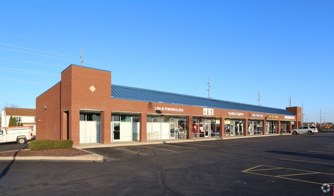
3201 Hilliard Rome Rd
050-002969
Virginia Military Survey #1335
Storebuilding
3201 ROME-HILLIARD RD ENTRY 3446-15022-1335 6.435 ACRES
X
Franklin
39097C0100D
Ohio
2024
6.44 AC
2024
Hilliard
010602
Columbus
37,326 SF
Columbus, OH
DEMOGRAPHICS near 3201 Hilliard Rome Rd
1 Mile
3 Mile
5 Mile
2024 Total Population
15,368
66,501
158,530
2029 Population
15,147
65,998
157,665
Pop Growth 2024-2029
(1.44%)
(0.76%)
(0.55%)
Average Age
38
37
38
2024 Total Households
5,740
26,248
65,289
HH Growth 2024-2029
(1.32%)
(0.70%)
(0.56%)
Median Household Inc
$100,654
$92,626
$90,867
Avg Household Size
2.60
2.50
2.40
2024 Avg HH Vehicles
2.00
2.00
2.00
Median Home Value
$254,580
$268,547
$291,144
Median Year Built
1993
1994
1993
Nearby Places
Map Layers
Map Styles
 Street
 Aerial
- Restaurants
- Banks
- Shops
- Fitness
- Groceries
PUBLIC TRANSPORTATION
AIRPORT
John Glenn Columbus International
DRIVE
WALK
Distance
John Glenn Columbus International
27 min
18.7 mi
Rickenbacker International
DRIVE
WALK
Distance
Rickenbacker International
33 min
23.3 mi
Freight Ports
Port of Toledo
DRIVE
WALK
Distance
Port of Toledo
180 min
130.0 mi
SALE & LEASE HISTORY
LISTING DATE
SALE/LEASE

Nov 28, 2018
For Lease
Nearby Properties
Address
Land Use
TOTAL SIZE
Lot Size
Zoning
Address
Land Use
TOTAL SIZE
Lot Size
Zoning
880,352 SF
94.89 AC
Address
Land Use
TOTAL SIZE
Lot Size
Zoning
417,762 SF
119.53 AC
Address
Land Use
TOTAL SIZE
Lot Size
Zoning
327,525 SF
70.58 AC
Address
Land Use
TOTAL SIZE
Lot Size
Zoning
529,001 SF
28.39 AC
Address
Land Use
TOTAL SIZE
Lot Size
Zoning
961,554 SF
75.09 AC
Address
Land Use
TOTAL SIZE
Lot Size
Zoning
133,910 SF
14.48 AC
Address
Land Use
TOTAL SIZE
Lot Size
Zoning
158,471 SF
19.11 AC
Address
Land Use
TOTAL SIZE
Lot Size
Zoning
91,413 SF
0.14 AC
Address
Land Use
TOTAL SIZE
Lot Size
Zoning
155,280 SF
9.42 AC
Address
Land Use
TOTAL SIZE
Lot Size
Zoning
566,334 SF
58.62 AC
Address
Land Use
TOTAL SIZE
Lot Size
Zoning
446,488 SF
45.12 AC
Address
Land Use
TOTAL SIZE
Lot Size
Zoning
163,895 SF
36.52 AC
Address
Land Use
TOTAL SIZE
Lot Size
Zoning
96,602 SF
10.78 AC
Address
Land Use
TOTAL SIZE
Lot Size
Zoning
24,736 SF
29.55 AC
Address
Land Use
TOTAL SIZE
Lot Size
Zoning
271,295 SF
14.75 AC
Address
Land Use
TOTAL SIZE
Lot Size
Zoning
293,744 SF
20.12 AC
Address
Land Use
TOTAL SIZE
Lot Size
Zoning
98,316 SF
10.81 AC
Address
Land Use
TOTAL SIZE
Lot Size
Zoning
157,875 SF
8.51 AC
Address
Land Use
TOTAL SIZE
Lot Size
Zoning
40,500 SF
20.91 AC
Address
Land Use
TOTAL SIZE
Lot Size
Zoning
156,030 SF
31.29 AC
Address
Land Use
TOTAL SIZE
Lot Size
Zoning
21,238 SF
14.67 AC
Address
Land Use
TOTAL SIZE
Lot Size
Zoning
149,424 SF
39.15 AC
Address
Land Use
TOTAL SIZE
Lot Size
Zoning
33,512 SF
12.27 AC
Address
Land Use
TOTAL SIZE
Lot Size
Zoning
126,656 SF
15.83 AC
Address
Land Use
TOTAL SIZE
Lot Size
Zoning
429,544 SF
23.21 AC
Address
Land Use
TOTAL SIZE
Lot Size
Zoning
137,350 SF
11.01 AC
Address
Land Use
TOTAL SIZE
Lot Size
Zoning
67,133 SF
16.67 AC
Address
Land Use
TOTAL SIZE
Lot Size
Zoning
55,758 SF
7.83 AC
Address
Land Use
TOTAL SIZE
Lot Size
Zoning
173,002 SF
7.16 AC
Address
Land Use
TOTAL SIZE
Lot Size
Zoning
395,835 SF
23.83 AC
The World's #1 Commercial Real Estate Marketplace
Connect with us
© 2025 CoStar Group
The information above has been obtained from sources believed reliable. While we do not doubt its accuracy we have not verified it and make no guarantee, warranty or representation about it. It is your responsibility to independently confirm its accuracy and completeness. Any projections, opinions, assumptions, or estimates used are for example only and do not represent the current or future performance of the property. The value of this transaction to you depends on tax and other factors which should be evaluated by your tax, financial, and legal advisors. You and your advisors should conduct a careful, independent investigation of the property to determine to your satisfaction the suitability of the property for your needs.