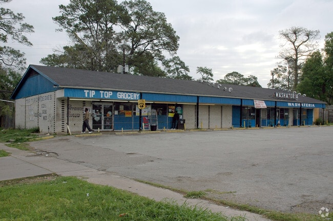
Property Record
3201 N Macgregor Way, Houston, TX 77004

NEARBY LISTINGS FOR SALE OR LEASE
Property Detail
3201 N Macgregor Way
Houston-The Woodlands-Sugar Land, TX
North Macgregor Oaks
0660750030014
LTS 14 & 15 BLK 3 NORTH MACGREGOR OAKS
Storebuilding
Harris
AE
Texas
48201C0880M
14,15
2024
0.57 AC
2025
Inner Loop East End
312902
Houston
4,800 SF
DEMOGRAPHICS near 3201 N Macgregor Way
1 Mile
3 Mile
5 Mile
2024 Total Population
20,233
185,042
480,079
2029 Population
21,161
192,295
497,799
Pop Growth 2024-2029
+ 4.59%
+ 3.92%
+ 3.69%
Average Age
39
36
37
2024 Total Households
9,346
83,677
210,809
HH Growth 2024-2029
+ 4.58%
+ 4.14%
+ 3.98%
Median Household Inc
$63,127
$62,381
$67,647
Avg Household Size
1.90
2.00
2.10
2024 Avg HH Vehicles
1.00
1.00
1.00
Median Home Value
$338,000
$345,036
$365,123
Median Year Built
1987
1989
1991
Nearby Places
Map Layers
Map Styles
 Street
 Aerial
- Restaurants
- Banks
- Shops
- Fitness
- Groceries
PUBLIC TRANSPORTATION
COMMUTER RAIL
DRIVE
WALK
Distance
10 min
5.2 mi
AIRPORT
William P Hobby
DRIVE
WALK
Distance
William P Hobby
23 min
10.1 mi
George Bush Intcntl/Houston
DRIVE
WALK
Distance
George Bush Intcntl/Houston
31 min
22.5 mi
Nearby Properties
Address
Land Use
TOTAL SIZE
Lot Size
Zoning
Address
Land Use
TOTAL SIZE
Lot Size
Zoning
899,279 SF
1.18 AC
Address
Land Use
TOTAL SIZE
Lot Size
Zoning
519,409 SF
1.52 AC
Address
Land Use
TOTAL SIZE
Lot Size
Zoning
1,252,274 SF
2.02 AC
Address
Land Use
TOTAL SIZE
Lot Size
Zoning
1,091,726 SF
2.60 AC
Address
Land Use
TOTAL SIZE
Lot Size
Zoning
1,232,364 SF
1.49 AC
Address
Land Use
TOTAL SIZE
Lot Size
Zoning
1,150,681 SF
1.17 AC
Address
Land Use
TOTAL SIZE
Lot Size
Zoning
704,249 SF
2.34 AC
Address
Land Use
TOTAL SIZE
Lot Size
Zoning
1,359,194 SF
Address
Land Use
TOTAL SIZE
Lot Size
Zoning
402,467 SF
28.30 AC
Address
Land Use
TOTAL SIZE
Lot Size
Zoning
612,078 SF
1.44 AC
Address
Land Use
TOTAL SIZE
Lot Size
Zoning
1,008,419 SF
1.44 AC
Address
Land Use
TOTAL SIZE
Lot Size
Zoning
408,475 SF
1.05 AC
Address
Land Use
TOTAL SIZE
Lot Size
Zoning
701,043 SF
4.69 AC
Address
Land Use
TOTAL SIZE
Lot Size
Zoning
1,227,182 SF
4.43 AC
Address
Land Use
TOTAL SIZE
Lot Size
Zoning
1,087,974 SF
1.18 AC
Address
Land Use
TOTAL SIZE
Lot Size
Zoning
656,994 SF
4.01 AC
Address
Land Use
TOTAL SIZE
Lot Size
Zoning
332,908 SF
0.91 AC
Address
Land Use
TOTAL SIZE
Lot Size
Zoning
310,967 SF
1.38 AC
Address
Land Use
TOTAL SIZE
Lot Size
Zoning
367,812 SF
1.14 AC
Address
Land Use
TOTAL SIZE
Lot Size
Zoning
633,358 SF
1.47 AC
Address
Land Use
TOTAL SIZE
Lot Size
Zoning
577,327 SF
28.80 AC
Address
Land Use
TOTAL SIZE
Lot Size
Zoning
607,893 SF
3.69 AC
Address
Land Use
TOTAL SIZE
Lot Size
Zoning
396,888 SF
2.02 AC
Address
Land Use
TOTAL SIZE
Lot Size
Zoning
766,950 SF
1.45 AC
Address
Land Use
TOTAL SIZE
Lot Size
Zoning
402,195 SF
1.16 AC
Address
Land Use
TOTAL SIZE
Lot Size
Zoning
171,997 SF
1.15 AC
Address
Land Use
TOTAL SIZE
Lot Size
Zoning
1,526,323 SF
2.87 AC
Address
Land Use
TOTAL SIZE
Lot Size
Zoning
486,076 SF
3.79 AC
Address
Land Use
TOTAL SIZE
Lot Size
Zoning
565,246 SF
1.14 AC
Address
Land Use
TOTAL SIZE
Lot Size
Zoning
290,097 SF
2.61 AC
The World's #1 Commercial Real Estate Marketplace
Connect with us
© 2026 CoStar Group
The information above has been obtained from sources believed reliable. While we do not doubt its accuracy we have not verified it and make no guarantee, warranty or representation about it. It is your responsibility to independently confirm its accuracy and completeness. Any projections, opinions, assumptions, or estimates used are for example only and do not represent the current or future performance of the property. The value of this transaction to you depends on tax and other factors which should be evaluated by your tax, financial, and legal advisors. You and your advisors should conduct a careful, independent investigation of the property to determine to your satisfaction the suitability of the property for your needs.