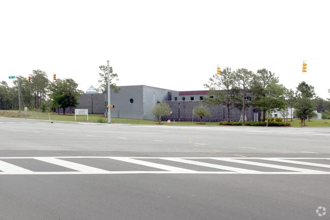
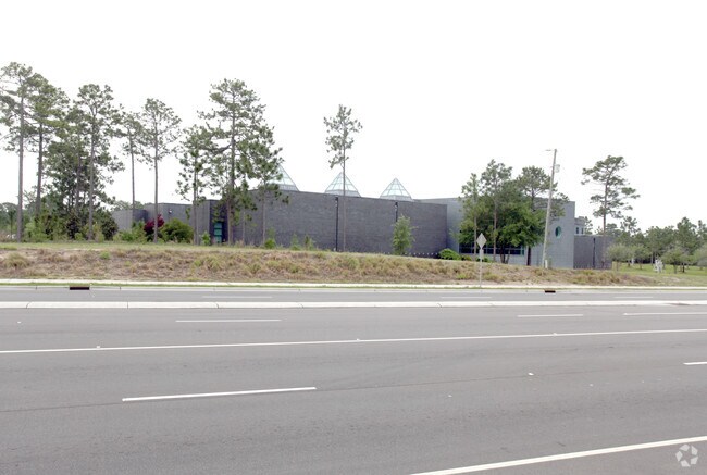
Property Record
3201 S 17Th St, Wilmington, NC 28412

Property Detail
3201 S 17Th St
R06500-003-099-000
LT 1R CAMERON PROPERTIES LIMITED PARTNERSHIP
Culturalhistorical
New Hanover
O&I,OFFICE
North Carolina
B and X Area of moderate flood hazard, usually the area between the limits of the 100-year and 500-year floods.
1r
2025
8.52 AC
2025
Hospital/Independence
012006
Wilmington
31,706 SF
Wilmington, NC
NEARBY LISTINGS FOR SALE OR LEASE
DEMOGRAPHICS near 3201 S 17Th St
1 mile
3 mile
5 mile
2025 Total Population
7,546
60,043
135,352
2030 Population
7,997
63,273
143,149
Pop Growth 2025-2030
+ 5.98%
+ 5.38%
+ 5.76%
Average Age
43
42
40
2025 Total Households
3,762
27,471
59,242
HH Growth 2025-2030
+ 6.06%
+ 5.49%
+ 5.96%
Median Household Inc
$67,816
$68,897
$68,358
Avg Household Size
1.90
2.10
2.10
2025 Avg HH Vehicles
2.00
2.00
2.00
Median Home Value
$304,668
$352,699
$368,738
Median Year Built
1995
1989
1990
Nearby Places
Map Layers
Map Styles
 Street
 Aerial
Transit
 Traffic
 Biking
Places
Listings with unknown addresses are not visible on the map
- Restaurants
- Banks
- Shops
- Fitness
- Groceries
PUBLIC TRANSPORTATION
AIRPORT
Wilmington International
Drive
Walk
Distance
Wilmington International
23 min
10.2 mi
Freight Ports
Port of Wilmington
Drive
Walk
Distance
Port of Wilmington
8 min
3.6 mi
Nearby Properties
Address
Land Use
TOTAL SIZE
Lot Size
Zoning
Address
Land Use
TOTAL SIZE
Lot Size
Zoning
393,150 SF
60.45 AC
O&I,OFFICE
Address
Land Use
TOTAL SIZE
Lot Size
Zoning
32,480 SF
258.11 AC
IND
Address
Land Use
TOTAL SIZE
Lot Size
Zoning
35,334 SF
38.86 AC
O&I,OFFICE
Address
Land Use
TOTAL SIZE
Lot Size
Zoning
606,792 SF
44.13 AC
RB,REGIONA
Address
Land Use
TOTAL SIZE
Lot Size
Zoning
191,720 SF
7.82 AC
RB,REGIONA
Address
Land Use
TOTAL SIZE
Lot Size
Zoning
224,640 SF
20.30 AC
MD-17
Address
Land Use
TOTAL SIZE
Lot Size
Zoning
308,208 SF
7.80 AC
O&I,OFFICE
Address
Land Use
TOTAL SIZE
Lot Size
Zoning
126,336 SF
14.54 AC
MD-17
Address
Land Use
TOTAL SIZE
Lot Size
Zoning
160,284 SF
59.79 AC
O&I,OFFICE
Address
Land Use
TOTAL SIZE
Lot Size
Zoning
125,944 SF
68.66 AC
IND
Address
Land Use
TOTAL SIZE
Lot Size
Zoning
23,760 SF
15.02 AC
MD-17
Address
Land Use
TOTAL SIZE
Lot Size
Zoning
8,002 SF
15.57 AC
MD-17
Address
Land Use
TOTAL SIZE
Lot Size
Zoning
108.30 AC
R-15,RESID
Address
Land Use
TOTAL SIZE
Lot Size
Zoning
41,076 SF
5.29 AC
MX
Address
Land Use
TOTAL SIZE
Lot Size
Zoning
41,118 SF
4.05 AC
MX
Address
Land Use
TOTAL SIZE
Lot Size
Zoning
6,780 SF
24.11 AC
RB,REGIONA
Address
Land Use
TOTAL SIZE
Lot Size
Zoning
228,521 SF
25.17 AC
RB,REGIONA
Address
Land Use
TOTAL SIZE
Lot Size
Zoning
94.15 AC
RB,REGIONA
Address
Land Use
TOTAL SIZE
Lot Size
Zoning
24,966 SF
5.55 AC
O&I,OFFICE
Address
Land Use
TOTAL SIZE
Lot Size
Zoning
288,589 SF
IND
Address
Land Use
TOTAL SIZE
Lot Size
Zoning
26,725 SF
54.70 AC
IND
Address
Land Use
TOTAL SIZE
Lot Size
Zoning
3,200 SF
16.62 AC
CS,COMMERC
Address
Land Use
TOTAL SIZE
Lot Size
Zoning
39,866 SF
15.89 AC
R-15,RESID
Address
Land Use
TOTAL SIZE
Lot Size
Zoning
16,694 SF
8.71 AC
O&I,OFFICE
Address
Land Use
TOTAL SIZE
Lot Size
Zoning
79,920 SF
9.59 AC
MD-17
Address
Land Use
TOTAL SIZE
Lot Size
Zoning
246,199 SF
55.96 AC
IND
Address
Land Use
TOTAL SIZE
Lot Size
Zoning
136,416 SF
37.56 AC
MD-17
Address
Land Use
TOTAL SIZE
Lot Size
Zoning
1,656 SF
74.28 AC
R-15,RESID
Address
Land Use
TOTAL SIZE
Lot Size
Zoning
1,000 SF
25.93 AC
IND
Address
Land Use
TOTAL SIZE
Lot Size
Zoning
7,362 SF
46.58 AC
R-5,RESIDE
The World's #1 Commercial Real Estate Marketplace
Connect with us
© 2026 CoStar Group
The information above has been obtained from sources believed reliable. While we do not doubt its accuracy we have not verified it and make no guarantee, warranty or representation about it. It is your responsibility to independently confirm its accuracy and completeness. Any projections, opinions, assumptions, or estimates used are for example only and do not represent the current or future performance of the property. The value of this transaction to you depends on tax and other factors which should be evaluated by your tax, financial, and legal advisors. You and your advisors should conduct a careful, independent investigation of the property to determine to your satisfaction the suitability of the property for your needs.