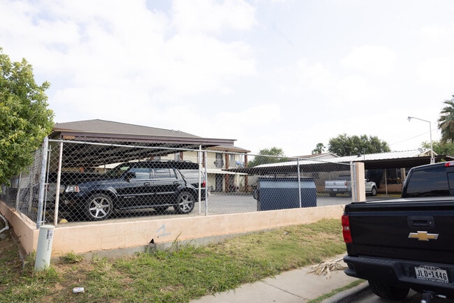
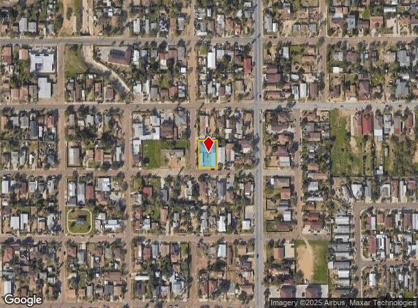
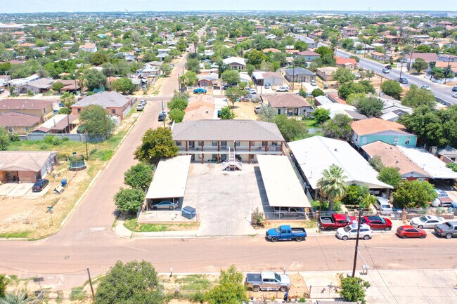
Property Record
3202 Chestnut St, Laredo, TX 78046
NEARBY LISTINGS FOR SALE OR LEASE
-
-
View all Laredo listings for sale on LoopNet.com
Property Detail
3202 Chestnut St
Laredo, TX
Eastern -- Blocks 2001 - 2050
182182
LOTS 8 W1/3-7 BLK 2036 ED
Multifamilydwelling
Webb
X
Texas
48479C1380C
8
2024
0.30 AC
2025
Texas South Area
000107
Other Market Areas
5,390 SF
DEMOGRAPHICS near 3202 Chestnut St
1 Mile
3 Mile
5 Mile
2024 Total Population
21,751
96,602
164,857
2029 Population
21,745
97,586
166,561
Pop Growth 2024-2029
(0.03%)
+ 1.02%
+ 1.03%
Average Age
33
32
34
2024 Total Households
5,847
26,574
47,645
HH Growth 2024-2029
(0.02%)
+ 1.01%
+ 1.01%
Median Household Inc
$45,102
$46,921
$40,931
Avg Household Size
3.70
3.50
3.30
2024 Avg HH Vehicles
2.00
2.00
2.00
Median Home Value
$132,019
$132,471
$125,159
Median Year Built
1993
1995
1991
Nearby Places
Map Layers
Map Styles
 Street
 Aerial
- Restaurants
- Banks
- Shops
- Fitness
- Groceries
PUBLIC TRANSPORTATION
AIRPORT
Laredo International
DRIVE
WALK
Distance
Laredo International
10 min
5.6 mi
Freight Ports
Port of Corpus Christi
DRIVE
WALK
Distance
Port of Corpus Christi
162 min
142.1 mi
SALE & LEASE HISTORY
LISTING DATE
SALE/LEASE

Mar 29, 2023
For Sale
Jun 08, 2023
For Sale
Jan 16, 2024
For Sale
Nearby Properties
Address
Land Use
TOTAL SIZE
Lot Size
Zoning
Address
Land Use
TOTAL SIZE
Lot Size
Zoning
423,977 SF
1.27 AC
R2
Address
Land Use
TOTAL SIZE
Lot Size
Zoning
310,346 SF
87.65 AC
R1A
Address
Land Use
TOTAL SIZE
Lot Size
Zoning
347,773 SF
49.74 AC
R1
Address
Land Use
TOTAL SIZE
Lot Size
Zoning
165,608 SF
28.50 AC
R2
Address
Land Use
TOTAL SIZE
Lot Size
Zoning
231,146 SF
1.77 AC
R1
Address
Land Use
TOTAL SIZE
Lot Size
Zoning
178,302 SF
45.97 AC
R3
Address
Land Use
TOTAL SIZE
Lot Size
Zoning
380,420 SF
9.18 AC
B3
Address
Land Use
TOTAL SIZE
Lot Size
Zoning
169,339 SF
28 AC
Address
Land Use
TOTAL SIZE
Lot Size
Zoning
137,182 SF
9.67 AC
R1
Address
Land Use
TOTAL SIZE
Lot Size
Zoning
108,994 SF
15.39 AC
Address
Land Use
TOTAL SIZE
Lot Size
Zoning
119,908 SF
11.03 AC
Address
Land Use
TOTAL SIZE
Lot Size
Zoning
183,795 SF
10.36 AC
R2
Address
Land Use
TOTAL SIZE
Lot Size
Zoning
93,414 SF
8.57 AC
R1
Address
Land Use
TOTAL SIZE
Lot Size
Zoning
107,824 SF
13.38 AC
R1
Address
Land Use
TOTAL SIZE
Lot Size
Zoning
102,815 SF
2.23 AC
Address
Land Use
TOTAL SIZE
Lot Size
Zoning
95,769 SF
10 AC
R1
Address
Land Use
TOTAL SIZE
Lot Size
Zoning
79,764 SF
30 AC
R1
Address
Land Use
TOTAL SIZE
Lot Size
Zoning
136,195 SF
9.50 AC
Address
Land Use
TOTAL SIZE
Lot Size
Zoning
87,789 SF
10.70 AC
Address
Land Use
TOTAL SIZE
Lot Size
Zoning
90,400 SF
1.77 AC
R3
Address
Land Use
TOTAL SIZE
Lot Size
Zoning
82,328 SF
5.12 AC
R3
Address
Land Use
TOTAL SIZE
Lot Size
Zoning
214,365 SF
18.11 AC
R2
Address
Land Use
TOTAL SIZE
Lot Size
Zoning
77,788 SF
19.67 AC
Address
Land Use
TOTAL SIZE
Lot Size
Zoning
79,772 SF
1.77 AC
R3
Address
Land Use
TOTAL SIZE
Lot Size
Zoning
55,094 SF
44.55 AC
B3
Address
Land Use
TOTAL SIZE
Lot Size
Zoning
72,897 SF
8 AC
R1
Address
Land Use
TOTAL SIZE
Lot Size
Zoning
81,470 SF
36.89 AC
Address
Land Use
TOTAL SIZE
Lot Size
Zoning
57,690 SF
8.98 AC
B4
Address
Land Use
TOTAL SIZE
Lot Size
Zoning
218,710 SF
27.27 AC
B3
Address
Land Use
TOTAL SIZE
Lot Size
Zoning
42,001 SF
6.01 AC
R1
The World's #1 Commercial Real Estate Marketplace
Connect with us
© 2025 CoStar Group
The information above has been obtained from sources believed reliable. While we do not doubt its accuracy we have not verified it and make no guarantee, warranty or representation about it. It is your responsibility to independently confirm its accuracy and completeness. Any projections, opinions, assumptions, or estimates used are for example only and do not represent the current or future performance of the property. The value of this transaction to you depends on tax and other factors which should be evaluated by your tax, financial, and legal advisors. You and your advisors should conduct a careful, independent investigation of the property to determine to your satisfaction the suitability of the property for your needs.