Property Record
3202 W Behrend Dr, Phoenix, AZ 85027
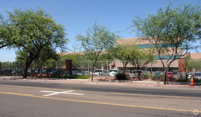
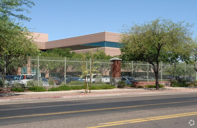

Property Detail
3202 W Behrend Dr
206-12-208B
CROSSPOINT AT BEARDSLEY PHASE 2 LOT 2 MCR 340-31
Officebuilding
Maricopa
I-P
Arizona
C and X Area of minimal flood hazard, usually depicted on FIRMs as above the 500-year flood level.
2
2025
7.84 AC
2025
Deer Valley/Airport
616400
Phoenix
228,085 SF
Phoenix-Mesa-Chandler, AZ
NEARBY LISTINGS FOR SALE OR LEASE
DEMOGRAPHICS near 3202 W Behrend Dr
1 mile
3 mile
5 mile
2025 Total Population
15,168
111,295
295,767
2030 Population
15,688
114,559
306,453
Pop Growth 2025-2030
+ 3.43%
+ 2.93%
+ 3.61%
Average Age
39
39
39
2025 Total Households
6,460
43,603
115,511
HH Growth 2025-2030
+ 3.50%
+ 3.01%
+ 3.81%
Median Household Inc
$73,765
$78,788
$81,543
Avg Household Size
2.30
2.50
2.50
2025 Avg HH Vehicles
2.00
2.00
2.00
Median Home Value
$338,453
$386,460
$427,256
Median Year Built
1988
1985
1987
Nearby Places
Map Layers
Map Styles
 Street
 Aerial
Layers
 Traffic
 Biking
Places
Listings with unknown addresses are not visible on the map
- Restaurants
- Banks
- Shops
- Fitness
- Groceries
PUBLIC TRANSPORTATION
AIRPORT
Phoenix Sky Harbor International
Drive
Walk
Distance
Phoenix Sky Harbor International
34 min
22.9 mi
Nearby Properties
Address
Land Use
TOTAL SIZE
Lot Size
Zoning
Address
Land Use
TOTAL SIZE
Lot Size
Zoning
159,642 SF
11.85 AC
C-C
Address
Land Use
TOTAL SIZE
Lot Size
Zoning
132,348 SF
9.16 AC
I-P
Address
Land Use
TOTAL SIZE
Lot Size
Zoning
Address
Land Use
TOTAL SIZE
Lot Size
Zoning
526,912 SF
55.64 AC
Address
Land Use
TOTAL SIZE
Lot Size
Zoning
53,813 SF
1,286.11 AC
Address
Land Use
TOTAL SIZE
Lot Size
Zoning
704,521 SF
15.12 AC
C-C
Address
Land Use
TOTAL SIZE
Lot Size
Zoning
625,318 SF
15.79 AC
Address
Land Use
TOTAL SIZE
Lot Size
Zoning
16.84 AC
Address
Land Use
TOTAL SIZE
Lot Size
Zoning
434,799 SF
69.70 AC
R-8
Address
Land Use
TOTAL SIZE
Lot Size
Zoning
17,365 SF
1.50 AC
C-G
Address
Land Use
TOTAL SIZE
Lot Size
Zoning
360,026 SF
74.94 AC
R-6
Address
Land Use
TOTAL SIZE
Lot Size
Zoning
264,909 SF
219.16 AC
I-1
Address
Land Use
TOTAL SIZE
Lot Size
Zoning
968,899 SF
76.37 AC
I-1
Address
Land Use
TOTAL SIZE
Lot Size
Zoning
361,228 SF
24.60 AC
I-P
Address
Land Use
TOTAL SIZE
Lot Size
Zoning
296,753 SF
9.53 AC
CPBP
Address
Land Use
TOTAL SIZE
Lot Size
Zoning
314,839 SF
39 AC
R-18
Address
Land Use
TOTAL SIZE
Lot Size
Zoning
307,891 SF
15.89 AC
Address
Land Use
TOTAL SIZE
Lot Size
Zoning
28.71 AC
Address
Land Use
TOTAL SIZE
Lot Size
Zoning
291,059 SF
16.54 AC
I-1
Address
Land Use
TOTAL SIZE
Lot Size
Zoning
189,524 SF
13.80 AC
I-P
Address
Land Use
TOTAL SIZE
Lot Size
Zoning
483,381 SF
27.83 AC
C-C
Address
Land Use
TOTAL SIZE
Lot Size
Zoning
229,000 SF
18.99 AC
I-P
Address
Land Use
TOTAL SIZE
Lot Size
Zoning
268,353 SF
20.45 AC
I-P
Address
Land Use
TOTAL SIZE
Lot Size
Zoning
217,379 SF
16.13 AC
I-1
Address
Land Use
TOTAL SIZE
Lot Size
Zoning
430,038 SF
26.71 AC
M-H
Address
Land Use
TOTAL SIZE
Lot Size
Zoning
145,956 SF
10.30 AC
CP/GCP
Address
Land Use
TOTAL SIZE
Lot Size
Zoning
135,370 SF
7.18 AC
I-1
Address
Land Use
TOTAL SIZE
Lot Size
Zoning
131,074 SF
7.32 AC
I-1
Address
Land Use
TOTAL SIZE
Lot Size
Zoning
358,005 SF
8.54 AC
M-H
The World's #1 Commercial Real Estate Marketplace
Connect with us
© 2026 CoStar Group
The information above has been obtained from sources believed reliable. While we do not doubt its accuracy we have not verified it and make no guarantee, warranty or representation about it. It is your responsibility to independently confirm its accuracy and completeness. Any projections, opinions, assumptions, or estimates used are for example only and do not represent the current or future performance of the property. The value of this transaction to you depends on tax and other factors which should be evaluated by your tax, financial, and legal advisors. You and your advisors should conduct a careful, independent investigation of the property to determine to your satisfaction the suitability of the property for your needs.