Property Record
3202 W Expressway 83, Weslaco, TX 78599

NEARBY LISTINGS FOR SALE OR LEASE
Property Detail
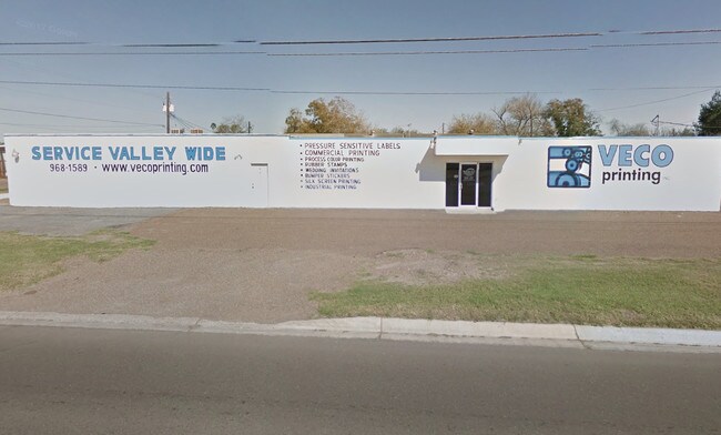
3202 W Expressway 83
McAllen-Edinburg-Mission, TX
West Tract - Swl
W3800-00-166-0000-01
WEST TRACT A TRIANGULAR TR E224.72-N339.37-S691.26 TR 166 & AN IRR TR W71.15-N298.34-S650.23 TR 167 N OF EXPWY .914AC NET
Commercialnec
Hidalgo
2024
Texas
2025
0.91 AC
022205
Outlying Hidalgo County
9,960 SF
McAllen/Edinburg/Pharr
DEMOGRAPHICS near 3202 W Expressway 83
1 Mile
3 Mile
5 Mile
2024 Total Population
6,202
62,016
120,592
2029 Population
6,577
65,973
128,326
Pop Growth 2024-2029
+ 6.05%
+ 6.38%
+ 6.41%
Average Age
38
35
35
2024 Total Households
1,879
18,883
35,778
HH Growth 2024-2029
+ 6.76%
+ 6.48%
+ 6.73%
Median Household Inc
$47,190
$42,174
$41,549
Avg Household Size
3.20
3.20
3.30
2024 Avg HH Vehicles
2.00
2.00
2.00
Median Home Value
$77,617
$88,909
$78,481
Median Year Built
1990
1994
1995
Nearby Places
Map Layers
Map Styles
 Street
 Aerial
- Restaurants
- Banks
- Shops
- Fitness
- Groceries
PUBLIC TRANSPORTATION
AIRPORT
McAllen International
DRIVE
WALK
Distance
McAllen International
20 min
15.1 mi
Valley International
DRIVE
WALK
Distance
Valley International
37 min
27.7 mi
Freight Ports
Port of Brownsville
DRIVE
WALK
Distance
Port of Brownsville
55 min
47.1 mi
SALE & LEASE HISTORY
LISTING DATE
SALE/LEASE

May 02, 2018
For Sale
Nearby Properties
Address
Land Use
TOTAL SIZE
Lot Size
Zoning
Address
Land Use
TOTAL SIZE
Lot Size
Zoning
307,987 SF
39.11 AC
Address
Land Use
TOTAL SIZE
Lot Size
Zoning
415,762 SF
56.31 AC
CO
Address
Land Use
TOTAL SIZE
Lot Size
Zoning
258,111 SF
51.09 AC
Address
Land Use
TOTAL SIZE
Lot Size
Zoning
205,544 SF
20.48 AC
C
Address
Land Use
TOTAL SIZE
Lot Size
Zoning
197,394 SF
14.28 AC
CO
Address
Land Use
TOTAL SIZE
Lot Size
Zoning
44,220 SF
107.38 AC
Address
Land Use
TOTAL SIZE
Lot Size
Zoning
109,578 SF
7.61 AC
Address
Land Use
TOTAL SIZE
Lot Size
Zoning
5 SF
46.56 AC
GT
Address
Land Use
TOTAL SIZE
Lot Size
Zoning
79,517 SF
16.26 AC
Address
Land Use
TOTAL SIZE
Lot Size
Zoning
108.55 AC
MP
Address
Land Use
TOTAL SIZE
Lot Size
Zoning
28,768 SF
3.20 AC
Address
Land Use
TOTAL SIZE
Lot Size
Zoning
122,491 SF
28.72 AC
Address
Land Use
TOTAL SIZE
Lot Size
Zoning
137,414 SF
10 AC
Address
Land Use
TOTAL SIZE
Lot Size
Zoning
240,421 SF
22.59 AC
Address
Land Use
TOTAL SIZE
Lot Size
Zoning
4,174 SF
19.70 AC
Address
Land Use
TOTAL SIZE
Lot Size
Zoning
125,297 SF
21.80 AC
Address
Land Use
TOTAL SIZE
Lot Size
Zoning
57,032 SF
1.82 AC
CO
Address
Land Use
TOTAL SIZE
Lot Size
Zoning
112,706 SF
10.13 AC
Address
Land Use
TOTAL SIZE
Lot Size
Zoning
97,698 SF
10.73 AC
CO
Address
Land Use
TOTAL SIZE
Lot Size
Zoning
61,420 SF
5.01 AC
CO
Address
Land Use
TOTAL SIZE
Lot Size
Zoning
13 SF
29 AC
Address
Land Use
TOTAL SIZE
Lot Size
Zoning
114,263 SF
19.94 AC
Address
Land Use
TOTAL SIZE
Lot Size
Zoning
49,538 SF
8 AC
Address
Land Use
TOTAL SIZE
Lot Size
Zoning
9 SF
15.24 AC
Address
Land Use
TOTAL SIZE
Lot Size
Zoning
63,469 SF
37.86 AC
CO
Address
Land Use
TOTAL SIZE
Lot Size
Zoning
70,035 SF
16.46 AC
Address
Land Use
TOTAL SIZE
Lot Size
Zoning
94,901 SF
8.80 AC
CO
Address
Land Use
TOTAL SIZE
Lot Size
Zoning
42,589 SF
4.46 AC
Address
Land Use
TOTAL SIZE
Lot Size
Zoning
1 SF
16.01 AC
Address
Land Use
TOTAL SIZE
Lot Size
Zoning
8 SF
18.79 AC
The World's #1 Commercial Real Estate Marketplace
Connect with us
© 2026 CoStar Group
The information above has been obtained from sources believed reliable. While we do not doubt its accuracy we have not verified it and make no guarantee, warranty or representation about it. It is your responsibility to independently confirm its accuracy and completeness. Any projections, opinions, assumptions, or estimates used are for example only and do not represent the current or future performance of the property. The value of this transaction to you depends on tax and other factors which should be evaluated by your tax, financial, and legal advisors. You and your advisors should conduct a careful, independent investigation of the property to determine to your satisfaction the suitability of the property for your needs.