Property Record
32021 Avenue E, Yucaipa, CA 92399
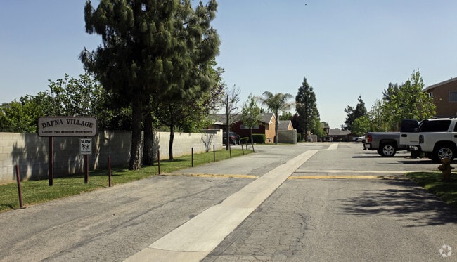

Property Detail
32021 Avenue E
Riverside-San Bernardino-Ontario, CA
SUB NO 3 OF A PART OF DUNLAP RANCHO PTN LOT 105 COM ON W LI SD LOT 210 FT S OF NW COR THEREOF SD COR BEING IN C/L AVE E TH E PARALLEL WITH SD C/L 150 FT M/L TO A PT WHICH IS 180 FT W OF E LI SD LOT SD E LI BEING C/L 16TH ST TH S 245 FT TH E 35 FT TH
0301-122-46
San Bernardino
Apartment
California
D Areas with possible but undetermined flood hazards.
105
2025
3.83 AC
2025
Yucaipa
008705
Inland Empire (California)
50,167 SF
NEARBY LISTINGS FOR SALE OR LEASE
-
-
View all Yucaipa listings for sale on LoopNet.com
DEMOGRAPHICS near 32021 Avenue E
1 mile
3 mile
5 mile
2025 Total Population
5,342
31,540
115,004
2030 Population
5,411
31,986
116,686
Pop Growth 2025-2030
+ 1.29%
+ 1.41%
+ 1.46%
Average Age
39
40
40
2025 Total Households
1,868
11,069
40,900
HH Growth 2025-2030
+ 1.28%
+ 1.44%
+ 1.49%
Median Household Inc
$95,105
$106,652
$99,113
Avg Household Size
2.80
2.80
2.70
2025 Avg HH Vehicles
2.00
2.00
2.00
Median Home Value
$513,554
$621,801
$592,772
Median Year Built
1975
1979
1976
Nearby Places
Map Layers
Map Styles
 Street
 Aerial
Layers
 Traffic
 Biking
Places
Listings with unknown addresses are not visible on the map
- Restaurants
- Banks
- Shops
- Fitness
- Groceries
PUBLIC TRANSPORTATION
COMMUTER RAIL
Drive
Walk
Distance
8 min
4.8 mi
Drive
Walk
Distance
10 min
5.9 mi
AIRPORT
Ontario International
Drive
Walk
Distance
Ontario International
39 min
30.4 mi
Palm Springs International
Drive
Walk
Distance
Palm Springs International
51 min
43.1 mi
Nearby Properties
Address
Land Use
TOTAL SIZE
Lot Size
Zoning
Address
Land Use
TOTAL SIZE
Lot Size
Zoning
369,838 SF
19.32 AC
Address
Land Use
TOTAL SIZE
Lot Size
Zoning
102,506 SF
4.47 AC
Address
Land Use
TOTAL SIZE
Lot Size
Zoning
5.47 AC
Address
Land Use
TOTAL SIZE
Lot Size
Zoning
17,278 SF
5.08 AC
Address
Land Use
TOTAL SIZE
Lot Size
Zoning
67,686 SF
4.16 AC
Address
Land Use
TOTAL SIZE
Lot Size
Zoning
56,491 SF
7.50 AC
Address
Land Use
TOTAL SIZE
Lot Size
Zoning
123,855 SF
9.99 AC
Address
Land Use
TOTAL SIZE
Lot Size
Zoning
56,491 SF
3.39 AC
Address
Land Use
TOTAL SIZE
Lot Size
Zoning
36,892 SF
2.30 AC
RM
Address
Land Use
TOTAL SIZE
Lot Size
Zoning
49,320 SF
1.68 AC
Address
Land Use
TOTAL SIZE
Lot Size
Zoning
49,952 SF
4.34 AC
Address
Land Use
TOTAL SIZE
Lot Size
Zoning
29,387 SF
3.21 AC
Address
Land Use
TOTAL SIZE
Lot Size
Zoning
27,627 SF
5.07 AC
Address
Land Use
TOTAL SIZE
Lot Size
Zoning
111,182 SF
3.11 AC
Address
Land Use
TOTAL SIZE
Lot Size
Zoning
78,309 SF
7.09 AC
Address
Land Use
TOTAL SIZE
Lot Size
Zoning
122,250 SF
4.92 AC
Address
Land Use
TOTAL SIZE
Lot Size
Zoning
29,996 SF
1.86 AC
Address
Land Use
TOTAL SIZE
Lot Size
Zoning
11,001 SF
1.08 AC
Address
Land Use
TOTAL SIZE
Lot Size
Zoning
1,970 SF
6.27 AC
Address
Land Use
TOTAL SIZE
Lot Size
Zoning
23,227 SF
1.81 AC
Address
Land Use
TOTAL SIZE
Lot Size
Zoning
27.20 AC
Address
Land Use
TOTAL SIZE
Lot Size
Zoning
44,864 SF
5.34 AC
Address
Land Use
TOTAL SIZE
Lot Size
Zoning
50,936 SF
6.50 AC
936
Address
Land Use
TOTAL SIZE
Lot Size
Zoning
51,682 SF
19.58 AC
Address
Land Use
TOTAL SIZE
Lot Size
Zoning
14,559 SF
4.98 AC
Address
Land Use
TOTAL SIZE
Lot Size
Zoning
6.53 AC
Address
Land Use
TOTAL SIZE
Lot Size
Zoning
20,015 SF
2.52 AC
The World's #1 Commercial Real Estate Marketplace
Connect with us
© 2026 CoStar Group
The information above has been obtained from sources believed reliable. While we do not doubt its accuracy we have not verified it and make no guarantee, warranty or representation about it. It is your responsibility to independently confirm its accuracy and completeness. Any projections, opinions, assumptions, or estimates used are for example only and do not represent the current or future performance of the property. The value of this transaction to you depends on tax and other factors which should be evaluated by your tax, financial, and legal advisors. You and your advisors should conduct a careful, independent investigation of the property to determine to your satisfaction the suitability of the property for your needs.