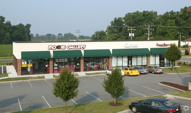
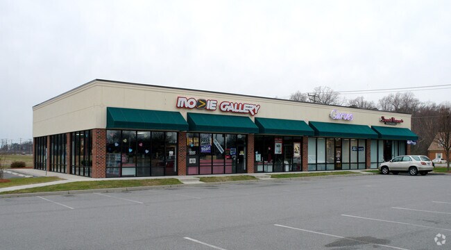
Property Record
3205 Bridge Rd, Suffolk, VA 23435

Property Detail
3205 Bridge Rd
304572900
NURNEY, INGRESSEGRESS, RT. 701
Commercialnec
Suffolk City
GENERAL CO
Virginia
B and X Area of moderate flood hazard, usually the area between the limits of the 100-year and 500-year floods.
0.53 AC
2025
Northern Suffolk
2025
Hampton Roads
075207
Virginia Beach-Chesapeake-Norfolk, VA-NC
6,900 SF
NEARBY LISTINGS FOR SALE OR LEASE
DEMOGRAPHICS near 3205 Bridge Rd
1 mile
3 mile
5 mile
2025 Total Population
2,754
25,011
70,280
2030 Population
3,037
27,126
74,014
Pop Growth 2025-2030
+ 10.28%
+ 8.46%
+ 5.31%
Average Age
41
40
39
2025 Total Households
992
9,433
26,486
HH Growth 2025-2030
+ 10.28%
+ 8.59%
+ 5.45%
Median Household Inc
$111,470
$107,108
$98,007
Avg Household Size
2.70
2.60
2.60
2025 Avg HH Vehicles
2.00
2.00
2.00
Median Home Value
$392,557
$415,292
$386,307
Median Year Built
2003
2003
1995
Nearby Places
Map Layers
Map Styles
 Street
 Aerial
Layers
 Traffic
 Biking
Places
Listings with unknown addresses are not visible on the map
- Restaurants
- Banks
- Shops
- Fitness
- Groceries
PUBLIC TRANSPORTATION
AIRPORT
Norfolk International
Drive
Walk
Distance
Norfolk International
33 min
18.5 mi
Newport News/Williamsburg International
Drive
Walk
Distance
Newport News/Williamsburg International
40 min
28.0 mi
Freight Ports
Virginia Port Authority - Newport News
Drive
Walk
Distance
Virginia Port Authority - Newport News
19 min
12.7 mi
Nearby Properties
Address
Land Use
TOTAL SIZE
Lot Size
Zoning
Address
Land Use
TOTAL SIZE
Lot Size
Zoning
13.52 AC
MIXED USE
Address
Land Use
TOTAL SIZE
Lot Size
Zoning
30.85 AC
PLANNED DE
Address
Land Use
TOTAL SIZE
Lot Size
Zoning
6,446 SF
8.76 AC
MIXED USE
Address
Land Use
TOTAL SIZE
Lot Size
Zoning
97,411 SF
17.90 AC
GENERAL CO
Address
Land Use
TOTAL SIZE
Lot Size
Zoning
22,723 SF
10.97 AC
GENERAL CO
Address
Land Use
TOTAL SIZE
Lot Size
Zoning
166,481 SF
11.15 AC
OFFICE-INS
Address
Land Use
TOTAL SIZE
Lot Size
Zoning
15,746 SF
24.70 AC
GENERAL CO
Address
Land Use
TOTAL SIZE
Lot Size
Zoning
11.83 AC
OFFICE-INS
Address
Land Use
TOTAL SIZE
Lot Size
Zoning
71,769 SF
20.80 AC
RES LOW-ME
Address
Land Use
TOTAL SIZE
Lot Size
Zoning
98,964 SF
13.57 AC
PLANNED DE
Address
Land Use
TOTAL SIZE
Lot Size
Zoning
29,060 SF
14.75 AC
RESIDENTIA
Address
Land Use
TOTAL SIZE
Lot Size
Zoning
49,736 SF
3.32 AC
MIXED USE
Address
Land Use
TOTAL SIZE
Lot Size
Zoning
12.47 AC
RESIDENTIA
Address
Land Use
TOTAL SIZE
Lot Size
Zoning
11,255 SF
14.62 AC
GENERAL CO
Address
Land Use
TOTAL SIZE
Lot Size
Zoning
29,940 SF
3.20 AC
MIXED USE
Address
Land Use
TOTAL SIZE
Lot Size
Zoning
12,395 SF
4.83 AC
GENERAL CO
Address
Land Use
TOTAL SIZE
Lot Size
Zoning
61,050 SF
8 AC
GENERAL CO
Address
Land Use
TOTAL SIZE
Lot Size
Zoning
12.30 AC
RESIDENTIA
Address
Land Use
TOTAL SIZE
Lot Size
Zoning
10,011 SF
4.74 AC
GENERAL CO
Address
Land Use
TOTAL SIZE
Lot Size
Zoning
5,055 SF
19.47 AC
OFFICE-INS
Address
Land Use
TOTAL SIZE
Lot Size
Zoning
3,328 SF
5.37 AC
MIXED USE
Address
Land Use
TOTAL SIZE
Lot Size
Zoning
271.20 AC
RURAL RESI
The World's #1 Commercial Real Estate Marketplace
Connect with us
© 2026 CoStar Group
The information above has been obtained from sources believed reliable. While we do not doubt its accuracy we have not verified it and make no guarantee, warranty or representation about it. It is your responsibility to independently confirm its accuracy and completeness. Any projections, opinions, assumptions, or estimates used are for example only and do not represent the current or future performance of the property. The value of this transaction to you depends on tax and other factors which should be evaluated by your tax, financial, and legal advisors. You and your advisors should conduct a careful, independent investigation of the property to determine to your satisfaction the suitability of the property for your needs.