Property Record
3205 S Riverside Dr, Sault Sainte Marie, MI 49783

NEARBY LISTINGS FOR SALE OR LEASE
-
-
View all Sault Sainte Marie listings for sale on LoopNet.com
Property Detail
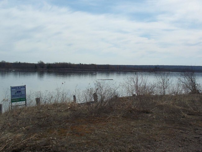
3205 S Riverside Dr
012-022-021-00
S22 T47n R1e
Commercialnec
1348/598 1254/897 1254/348 1074/339 2009 SPL PER 1061/654 1028/598 960/544 712/5 647/704 539/34 537/
AE
Chippewa
26033C0508D
Michigan
2024
1.10 AC
2025
Upper Peninsula
970500
Other Market Areas
3,000 SF
Sault Ste. Marie, MI
DEMOGRAPHICS near 3205 S Riverside Dr
1 Mile
3 Mile
5 Mile
2024 Total Population
464
3,496
13,552
2029 Population
475
3,564
13,602
Pop Growth 2024-2029
+ 2.37%
+ 1.95%
+ 0.37%
Average Age
44
42
40
2024 Total Households
180
1,440
5,759
HH Growth 2024-2029
+ 1.67%
+ 1.53%
+ 0.16%
Median Household Inc
$69,374
$55,700
$49,695
Avg Household Size
2.30
2.30
2.20
2024 Avg HH Vehicles
2.00
2.00
2.00
Median Home Value
$190,475
$162,727
$134,030
Median Year Built
1988
1981
1968
Nearby Places
Map Layers
Map Styles
 Street
 Aerial
- Restaurants
- Banks
- Shops
- Fitness
- Groceries
PUBLIC TRANSPORTATION
AIRPORT
Sault Ste Marie
DRIVE
WALK
Distance
Sault Ste Marie
39 min
20.1 mi
Freight Ports
Port Milwaukee
DRIVE
WALK
Distance
Port Milwaukee
479 min
402.2 mi
Nearby Properties
Address
Land Use
TOTAL SIZE
Lot Size
Zoning
Address
Land Use
TOTAL SIZE
Lot Size
Zoning
120,010.55 AC
B3
Address
Land Use
TOTAL SIZE
Lot Size
Zoning
7.92 AC
SPLIT
Address
Land Use
TOTAL SIZE
Lot Size
Zoning
4.59 AC
I2
Address
Land Use
TOTAL SIZE
Lot Size
Zoning
Address
Land Use
TOTAL SIZE
Lot Size
Zoning
42 AC
SPLIT
Address
Land Use
TOTAL SIZE
Lot Size
Zoning
Address
Land Use
TOTAL SIZE
Lot Size
Zoning
6,771 SF
2.80 AC
T
Address
Land Use
TOTAL SIZE
Lot Size
Zoning
22,672 SF
6.60 AC
Address
Land Use
TOTAL SIZE
Lot Size
Zoning
81,328.39 AC
T
Address
Land Use
TOTAL SIZE
Lot Size
Zoning
Address
Land Use
TOTAL SIZE
Lot Size
Zoning
Address
Land Use
TOTAL SIZE
Lot Size
Zoning
1.15 AC
I1
Address
Land Use
TOTAL SIZE
Lot Size
Zoning
43.21 AC
SPLIT
Address
Land Use
TOTAL SIZE
Lot Size
Zoning
4.54 AC
I2
Address
Land Use
TOTAL SIZE
Lot Size
Zoning
9,784 SF
2.70 AC
SPLIT
Address
Land Use
TOTAL SIZE
Lot Size
Zoning
26,877.14 AC
B3
Address
Land Use
TOTAL SIZE
Lot Size
Zoning
10,759.57 AC
B3
Address
Land Use
TOTAL SIZE
Lot Size
Zoning
5.88 AC
RSV
Address
Land Use
TOTAL SIZE
Lot Size
Zoning
10 AC
B3
Address
Land Use
TOTAL SIZE
Lot Size
Zoning
Address
Land Use
TOTAL SIZE
Lot Size
Zoning
8 AC
B3
Address
Land Use
TOTAL SIZE
Lot Size
Zoning
2.69 AC
B3
Address
Land Use
TOTAL SIZE
Lot Size
Zoning
2.59 AC
R1
Address
Land Use
TOTAL SIZE
Lot Size
Zoning
9.33 AC
B3
Address
Land Use
TOTAL SIZE
Lot Size
Zoning
7.10 AC
B3
Address
Land Use
TOTAL SIZE
Lot Size
Zoning
2,340 SF
77.15 AC
Address
Land Use
TOTAL SIZE
Lot Size
Zoning
2.24 AC
T
Address
Land Use
TOTAL SIZE
Lot Size
Zoning
1.21 AC
I2
Address
Land Use
TOTAL SIZE
Lot Size
Zoning
19,852 SF
5 AC
Address
Land Use
TOTAL SIZE
Lot Size
Zoning
51,619.79 AC
SPLIT
The World's #1 Commercial Real Estate Marketplace
Connect with us
© 2026 CoStar Group
The information above has been obtained from sources believed reliable. While we do not doubt its accuracy we have not verified it and make no guarantee, warranty or representation about it. It is your responsibility to independently confirm its accuracy and completeness. Any projections, opinions, assumptions, or estimates used are for example only and do not represent the current or future performance of the property. The value of this transaction to you depends on tax and other factors which should be evaluated by your tax, financial, and legal advisors. You and your advisors should conduct a careful, independent investigation of the property to determine to your satisfaction the suitability of the property for your needs.