Property Record
3206 Broad Ave, Memphis, TN 38112

NEARBY LISTINGS FOR SALE OR LEASE
-
-
View all Memphis listings for sale on LoopNet.com
Property Detail
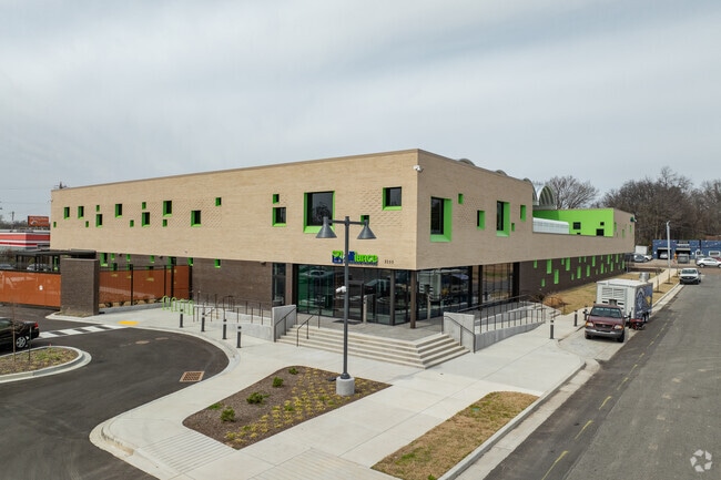
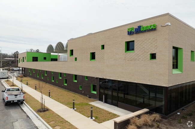
3206 Broad Ave
Memphis, TN-MS-AR
Alliance Planned Development
04-4036-0-0043C
NS BROAD AVE COR MALCOMB ST (NW) TO SUMMER AVE MAP:130K
Officebuilding
Shelby
X
Tennessee
47157C0290F
1
2023
2.31 AC
2025
Midtown
002800
Memphis
61,914 SF
DEMOGRAPHICS near 3206 Broad Ave
1 mile
3 mile
5 mile
2024 Total Population
13,378
105,370
238,095
2029 Population
13,461
105,119
237,512
Pop Growth 2024-2029
+ 0.62%
(0.24%)
(0.24%)
Average Age
36
37
38
2024 Total Households
5,509
44,326
100,597
HH Growth 2024-2029
+ 0.44%
(0.30%)
(0.37%)
Median Household Inc
$31,205
$44,167
$42,958
Avg Household Size
2.30
2.30
2.30
2024 Avg HH Vehicles
1.00
2.00
1.00
Median Home Value
$180,383
$237,697
$180,248
Median Year Built
1956
1954
1957
Nearby Places
Map Layers
Map Styles
 Street
 Aerial
Transit
 Traffic
 Biking
Places
Listings with unknown addresses are not visible on the map
- Restaurants
- Banks
- Shops
- Fitness
- Groceries
PUBLIC TRANSPORTATION
COMMUTER RAIL
Central Station (Riverfront Loop - Memphis Area Transit Authority Trolley (MataTrolley))
Drive
Walk
Distance
Central Station (Riverfront Loop - Memphis Area Transit Authority Trolley (MataTrolley))
14 min
7.5 mi
AIRPORT
Memphis International
Drive
Walk
Distance
Memphis International
16 min
9.4 mi
Nearby Properties
Address
Land Use
TOTAL SIZE
Lot Size
Zoning
Address
Land Use
TOTAL SIZE
Lot Size
Zoning
218,327 SF
4.89 AC
R-6
Address
Land Use
TOTAL SIZE
Lot Size
Zoning
115,053 SF
4.63 AC
CMU-1
Address
Land Use
TOTAL SIZE
Lot Size
Zoning
2,137 SF
346 AC
R-15
Address
Land Use
TOTAL SIZE
Lot Size
Zoning
99,732 SF
1.08 AC
CMU-3
Address
Land Use
TOTAL SIZE
Lot Size
Zoning
100,246 SF
0.93 AC
CMU-3
Address
Land Use
TOTAL SIZE
Lot Size
Zoning
33,391 SF
1.26 AC
CMU-1
Address
Land Use
TOTAL SIZE
Lot Size
Zoning
87,504 SF
0.88 AC
CMU-3
Address
Land Use
TOTAL SIZE
Lot Size
Zoning
222,671 SF
8.77 AC
EMP
Address
Land Use
TOTAL SIZE
Lot Size
Zoning
53,088 SF
1.51 AC
CMU-3
Address
Land Use
TOTAL SIZE
Lot Size
Zoning
38,348 SF
1.74 AC
RW
Address
Land Use
TOTAL SIZE
Lot Size
Zoning
120.15 AC
RU-1
Address
Land Use
TOTAL SIZE
Lot Size
Zoning
118,073 SF
4.75 AC
CMU-1
Address
Land Use
TOTAL SIZE
Lot Size
Zoning
114,326 SF
1.99 AC
R-6
Address
Land Use
TOTAL SIZE
Lot Size
Zoning
96 AC
R-10
Address
Land Use
TOTAL SIZE
Lot Size
Zoning
17,438 SF
25.84 AC
RU-3
Address
Land Use
TOTAL SIZE
Lot Size
Zoning
66,580 SF
3.75 AC
RU-3
Address
Land Use
TOTAL SIZE
Lot Size
Zoning
699,184 SF
19.67 AC
IH
Address
Land Use
TOTAL SIZE
Lot Size
Zoning
104.22 AC
R-15
Address
Land Use
TOTAL SIZE
Lot Size
Zoning
40,270 SF
2 AC
Address
Land Use
TOTAL SIZE
Lot Size
Zoning
66,728 SF
346 AC
RS-15
Address
Land Use
TOTAL SIZE
Lot Size
Zoning
87,283 SF
2.14 AC
CMU-1
Address
Land Use
TOTAL SIZE
Lot Size
Zoning
69,204 SF
4.54 AC
CMU-3
Address
Land Use
TOTAL SIZE
Lot Size
Zoning
190,456 SF
13.71 AC
CMU-1
Address
Land Use
TOTAL SIZE
Lot Size
Zoning
399,662 SF
27.28 AC
EMP
Address
Land Use
TOTAL SIZE
Lot Size
Zoning
300,011 SF
17.53 AC
EMP
Address
Land Use
TOTAL SIZE
Lot Size
Zoning
81,516 SF
2.76 AC
RU-3
Address
Land Use
TOTAL SIZE
Lot Size
Zoning
106,268 SF
3.95 AC
CMU-3
Address
Land Use
TOTAL SIZE
Lot Size
Zoning
35,150 SF
3.59 AC
CMU-3
Address
Land Use
TOTAL SIZE
Lot Size
Zoning
40,854 SF
2.16 AC
R-6
The World's #1 Commercial Real Estate Marketplace
Connect with us
© 2026 CoStar Group
The information above has been obtained from sources believed reliable. While we do not doubt its accuracy we have not verified it and make no guarantee, warranty or representation about it. It is your responsibility to independently confirm its accuracy and completeness. Any projections, opinions, assumptions, or estimates used are for example only and do not represent the current or future performance of the property. The value of this transaction to you depends on tax and other factors which should be evaluated by your tax, financial, and legal advisors. You and your advisors should conduct a careful, independent investigation of the property to determine to your satisfaction the suitability of the property for your needs.