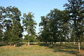
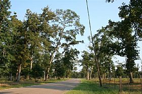
Property Record
3207 Waukegan Rd, Conroe, TX 77306


Property Detail
3207 Waukegan Rd
0073-00-01100
A0073 - BRIDGES WM B, TRACT 11, ACRES 25.688
Vacantlandnec
MONTGOMERY
1
Texas
AE The base floodplain where base flood elevations are provided. AE Zones are now used on new format FIRMs instead of A1-A30 Zones.
25.69 AC
2024
Outlying Montgomery Cnty
2025
Houston
693002
Houston-Pasadena-The Woodlands, TX
NEARBY LISTINGS FOR SALE OR LEASE
DEMOGRAPHICS near 3207 Waukegan Rd
1 mile
3 mile
5 mile
2025 Total Population
3,059
21,477
41,876
2030 Population
3,661
25,639
50,133
Pop Growth 2025-2030
+ 19.68%
+ 19.38%
+ 19.72%
Average Age
32
35
36
2025 Total Households
876
6,551
13,344
HH Growth 2025-2030
+ 20.21%
+ 19.94%
+ 20.29%
Median Household Inc
$82,796
$65,350
$75,973
Avg Household Size
3.40
3.20
3.10
2025 Avg HH Vehicles
3.00
2.00
2.00
Median Home Value
$231,103
$184,423
$244,004
Median Year Built
2009
2005
2008
Nearby Places
Map Layers
Map Styles
 Street
 Aerial
Layers
 Traffic
 Biking
Places
Listings with unknown addresses are not visible on the map
- Restaurants
- Banks
- Shops
- Fitness
- Groceries
PUBLIC TRANSPORTATION
AIRPORT
George Bush Intcntl/Houston
Drive
Walk
Distance
George Bush Intcntl/Houston
50 min
38.9 mi
Freight Ports
Port of Houston
Drive
Walk
Distance
Port of Houston
73 min
54.6 mi
Nearby Properties
Address
Land Use
TOTAL SIZE
Lot Size
Zoning
Address
Land Use
TOTAL SIZE
Lot Size
Zoning
266,751 SF
12.95 AC
1
Address
Land Use
TOTAL SIZE
Lot Size
Zoning
124,209 SF
9.18 AC
1
Address
Land Use
TOTAL SIZE
Lot Size
Zoning
187,426 SF
61.77 AC
1
Address
Land Use
TOTAL SIZE
Lot Size
Zoning
140,900 SF
83.24 AC
1
Address
Land Use
TOTAL SIZE
Lot Size
Zoning
84,192 SF
23.22 AC
1
Address
Land Use
TOTAL SIZE
Lot Size
Zoning
44,182 SF
6.25 AC
1
Address
Land Use
TOTAL SIZE
Lot Size
Zoning
64,150 SF
6.41 AC
1
Address
Land Use
TOTAL SIZE
Lot Size
Zoning
65,448 SF
10 AC
1
Address
Land Use
TOTAL SIZE
Lot Size
Zoning
Address
Land Use
TOTAL SIZE
Lot Size
Zoning
9,120 SF
2.34 AC
Address
Land Use
TOTAL SIZE
Lot Size
Zoning
38,020 SF
28.47 AC
1
Address
Land Use
TOTAL SIZE
Lot Size
Zoning
11,929 SF
35.97 AC
1
Address
Land Use
TOTAL SIZE
Lot Size
Zoning
37,300 SF
11.70 AC
1
Address
Land Use
TOTAL SIZE
Lot Size
Zoning
9,582 SF
10.46 AC
1
Address
Land Use
TOTAL SIZE
Lot Size
Zoning
9,002 SF
1.31 AC
1
Address
Land Use
TOTAL SIZE
Lot Size
Zoning
8,450 SF
2.16 AC
Address
Land Use
TOTAL SIZE
Lot Size
Zoning
9,373 SF
0.93 AC
Address
Land Use
TOTAL SIZE
Lot Size
Zoning
28,920 SF
8.44 AC
1
Address
Land Use
TOTAL SIZE
Lot Size
Zoning
12,866 SF
10.30 AC
1
Address
Land Use
TOTAL SIZE
Lot Size
Zoning
6,254 SF
1.82 AC
Address
Land Use
TOTAL SIZE
Lot Size
Zoning
9,000 SF
1.10 AC
Address
Land Use
TOTAL SIZE
Lot Size
Zoning
11,543 SF
17.92 AC
1
Address
Land Use
TOTAL SIZE
Lot Size
Zoning
43,371 SF
5.04 AC
Address
Land Use
TOTAL SIZE
Lot Size
Zoning
13,960 SF
5 AC
Address
Land Use
TOTAL SIZE
Lot Size
Zoning
7,740 SF
1.07 AC
Address
Land Use
TOTAL SIZE
Lot Size
Zoning
8,356 SF
1.75 AC
Address
Land Use
TOTAL SIZE
Lot Size
Zoning
19,400 SF
5 AC
Address
Land Use
TOTAL SIZE
Lot Size
Zoning
5,000 SF
2 AC
1
Address
Land Use
TOTAL SIZE
Lot Size
Zoning
50,248 SF
10.01 AC
1
Address
Land Use
TOTAL SIZE
Lot Size
Zoning
4,800 SF
1.15 AC
1
The World's #1 Commercial Real Estate Marketplace
Connect with us
© 2026 CoStar Group
The information above has been obtained from sources believed reliable. While we do not doubt its accuracy we have not verified it and make no guarantee, warranty or representation about it. It is your responsibility to independently confirm its accuracy and completeness. Any projections, opinions, assumptions, or estimates used are for example only and do not represent the current or future performance of the property. The value of this transaction to you depends on tax and other factors which should be evaluated by your tax, financial, and legal advisors. You and your advisors should conduct a careful, independent investigation of the property to determine to your satisfaction the suitability of the property for your needs.