Property Record
32095 Frazier Rd, Auberry, CA 93602


NEARBY LISTINGS FOR SALE OR LEASE
-
-
View all Auberry listings for sale on LoopNet.com
Property Detail
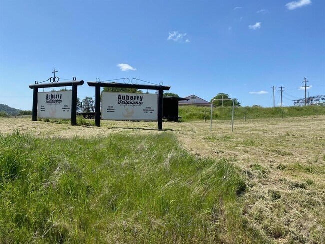
32095 Frazier Rd
128-121-32
Parcel Map No 6901
Religious
5 AC PAR 1 P/M 6901 BK 47 PGS 8 & 9
X
Fresno
06019C0700H
California
2025
5 AC
2025
E Outlying Fresno County
006405
Fresno
1,710 SF
Fresno, CA
DEMOGRAPHICS near 32095 Frazier Rd
1 Mile
3 Mile
5 Mile
2024 Total Population
489
2,268
3,973
2029 Population
480
2,240
4,009
Pop Growth 2024-2029
(1.84%)
(1.23%)
+ 0.91%
Average Age
43
43
44
2024 Total Households
189
875
1,541
HH Growth 2024-2029
(2.12%)
(1.26%)
+ 0.97%
Median Household Inc
$77,273
$74,399
$71,472
Avg Household Size
2.40
2.50
2.50
2024 Avg HH Vehicles
2.00
2.00
2.00
Median Home Value
$432,143
$434,868
$422,546
Median Year Built
1984
1983
1980
Nearby Places
Map Layers
Map Styles
 Street
 Aerial
- Restaurants
- Banks
- Shops
- Fitness
- Groceries
PUBLIC TRANSPORTATION
AIRPORT
Fresno Yosemite International
DRIVE
WALK
Distance
Fresno Yosemite International
50 min
33.2 mi
Freight Ports
Port of Stockton
DRIVE
WALK
Distance
Port of Stockton
197 min
155.3 mi
SALE & LEASE HISTORY
LISTING DATE
SALE/LEASE

May 06, 2021
For Sale
May 03, 2021
For Sale
Nearby Properties
Address
Land Use
TOTAL SIZE
Lot Size
Zoning
Address
Land Use
TOTAL SIZE
Lot Size
Zoning
3,590 SF
3.90 AC
C6
Address
Land Use
TOTAL SIZE
Lot Size
Zoning
43,077 SF
10.57 AC
C6
Address
Land Use
TOTAL SIZE
Lot Size
Zoning
5,041 SF
1.83 AC
Address
Land Use
TOTAL SIZE
Lot Size
Zoning
20,059 SF
1.72 AC
C6
Address
Land Use
TOTAL SIZE
Lot Size
Zoning
17,979 SF
4.38 AC
CG/CMS
Address
Land Use
TOTAL SIZE
Lot Size
Zoning
44,545 SF
142.65 AC
RC40
Address
Land Use
TOTAL SIZE
Lot Size
Zoning
16,400 SF
2.23 AC
CG/CMS
Address
Land Use
TOTAL SIZE
Lot Size
Zoning
9,100 SF
1.07 AC
CGCMS
Address
Land Use
TOTAL SIZE
Lot Size
Zoning
728 SF
9.91 AC
RMX
Address
Land Use
TOTAL SIZE
Lot Size
Zoning
14,357 SF
2.87 AC
RR
Address
Land Use
TOTAL SIZE
Lot Size
Zoning
9,680 SF
1.48 AC
CM
Address
Land Use
TOTAL SIZE
Lot Size
Zoning
18,400 SF
15.93 AC
RR
Address
Land Use
TOTAL SIZE
Lot Size
Zoning
5,089 SF
4.06 AC
AE40
Address
Land Use
TOTAL SIZE
Lot Size
Zoning
4,592 SF
125.05 AC
RR
Address
Land Use
TOTAL SIZE
Lot Size
Zoning
7,367 SF
2.40 AC
RP
Address
Land Use
TOTAL SIZE
Lot Size
Zoning
2,724 SF
40.69 AC
AE40
Address
Land Use
TOTAL SIZE
Lot Size
Zoning
20,180 SF
2.28 AC
RR
Address
Land Use
TOTAL SIZE
Lot Size
Zoning
2,814 SF
80 AC
AE40
Address
Land Use
TOTAL SIZE
Lot Size
Zoning
1,180 SF
125.62 AC
RR
Address
Land Use
TOTAL SIZE
Lot Size
Zoning
18,880 SF
3.02 AC
CM
Address
Land Use
TOTAL SIZE
Lot Size
Zoning
39.41 AC
AE40
Address
Land Use
TOTAL SIZE
Lot Size
Zoning
3,923 SF
40.90 AC
AE40
Address
Land Use
TOTAL SIZE
Lot Size
Zoning
158.30 AC
AE40
Address
Land Use
TOTAL SIZE
Lot Size
Zoning
1,572 SF
118.68 AC
RR
Address
Land Use
TOTAL SIZE
Lot Size
Zoning
800 SF
1.22 AC
CM
Address
Land Use
TOTAL SIZE
Lot Size
Zoning
3,286 SF
601.57 AC
AE40
Address
Land Use
TOTAL SIZE
Lot Size
Zoning
3,228 SF
40 AC
AL40
Address
Land Use
TOTAL SIZE
Lot Size
Zoning
14,852 SF
4.62 AC
M3
Address
Land Use
TOTAL SIZE
Lot Size
Zoning
6,777 SF
68.28 AC
M3
The World's #1 Commercial Real Estate Marketplace
Connect with us
© 2025 CoStar Group
The information above has been obtained from sources believed reliable. While we do not doubt its accuracy we have not verified it and make no guarantee, warranty or representation about it. It is your responsibility to independently confirm its accuracy and completeness. Any projections, opinions, assumptions, or estimates used are for example only and do not represent the current or future performance of the property. The value of this transaction to you depends on tax and other factors which should be evaluated by your tax, financial, and legal advisors. You and your advisors should conduct a careful, independent investigation of the property to determine to your satisfaction the suitability of the property for your needs.