Property Record
325 E Pershing Rd, Chicago, IL 60653


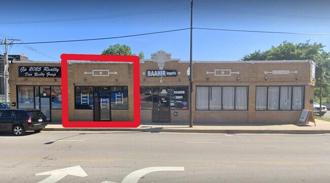
Property Detail
325 E Pershing Rd
20-03-105-001-0000
Cook
Commercialbuilding
Illinois
B3-3
70,67
B and X Area of moderate flood hazard, usually the area between the limits of the 100-year and 500-year floods.
0.18 AC
2023
South Chicago
2025
Chicago
380600
Chicago-Naperville-Elgin, IL-IN
5,190 SF
NEARBY LISTINGS FOR SALE OR LEASE
DEMOGRAPHICS near 325 E Pershing Rd
1 mile
3 mile
5 mile
2024 Total Population
39,271
242,429
677,077
2029 Population
39,820
241,260
673,946
Pop Growth 2024-2029
+ 1.40%
(0.48%)
(0.46%)
Average Age
39
39
38
2024 Total Households
17,878
107,484
295,694
HH Growth 2024-2029
+ 1.09%
(0.37%)
+ 0.03%
Median Household Inc
$41,567
$64,580
$71,347
Avg Household Size
2.10
2.10
2.10
2024 Avg HH Vehicles
1.00
1.00
1.00
Median Home Value
$348,670
$360,475
$343,601
Median Year Built
1972
1959
1964
Nearby Places
Map Layers
Map Styles
 Street
 Aerial
Transit
 Traffic
 Biking
Places
Listings with unknown addresses are not visible on the map
- Restaurants
- Banks
- Shops
- Fitness
- Groceries
PUBLIC TRANSPORTATION
TRANSIT/SUBWAY
Indiana Station (Green Line - Chicago Transit Authority "L" Trains (The "L"))
Drive
Walk
Distance
Indiana Station (Green Line - Chicago Transit Authority "L" Trains (The "L"))
2 min
6 min
0.3 mi
43rd Street Station (Green Line - Chicago Transit Authority "L" Trains (The "L"))
Drive
Walk
Distance
43rd Street Station (Green Line - Chicago Transit Authority "L" Trains (The "L"))
2 min
10 min
0.5 mi
35th-Bronzeville-IIT Station (Green Line - Chicago Transit Authority "L" Trains (The "L"))
Drive
Walk
Distance
35th-Bronzeville-IIT Station (Green Line - Chicago Transit Authority "L" Trains (The "L"))
3 min
20 min
1.0 mi
COMMUTER RAIL
Drive
Walk
Distance
2 min
1.1 mi
27th Street Station (Metra Electric Line - Northeast Illinois Regional Commuter Railroad (Metra))
Drive
Walk
Distance
27th Street Station (Metra Electric Line - Northeast Illinois Regional Commuter Railroad (Metra))
6 min
2.0 mi
AIRPORT
Chicago Midway International
Drive
Walk
Distance
Chicago Midway International
16 min
8.0 mi
Chicago O'Hare International
Drive
Walk
Distance
Chicago O'Hare International
34 min
22.0 mi
SALE & LEASE HISTORY
LISTING DATE
SALE/LEASE

Oct 11, 2016
For Lease
Dec 02, 2024
For Lease
Nearby Properties
Address
Land Use
TOTAL SIZE
Lot Size
Zoning
Address
Land Use
TOTAL SIZE
Lot Size
Zoning
1,215,367 SF
3.76 AC
PD 675
Address
Land Use
TOTAL SIZE
Lot Size
Zoning
590,844 SF
0.80 AC
PD 26
Address
Land Use
TOTAL SIZE
Lot Size
Zoning
474,979 SF
29.67 AC
PD 553
Address
Land Use
TOTAL SIZE
Lot Size
Zoning
0.85 AC
DS-3
Address
Land Use
TOTAL SIZE
Lot Size
Zoning
Address
Land Use
TOTAL SIZE
Lot Size
Zoning
0.28 AC
PD 38
Address
Land Use
TOTAL SIZE
Lot Size
Zoning
4.11 AC
M2-3
Address
Land Use
TOTAL SIZE
Lot Size
Zoning
460,333 SF
2.62 AC
C2-3
Address
Land Use
TOTAL SIZE
Lot Size
Zoning
136,720 SF
0.54 AC
PD 1
Address
Land Use
TOTAL SIZE
Lot Size
Zoning
3.14 AC
PD 1211
Address
Land Use
TOTAL SIZE
Lot Size
Zoning
1,302,463 SF
3.14 AC
PD 1211
Address
Land Use
TOTAL SIZE
Lot Size
Zoning
0.35 AC
PD 1317
Address
Land Use
TOTAL SIZE
Lot Size
Zoning
548,210 SF
1.11 AC
PD 681
Address
Land Use
TOTAL SIZE
Lot Size
Zoning
508,816 SF
1.11 AC
DX-7,PD 49
Address
Land Use
TOTAL SIZE
Lot Size
Zoning
552,300 SF
0.69 AC
PMD 11
Address
Land Use
TOTAL SIZE
Lot Size
Zoning
111,322 SF
1 AC
DS-5
Address
Land Use
TOTAL SIZE
Lot Size
Zoning
Address
Land Use
TOTAL SIZE
Lot Size
Zoning
250,040 SF
15.70 AC
PD 1169
Address
Land Use
TOTAL SIZE
Lot Size
Zoning
13.54 AC
Address
Land Use
TOTAL SIZE
Lot Size
Zoning
225,784 SF
0.69 AC
DS-3
Address
Land Use
TOTAL SIZE
Lot Size
Zoning
264,800 SF
0.61 AC
DX-7
Address
Land Use
TOTAL SIZE
Lot Size
Zoning
169,435 SF
11.35 AC
PD 307
Address
Land Use
TOTAL SIZE
Lot Size
Zoning
313,559 SF
PD 1318
Address
Land Use
TOTAL SIZE
Lot Size
Zoning
630,837 SF
0.25 AC
PD 1317
Address
Land Use
TOTAL SIZE
Lot Size
Zoning
433,317 SF
0.52 AC
PMD 11
Address
Land Use
TOTAL SIZE
Lot Size
Zoning
2.65 AC
PD 38
Address
Land Use
TOTAL SIZE
Lot Size
Zoning
10 AC
PD 1169
Address
Land Use
TOTAL SIZE
Lot Size
Zoning
213,289 SF
0.65 AC
DX-7
Address
Land Use
TOTAL SIZE
Lot Size
Zoning
8.54 AC
PD 1169
Address
Land Use
TOTAL SIZE
Lot Size
Zoning
1,687,020 SF
10.25 AC
PD 1169
The World's #1 Commercial Real Estate Marketplace
Connect with us
© 2026 CoStar Group
The information above has been obtained from sources believed reliable. While we do not doubt its accuracy we have not verified it and make no guarantee, warranty or representation about it. It is your responsibility to independently confirm its accuracy and completeness. Any projections, opinions, assumptions, or estimates used are for example only and do not represent the current or future performance of the property. The value of this transaction to you depends on tax and other factors which should be evaluated by your tax, financial, and legal advisors. You and your advisors should conduct a careful, independent investigation of the property to determine to your satisfaction the suitability of the property for your needs.