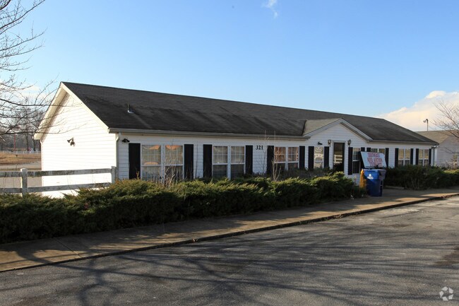
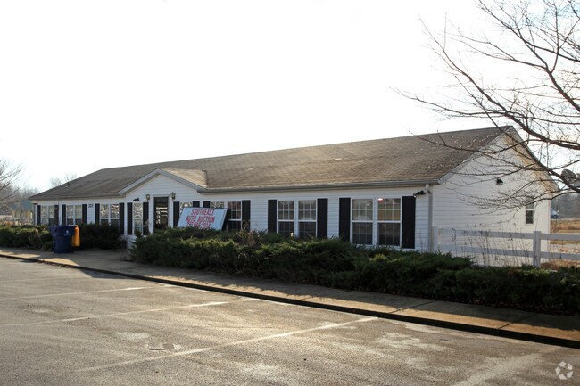
Property Record
321 Corvette Dr, Bowling Green, KY 42101

Save to a Folder
{{folder.Name}}
{{folder.ListingIds.length}} Properties
{{folder.ListingIds.length}} Property
Create a New Folder
Property Detail
321 Corvette Dr
051A-07-015A
WARREN
Commercialnec
Kentucky
B and X Area of moderate flood hazard, usually the area between the limits of the 100-year and 500-year floods.
15-1
2025
8.05 AC
2025
Bowling Green Area
011300
Other Market Areas
3,609 SF
Bowling Green, KY
NEARBY LISTINGS FOR SALE OR LEASE
DEMOGRAPHICS near 321 Corvette Dr
1 mile
3 mile
5 mile
2025 Total Population
1,243
16,445
57,077
2030 Population
1,372
18,046
62,330
Pop Growth 2025-2030
+ 10.38%
+ 9.74%
+ 9.20%
Average Age
35
37
36
2025 Total Households
511
6,851
22,266
HH Growth 2025-2030
+ 11.35%
+ 10.44%
+ 10.25%
Median Household Inc
$57,646
$67,949
$55,705
Avg Household Size
2.30
2.40
2.30
2025 Avg HH Vehicles
2.00
2.00
2.00
Median Home Value
$183,683
$267,794
$265,102
Median Year Built
2007
1995
1988
Nearby Places
Map Layers
Map Styles
 Street
 Aerial
Layers
 Traffic
 Biking
Places
Listings with unknown addresses are not visible on the map
- Restaurants
- Banks
- Shops
- Fitness
- Groceries
Nearby Properties
Address
Land Use
TOTAL SIZE
Lot Size
Zoning
Address
Land Use
TOTAL SIZE
Lot Size
Zoning
12.29 AC
Address
Land Use
TOTAL SIZE
Lot Size
Zoning
2,196,945 SF
212 AC
Address
Land Use
TOTAL SIZE
Lot Size
Zoning
175,830 SF
8 AC
Address
Land Use
TOTAL SIZE
Lot Size
Zoning
105,987 SF
7.98 AC
Address
Land Use
TOTAL SIZE
Lot Size
Zoning
167,354 SF
13.63 AC
Address
Land Use
TOTAL SIZE
Lot Size
Zoning
290,029 SF
17.48 AC
Address
Land Use
TOTAL SIZE
Lot Size
Zoning
89,129 SF
49.26 AC
Address
Land Use
TOTAL SIZE
Lot Size
Zoning
3,840 SF
5.68 AC
Address
Land Use
TOTAL SIZE
Lot Size
Zoning
1,397 SF
6.89 AC
Address
Land Use
TOTAL SIZE
Lot Size
Zoning
3,120 SF
4.97 AC
Address
Land Use
TOTAL SIZE
Lot Size
Zoning
6,000 SF
242.33 AC
Address
Land Use
TOTAL SIZE
Lot Size
Zoning
1,740 SF
136.33 AC
Address
Land Use
TOTAL SIZE
Lot Size
Zoning
191,054 SF
9.02 AC
Address
Land Use
TOTAL SIZE
Lot Size
Zoning
13,342 SF
189.40 AC
Address
Land Use
TOTAL SIZE
Lot Size
Zoning
Address
Land Use
TOTAL SIZE
Lot Size
Zoning
24,440 SF
5 AC
Address
Land Use
TOTAL SIZE
Lot Size
Zoning
170,932 SF
12.42 AC
Address
Land Use
TOTAL SIZE
Lot Size
Zoning
9,975 SF
1.43 AC
Address
Land Use
TOTAL SIZE
Lot Size
Zoning
168,414 SF
18.03 AC
Address
Land Use
TOTAL SIZE
Lot Size
Zoning
142,800 SF
13.10 AC
Address
Land Use
TOTAL SIZE
Lot Size
Zoning
145,624 SF
19.66 AC
Address
Land Use
TOTAL SIZE
Lot Size
Zoning
50,600 SF
8.02 AC
Address
Land Use
TOTAL SIZE
Lot Size
Zoning
52,522 SF
20.06 AC
Address
Land Use
TOTAL SIZE
Lot Size
Zoning
44,800 SF
4.51 AC
Address
Land Use
TOTAL SIZE
Lot Size
Zoning
6,600 SF
4.14 AC
Address
Land Use
TOTAL SIZE
Lot Size
Zoning
21,304 SF
4.96 AC
Address
Land Use
TOTAL SIZE
Lot Size
Zoning
123,096 SF
48.76 AC
Address
Land Use
TOTAL SIZE
Lot Size
Zoning
27,282 SF
2.11 AC
Address
Land Use
TOTAL SIZE
Lot Size
Zoning
5,292 SF
2.96 AC
Address
Land Use
TOTAL SIZE
Lot Size
Zoning
6,842 SF
5 AC
The World's #1 Commercial Real Estate Marketplace
Connect with us
© 2026 CoStar Group
The information above has been obtained from sources believed reliable. While we do not doubt its accuracy we have not verified it and make no guarantee, warranty or representation about it. It is your responsibility to independently confirm its accuracy and completeness. Any projections, opinions, assumptions, or estimates used are for example only and do not represent the current or future performance of the property. The value of this transaction to you depends on tax and other factors which should be evaluated by your tax, financial, and legal advisors. You and your advisors should conduct a careful, independent investigation of the property to determine to your satisfaction the suitability of the property for your needs.