Property Record
321 Main Ave, De Pere, WI 54115
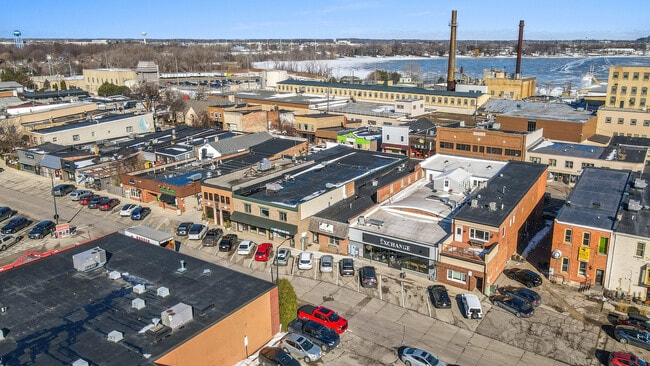


Property Detail
321 Main Ave
Green Bay, WI
2,541 SQ FT PLAT OF W. DEPERE E1/3 OF LOT 9 EX 779 R 546 & ALSO SLY 39 FT OF ELY 1 FT OF WLY2/3 OF LOT 9 EX 773 R 474
WD-910
Brown
Commercialnec
Wisconsin
B and X Area of moderate flood hazard, usually the area between the limits of the 100-year and 500-year floods.
9
2025
0.06 AC
2025
Ashwaubenon
010201
Green Bay
2,376 SF
NEARBY LISTINGS FOR SALE OR LEASE
DEMOGRAPHICS near 321 Main Ave
1 mile
3 mile
5 mile
2024 Total Population
9,967
46,578
103,873
2029 Population
10,107
47,385
105,824
Pop Growth 2024-2029
+ 1.40%
+ 1.73%
+ 1.88%
Average Age
38
41
41
2024 Total Households
3,832
19,141
43,040
HH Growth 2024-2029
+ 1.70%
+ 1.85%
+ 1.94%
Median Household Inc
$66,388
$86,130
$81,678
Avg Household Size
2.20
2.30
2.30
2024 Avg HH Vehicles
2.00
2.00
2.00
Median Home Value
$246,724
$303,342
$270,272
Median Year Built
1972
1986
1978
Nearby Places
Map Layers
Map Styles
 Street
 Aerial
Transit
 Traffic
 Biking
Places
Listings with unknown addresses are not visible on the map
- Restaurants
- Banks
- Shops
- Fitness
- Groceries
PUBLIC TRANSPORTATION
AIRPORT
Green Bay/Austin Straubel International
Drive
Walk
Distance
Green Bay/Austin Straubel International
10 min
4.9 mi
Appleton International
Drive
Walk
Distance
Appleton International
40 min
32.3 mi
Freight Ports
Port Milwaukee
Drive
Walk
Distance
Port Milwaukee
136 min
118.2 mi
SALE & LEASE HISTORY
LISTING DATE
SALE/LEASE

Mar 05, 2025
For Sale
Nearby Properties
Address
Land Use
TOTAL SIZE
Lot Size
Zoning
Address
Land Use
TOTAL SIZE
Lot Size
Zoning
11.89 AC
Address
Land Use
TOTAL SIZE
Lot Size
Zoning
452,950 SF
34.59 AC
Address
Land Use
TOTAL SIZE
Lot Size
Zoning
27.86 AC
Address
Land Use
TOTAL SIZE
Lot Size
Zoning
25.31 AC
Address
Land Use
TOTAL SIZE
Lot Size
Zoning
487,996 SF
23.04 AC
Address
Land Use
TOTAL SIZE
Lot Size
Zoning
71.85 AC
Address
Land Use
TOTAL SIZE
Lot Size
Zoning
339,679 SF
56.88 AC
Address
Land Use
TOTAL SIZE
Lot Size
Zoning
45.50 AC
Address
Land Use
TOTAL SIZE
Lot Size
Zoning
18.61 AC
Address
Land Use
TOTAL SIZE
Lot Size
Zoning
15.61 AC
Address
Land Use
TOTAL SIZE
Lot Size
Zoning
240,000 SF
12.56 AC
Address
Land Use
TOTAL SIZE
Lot Size
Zoning
26.42 AC
Address
Land Use
TOTAL SIZE
Lot Size
Zoning
9.14 AC
Address
Land Use
TOTAL SIZE
Lot Size
Zoning
Address
Land Use
TOTAL SIZE
Lot Size
Zoning
18.13 AC
Address
Land Use
TOTAL SIZE
Lot Size
Zoning
2.98 AC
Address
Land Use
TOTAL SIZE
Lot Size
Zoning
5.94 AC
Address
Land Use
TOTAL SIZE
Lot Size
Zoning
13.58 AC
Address
Land Use
TOTAL SIZE
Lot Size
Zoning
200,000 SF
15.27 AC
Address
Land Use
TOTAL SIZE
Lot Size
Zoning
189,186 SF
17.54 AC
Address
Land Use
TOTAL SIZE
Lot Size
Zoning
10.58 AC
Address
Land Use
TOTAL SIZE
Lot Size
Zoning
6.34 AC
Address
Land Use
TOTAL SIZE
Lot Size
Zoning
14.02 AC
Address
Land Use
TOTAL SIZE
Lot Size
Zoning
156,284 SF
13.76 AC
Address
Land Use
TOTAL SIZE
Lot Size
Zoning
6.55 AC
Address
Land Use
TOTAL SIZE
Lot Size
Zoning
19.59 AC
Address
Land Use
TOTAL SIZE
Lot Size
Zoning
17.84 AC
Address
Land Use
TOTAL SIZE
Lot Size
Zoning
245,300 SF
17.28 AC
Address
Land Use
TOTAL SIZE
Lot Size
Zoning
4.75 AC
Address
Land Use
TOTAL SIZE
Lot Size
Zoning
6.40 AC
The World's #1 Commercial Real Estate Marketplace
Connect with us
© 2026 CoStar Group
The information above has been obtained from sources believed reliable. While we do not doubt its accuracy we have not verified it and make no guarantee, warranty or representation about it. It is your responsibility to independently confirm its accuracy and completeness. Any projections, opinions, assumptions, or estimates used are for example only and do not represent the current or future performance of the property. The value of this transaction to you depends on tax and other factors which should be evaluated by your tax, financial, and legal advisors. You and your advisors should conduct a careful, independent investigation of the property to determine to your satisfaction the suitability of the property for your needs.