Property Record
321 N Stanton St, El Paso, TX 79901
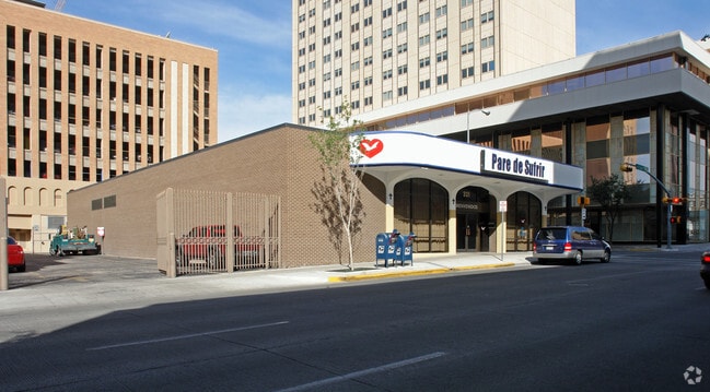
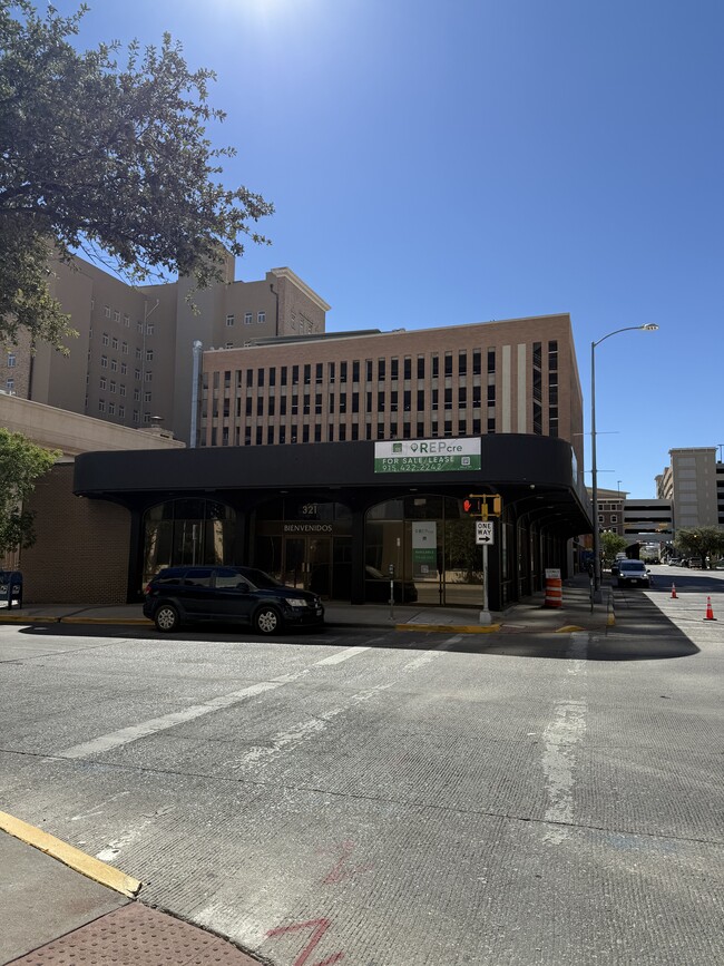
This Property Is For Sale
NEARBY LISTINGS FOR SALE OR LEASE
Property Detail
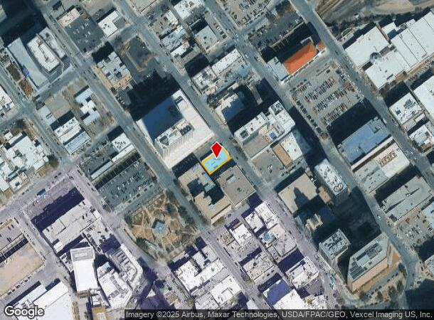
321 N Stanton St
El Paso, TX
Mills
M473-999-0030-1700
3 MILLS 60 FT ON N STANTON X 120 FT ON MAIN NEC (7200 SQ FT)
Commercialnec
El Paso
2024
Texas
2025
0.17 AC
001700
CBD
7,886 SF
El Paso
DEMOGRAPHICS near 321 N Stanton St
1 Mile
3 Mile
5 Mile
2024 Total Population
18,476
48,467
121,212
2029 Population
18,988
49,757
123,919
Pop Growth 2024-2029
+ 2.77%
+ 2.66%
+ 2.23%
Average Age
40
40
39
2024 Total Households
8,107
19,740
48,733
HH Growth 2024-2029
+ 3.01%
+ 2.76%
+ 2.21%
Median Household Inc
$18,654
$25,687
$32,998
Avg Household Size
2.10
2.30
2.40
2024 Avg HH Vehicles
1.00
1.00
1.00
Median Home Value
$146,096
$160,210
$138,633
Median Year Built
1949
1953
1962
Nearby Places
Map Layers
Map Styles
 Street
 Aerial
- Restaurants
- Banks
- Shops
- Fitness
- Groceries
PUBLIC TRANSPORTATION
AIRPORT
El Paso International
DRIVE
WALK
Distance
El Paso International
15 min
13.2 mi
Freight Ports
Port of Corpus Christi
DRIVE
WALK
Distance
Port of Corpus Christi
1 min
610.0 mi
Nearby Properties
Address
Land Use
TOTAL SIZE
Lot Size
Zoning
Address
Land Use
TOTAL SIZE
Lot Size
Zoning
1,387,028 SF
65.27 AC
R4
Address
Land Use
TOTAL SIZE
Lot Size
Zoning
558,800 SF
1.55 AC
C5
Address
Land Use
TOTAL SIZE
Lot Size
Zoning
318,665 SF
1.43 AC
C5
Address
Land Use
TOTAL SIZE
Lot Size
Zoning
859,302 SF
21.17 AC
C2
Address
Land Use
TOTAL SIZE
Lot Size
Zoning
324,056 SF
1.49 AC
C4
Address
Land Use
TOTAL SIZE
Lot Size
Zoning
1 SF
5.75 AC
C5S
Address
Land Use
TOTAL SIZE
Lot Size
Zoning
347,241 SF
Address
Land Use
TOTAL SIZE
Lot Size
Zoning
169,031 SF
1.22 AC
SP
Address
Land Use
TOTAL SIZE
Lot Size
Zoning
313,532 SF
5.73 AC
C1S
Address
Land Use
TOTAL SIZE
Lot Size
Zoning
1 SF
45.46 AC
M1
Address
Land Use
TOTAL SIZE
Lot Size
Zoning
629,002 SF
1.22 AC
C5
Address
Land Use
TOTAL SIZE
Lot Size
Zoning
128,916 SF
1.50 AC
C5
Address
Land Use
TOTAL SIZE
Lot Size
Zoning
86,391 SF
1.55 AC
C5
Address
Land Use
TOTAL SIZE
Lot Size
Zoning
142,858 SF
0.17 AC
R3H
Address
Land Use
TOTAL SIZE
Lot Size
Zoning
156,184 SF
8.39 AC
R5S
Address
Land Use
TOTAL SIZE
Lot Size
Zoning
97,809 SF
20.31 AC
C3S
Address
Land Use
TOTAL SIZE
Lot Size
Zoning
114,289 SF
3.03 AC
R5
Address
Land Use
TOTAL SIZE
Lot Size
Zoning
185,087 SF
10.27 AC
A3S
Address
Land Use
TOTAL SIZE
Lot Size
Zoning
420,509 SF
1.02 AC
C5
Address
Land Use
TOTAL SIZE
Lot Size
Zoning
128,560 SF
0.72 AC
M1
Address
Land Use
TOTAL SIZE
Lot Size
Zoning
73,574 SF
0.69 AC
C5
Address
Land Use
TOTAL SIZE
Lot Size
Zoning
155,308 SF
Address
Land Use
TOTAL SIZE
Lot Size
Zoning
231,480 SF
12.77 AC
C4S
Address
Land Use
TOTAL SIZE
Lot Size
Zoning
55,208 SF
5.34 AC
SD
Address
Land Use
TOTAL SIZE
Lot Size
Zoning
221,370 SF
0.73 AC
GMU
Address
Land Use
TOTAL SIZE
Lot Size
Zoning
92,100 SF
5.23 AC
C1
Address
Land Use
TOTAL SIZE
Lot Size
Zoning
149,818 SF
Address
Land Use
TOTAL SIZE
Lot Size
Zoning
112,692 SF
C4
Address
Land Use
TOTAL SIZE
Lot Size
Zoning
260,800 SF
0.61 AC
C5
The World's #1 Commercial Real Estate Marketplace
Connect with us
© 2025 CoStar Group
The information above has been obtained from sources believed reliable. While we do not doubt its accuracy we have not verified it and make no guarantee, warranty or representation about it. It is your responsibility to independently confirm its accuracy and completeness. Any projections, opinions, assumptions, or estimates used are for example only and do not represent the current or future performance of the property. The value of this transaction to you depends on tax and other factors which should be evaluated by your tax, financial, and legal advisors. You and your advisors should conduct a careful, independent investigation of the property to determine to your satisfaction the suitability of the property for your needs.