Property Record
321 Route 1, Edison, NJ 08817


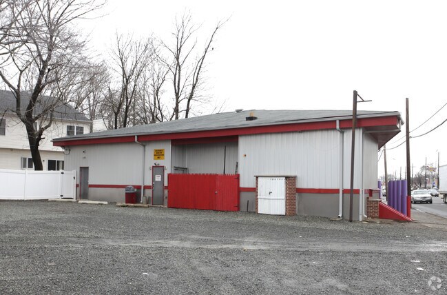
Property Detail
321 Route 1
Lakewood-New Brunswick, NJ
125X80 151X160
05-00227-0000-00014-01
Middlesex
Storemultistory
New Jersey
GBH
14.1
B and X Area of moderate flood hazard, usually the area between the limits of the 100-year and 500-year floods.
0.39 AC
2024
South Edison
2025
Northern New Jersey
001600
NEARBY LISTINGS FOR SALE OR LEASE
DEMOGRAPHICS near 321 Route 1
1 mile
3 mile
5 mile
2025 Total Population
20,320
131,437
302,695
2030 Population
21,089
136,463
314,709
Pop Growth 2025-2030
+ 3.78%
+ 3.82%
+ 3.97%
Average Age
40
36
38
2025 Total Households
7,285
42,390
100,977
HH Growth 2025-2030
+ 3.91%
+ 4.42%
+ 4.36%
Median Household Inc
$97,314
$95,380
$107,310
Avg Household Size
2.60
2.70
2.70
2025 Avg HH Vehicles
2.00
2.00
2.00
Median Home Value
$438,344
$461,389
$475,931
Median Year Built
1957
1969
1969
Nearby Places
Map Layers
Map Styles
 Street
 Aerial
Transit
 Traffic
 Biking
Places
Listings with unknown addresses are not visible on the map
- Restaurants
- Banks
- Shops
- Fitness
- Groceries
PUBLIC TRANSPORTATION
COMMUTER RAIL
Edison (Northeast Corridor Line - NJ Transit Commuter Rail (NJ Transit))
Drive
Walk
Distance
Edison (Northeast Corridor Line - NJ Transit Commuter Rail (NJ Transit))
5 min
1.7 mi
New Brunswick (Northeast Corridor Line - NJ Transit Commuter Rail (NJ Transit))
Drive
Walk
Distance
New Brunswick (Northeast Corridor Line - NJ Transit Commuter Rail (NJ Transit))
6 min
3.6 mi
AIRPORT
Newark Liberty International
Drive
Walk
Distance
Newark Liberty International
33 min
25.8 mi
Trenton Mercer
Drive
Walk
Distance
Trenton Mercer
42 min
30.8 mi
Freight Ports
New York Container Terminal
Drive
Walk
Distance
New York Container Terminal
27 min
18.6 mi
Nearby Properties
Address
Land Use
TOTAL SIZE
Lot Size
Zoning
Address
Land Use
TOTAL SIZE
Lot Size
Zoning
8.25 AC
D-HI
Address
Land Use
TOTAL SIZE
Lot Size
Zoning
Address
Land Use
TOTAL SIZE
Lot Size
Zoning
38,536 SF
149.61 AC
IN-2
Address
Land Use
TOTAL SIZE
Lot Size
Zoning
11.50 AC
HI
Address
Land Use
TOTAL SIZE
Lot Size
Zoning
37.80 AC
IN-2
Address
Land Use
TOTAL SIZE
Lot Size
Zoning
77.04 AC
I2
Address
Land Use
TOTAL SIZE
Lot Size
Zoning
138,550 SF
104.63 AC
E
Address
Land Use
TOTAL SIZE
Lot Size
Zoning
448,983 SF
17 AC
O-1
Address
Land Use
TOTAL SIZE
Lot Size
Zoning
21.30 AC
IN-1
Address
Land Use
TOTAL SIZE
Lot Size
Zoning
Address
Land Use
TOTAL SIZE
Lot Size
Zoning
52,074 SF
68.14 AC
E
Address
Land Use
TOTAL SIZE
Lot Size
Zoning
1.15 AC
C-4
Address
Land Use
TOTAL SIZE
Lot Size
Zoning
0.25 AC
C-4
Address
Land Use
TOTAL SIZE
Lot Size
Zoning
215,908 SF
0.92 AC
D-HI
Address
Land Use
TOTAL SIZE
Lot Size
Zoning
23,140 SF
107.63 AC
E
Address
Land Use
TOTAL SIZE
Lot Size
Zoning
165.43 AC
EI
Address
Land Use
TOTAL SIZE
Lot Size
Zoning
6,495 SF
5.74 AC
IN-1
Address
Land Use
TOTAL SIZE
Lot Size
Zoning
222,500 SF
1.81 AC
D-HI
Address
Land Use
TOTAL SIZE
Lot Size
Zoning
53,900 SF
4.69 AC
IN-1
Address
Land Use
TOTAL SIZE
Lot Size
Zoning
5.54 AC
C-5
Address
Land Use
TOTAL SIZE
Lot Size
Zoning
Address
Land Use
TOTAL SIZE
Lot Size
Zoning
147.45 AC
RRRD
Address
Land Use
TOTAL SIZE
Lot Size
Zoning
Address
Land Use
TOTAL SIZE
Lot Size
Zoning
Address
Land Use
TOTAL SIZE
Lot Size
Zoning
1,200 SF
0.03 AC
D-HI
Address
Land Use
TOTAL SIZE
Lot Size
Zoning
11.44 AC
Address
Land Use
TOTAL SIZE
Lot Size
Zoning
Address
Land Use
TOTAL SIZE
Lot Size
Zoning
81,600 SF
49.89 AC
LI
Address
Land Use
TOTAL SIZE
Lot Size
Zoning
49.83 AC
LI
Address
Land Use
TOTAL SIZE
Lot Size
Zoning
The World's #1 Commercial Real Estate Marketplace
Connect with us
© 2026 CoStar Group
The information above has been obtained from sources believed reliable. While we do not doubt its accuracy we have not verified it and make no guarantee, warranty or representation about it. It is your responsibility to independently confirm its accuracy and completeness. Any projections, opinions, assumptions, or estimates used are for example only and do not represent the current or future performance of the property. The value of this transaction to you depends on tax and other factors which should be evaluated by your tax, financial, and legal advisors. You and your advisors should conduct a careful, independent investigation of the property to determine to your satisfaction the suitability of the property for your needs.