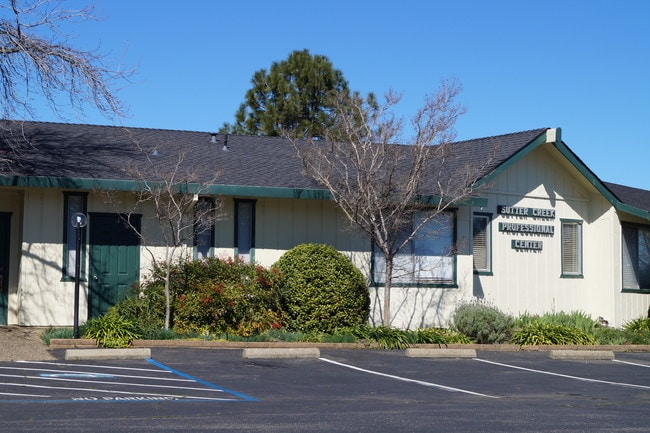
Property Record
321 State Highway 49, Sutter Creek, CA 95685


NEARBY LISTINGS FOR SALE OR LEASE
Property Detail
321 State Highway 49
018-010-025-000
Parcel Map 1857
Commercialnec
34M37 PAR A1 SEC7 T6N R11E
X
Amador
06005C0343F
California
2024
0.83 AC
2025
Merced/Central
000303
Other Market Areas
4,761 SF
DEMOGRAPHICS near 321 State Highway 49
1 Mile
3 Mile
5 Mile
2024 Total Population
1,864
6,888
10,209
2029 Population
1,959
7,260
10,785
Pop Growth 2024-2029
+ 5.10%
+ 5.40%
+ 5.64%
Average Age
46
46
47
2024 Total Households
869
3,097
4,552
HH Growth 2024-2029
+ 5.41%
+ 5.68%
+ 5.93%
Median Household Inc
$54,687
$62,709
$62,205
Avg Household Size
2.10
2.20
2.20
2024 Avg HH Vehicles
2.00
2.00
2.00
Median Home Value
$410,396
$430,597
$439,559
Median Year Built
1971
1978
1979
Nearby Places
Map Layers
Map Styles
 Street
 Aerial
- Restaurants
- Banks
- Shops
- Fitness
- Groceries
SALE & LEASE HISTORY
LISTING DATE
SALE/LEASE

Mar 19, 2019
For Lease
Jun 06, 2023
For Sale
Dec 10, 2018
For Sale
Nearby Properties
Address
Land Use
TOTAL SIZE
Lot Size
Zoning
Address
Land Use
TOTAL SIZE
Lot Size
Zoning
48,945 SF
5.66 AC
M
Address
Land Use
TOTAL SIZE
Lot Size
Zoning
4.75 AC
NC
Address
Land Use
TOTAL SIZE
Lot Size
Zoning
111,658 SF
11.12 AC
C1
Address
Land Use
TOTAL SIZE
Lot Size
Zoning
5.17 AC
M
Address
Land Use
TOTAL SIZE
Lot Size
Zoning
103,794 SF
16.30 AC
PD
Address
Land Use
TOTAL SIZE
Lot Size
Zoning
3,163 SF
26.61 AC
NC
Address
Land Use
TOTAL SIZE
Lot Size
Zoning
Address
Land Use
TOTAL SIZE
Lot Size
Zoning
40,794 SF
3.87 AC
C1
Address
Land Use
TOTAL SIZE
Lot Size
Zoning
40,070 SF
3.74 AC
M
Address
Land Use
TOTAL SIZE
Lot Size
Zoning
39,953 SF
2.03 AC
NC
Address
Land Use
TOTAL SIZE
Lot Size
Zoning
12,670 SF
1.05 AC
C1
Address
Land Use
TOTAL SIZE
Lot Size
Zoning
99,056 SF
10.29 AC
PD-C1
Address
Land Use
TOTAL SIZE
Lot Size
Zoning
3,075 SF
0.75 AC
Address
Land Use
TOTAL SIZE
Lot Size
Zoning
36,223 SF
2.11 AC
NC
Address
Land Use
TOTAL SIZE
Lot Size
Zoning
42,900 SF
4.63 AC
C1
Address
Land Use
TOTAL SIZE
Lot Size
Zoning
3.01 AC
NC
Address
Land Use
TOTAL SIZE
Lot Size
Zoning
2,690 SF
0.35 AC
C2
Address
Land Use
TOTAL SIZE
Lot Size
Zoning
Address
Land Use
TOTAL SIZE
Lot Size
Zoning
20,926 SF
0.39 AC
C1
Address
Land Use
TOTAL SIZE
Lot Size
Zoning
3.37 AC
MM
Address
Land Use
TOTAL SIZE
Lot Size
Zoning
7,488 SF
2.37 AC
NC
Address
Land Use
TOTAL SIZE
Lot Size
Zoning
44,190 SF
1.16 AC
NC
Address
Land Use
TOTAL SIZE
Lot Size
Zoning
1.18 AC
M
Address
Land Use
TOTAL SIZE
Lot Size
Zoning
2.65 AC
NC
Address
Land Use
TOTAL SIZE
Lot Size
Zoning
5.05 AC
R1A
Address
Land Use
TOTAL SIZE
Lot Size
Zoning
4,000 SF
2.67 AC
Address
Land Use
TOTAL SIZE
Lot Size
Zoning
13,075 SF
2.06 AC
MM
Address
Land Use
TOTAL SIZE
Lot Size
Zoning
14,788 SF
0.97 AC
NC
Address
Land Use
TOTAL SIZE
Lot Size
Zoning
2,520 SF
3.42 AC
C1
The World's #1 Commercial Real Estate Marketplace
Connect with us
© 2026 CoStar Group
The information above has been obtained from sources believed reliable. While we do not doubt its accuracy we have not verified it and make no guarantee, warranty or representation about it. It is your responsibility to independently confirm its accuracy and completeness. Any projections, opinions, assumptions, or estimates used are for example only and do not represent the current or future performance of the property. The value of this transaction to you depends on tax and other factors which should be evaluated by your tax, financial, and legal advisors. You and your advisors should conduct a careful, independent investigation of the property to determine to your satisfaction the suitability of the property for your needs.