Property Record
321 W 19Th St, Houston, TX 77008


Save to a Folder
{{folder.Name}}
{{folder.ListingIds.length}} Properties
{{folder.ListingIds.length}} Property
Create a New Folder
Current Lease Availabilities
Property Detail
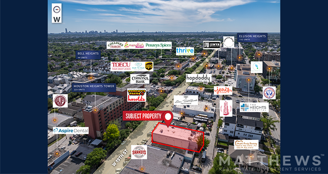
321 W 19Th St
Houston-Pasadena-The Woodlands, TX
LTS 40 & 41 BLK 90 HOUSTON HEIGHTS
0200860000040
HARRIS
Storebuilding
Texas
B and X Area of moderate flood hazard, usually the area between the limits of the 100-year and 500-year floods.
40,41
2025
0.15 AC
2025
Inner Loop/Heights
511301
Houston
12,000 SF
NEARBY LISTINGS FOR SALE OR LEASE
DEMOGRAPHICS near 321 W 19Th St
1 mile
3 mile
5 mile
2025 Total Population
24,535
181,532
469,270
2030 Population
26,811
197,079
508,496
Pop Growth 2025-2030
+ 9.28%
+ 8.56%
+ 8.36%
Average Age
39
38
38
2025 Total Households
11,645
82,872
205,303
HH Growth 2025-2030
+ 9.36%
+ 8.82%
+ 8.87%
Median Household Inc
$162,280
$110,722
$88,498
Avg Household Size
2.10
2.20
2.20
2025 Avg HH Vehicles
2.00
2.00
2.00
Median Home Value
$689,846
$523,913
$462,904
Median Year Built
2002
1999
1993
Nearby Places
Map Layers
Map Styles
 Street
 Aerial
Layers
 Traffic
 Biking
Places
Listings with unknown addresses are not visible on the map
- Restaurants
- Banks
- Shops
- Fitness
- Groceries
PUBLIC TRANSPORTATION
COMMUTER RAIL
Drive
Walk
Distance
9 min
4.2 mi
AIRPORT
William P Hobby
Drive
Walk
Distance
William P Hobby
30 min
17.0 mi
George Bush Intcntl/Houston
Drive
Walk
Distance
George Bush Intcntl/Houston
25 min
19.0 mi
Freight Ports
Port of Houston
Drive
Walk
Distance
Port of Houston
23 min
14.2 mi
Nearby Properties
Address
Land Use
TOTAL SIZE
Lot Size
Zoning
Address
Land Use
TOTAL SIZE
Lot Size
Zoning
453,456 SF
3.11 AC
Address
Land Use
TOTAL SIZE
Lot Size
Zoning
432,689 SF
2.84 AC
Address
Land Use
TOTAL SIZE
Lot Size
Zoning
519,374 SF
6.18 AC
Address
Land Use
TOTAL SIZE
Lot Size
Zoning
788,433 SF
5.09 AC
Address
Land Use
TOTAL SIZE
Lot Size
Zoning
416,975 SF
2.52 AC
Address
Land Use
TOTAL SIZE
Lot Size
Zoning
675,412 SF
10.09 AC
Address
Land Use
TOTAL SIZE
Lot Size
Zoning
641,392 SF
10 AC
Address
Land Use
TOTAL SIZE
Lot Size
Zoning
591,997 SF
4.83 AC
Address
Land Use
TOTAL SIZE
Lot Size
Zoning
563,626 SF
4.71 AC
Address
Land Use
TOTAL SIZE
Lot Size
Zoning
308,055 SF
2.22 AC
Address
Land Use
TOTAL SIZE
Lot Size
Zoning
474,326 SF
43.16 AC
Address
Land Use
TOTAL SIZE
Lot Size
Zoning
314,489 SF
1.84 AC
Address
Land Use
TOTAL SIZE
Lot Size
Zoning
429,771 SF
3.49 AC
Address
Land Use
TOTAL SIZE
Lot Size
Zoning
315,439 SF
3.54 AC
Address
Land Use
TOTAL SIZE
Lot Size
Zoning
641,684 SF
3.30 AC
Address
Land Use
TOTAL SIZE
Lot Size
Zoning
432,691 SF
3.26 AC
Address
Land Use
TOTAL SIZE
Lot Size
Zoning
443,982 SF
3.79 AC
Address
Land Use
TOTAL SIZE
Lot Size
Zoning
324,709 SF
4 AC
Address
Land Use
TOTAL SIZE
Lot Size
Zoning
261,312 SF
1.81 AC
Address
Land Use
TOTAL SIZE
Lot Size
Zoning
457,647 SF
2.30 AC
Address
Land Use
TOTAL SIZE
Lot Size
Zoning
468,706 SF
3.80 AC
Address
Land Use
TOTAL SIZE
Lot Size
Zoning
538,026 SF
7.03 AC
Address
Land Use
TOTAL SIZE
Lot Size
Zoning
593,265 SF
3.73 AC
Address
Land Use
TOTAL SIZE
Lot Size
Zoning
683,861 SF
15.03 AC
Address
Land Use
TOTAL SIZE
Lot Size
Zoning
366,386 SF
10.85 AC
Address
Land Use
TOTAL SIZE
Lot Size
Zoning
445,191 SF
3.58 AC
Address
Land Use
TOTAL SIZE
Lot Size
Zoning
375,693 SF
9.16 AC
Address
Land Use
TOTAL SIZE
Lot Size
Zoning
477,064 SF
4.60 AC
Address
Land Use
TOTAL SIZE
Lot Size
Zoning
684,371 SF
3.97 AC
Address
Land Use
TOTAL SIZE
Lot Size
Zoning
255,545 SF
2.91 AC
The World's #1 Commercial Real Estate Marketplace
Connect with us
© 2026 CoStar Group
The information above has been obtained from sources believed reliable. While we do not doubt its accuracy we have not verified it and make no guarantee, warranty or representation about it. It is your responsibility to independently confirm its accuracy and completeness. Any projections, opinions, assumptions, or estimates used are for example only and do not represent the current or future performance of the property. The value of this transaction to you depends on tax and other factors which should be evaluated by your tax, financial, and legal advisors. You and your advisors should conduct a careful, independent investigation of the property to determine to your satisfaction the suitability of the property for your needs.