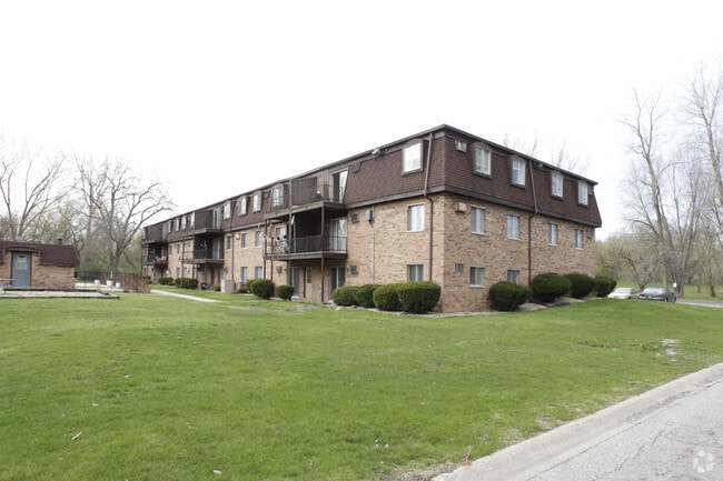
Property Record
321 W 58Th Pl, Merrillville, IN 46410

NEARBY LISTINGS FOR SALE OR LEASE
-
-
View all Merrillville listings for sale on LoopNet.com
Property Detail
321 W 58Th Pl
45-12-04-426-013.000-030
W1/2 SW. NE. SE. EX. N. 215FT. EX. E. 30FT.& EX.S 30FT. S.4 T.35 R.8 2.856AC.
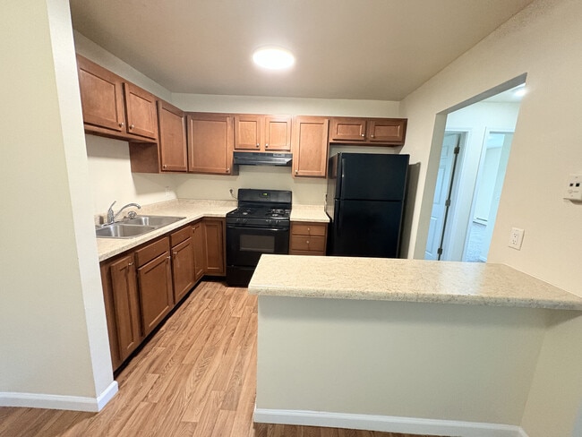
Apartment
Lake
X
Indiana
18089C0164E
1
2024
2.86 AC
2025
South Lake County
042403
Chicago
63,648 SF
Chicago-Naperville-Elgin, IL-IN
DEMOGRAPHICS near 321 W 58Th Pl
1 Mile
3 Mile
5 Mile
2024 Total Population
9,531
52,357
131,501
2029 Population
9,616
54,128
134,445
Pop Growth 2024-2029
+ 0.89%
+ 3.38%
+ 2.24%
Average Age
39
40
40
2024 Total Households
3,696
20,018
52,770
HH Growth 2024-2029
+ 0.81%
+ 3.27%
+ 2.21%
Median Household Inc
$46,154
$47,321
$54,610
Avg Household Size
2.50
2.50
2.40
2024 Avg HH Vehicles
2.00
2.00
2.00
Median Home Value
$148,290
$137,680
$165,108
Median Year Built
1966
1962
1969
Nearby Places
Map Layers
Map Styles
 Street
 Aerial
- Restaurants
- Banks
- Shops
- Fitness
- Groceries
PUBLIC TRANSPORTATION
AIRPORT
Chicago Midway International
DRIVE
WALK
Distance
Chicago Midway International
61 min
39.8 mi
Nearby Properties
Address
Land Use
TOTAL SIZE
Lot Size
Zoning
Address
Land Use
TOTAL SIZE
Lot Size
Zoning
552,100 SF
49.14 AC
Address
Land Use
TOTAL SIZE
Lot Size
Zoning
590,274 SF
48.18 AC
Address
Land Use
TOTAL SIZE
Lot Size
Zoning
623,283 SF
44.38 AC
Address
Land Use
TOTAL SIZE
Lot Size
Zoning
359,024 SF
43 AC
Address
Land Use
TOTAL SIZE
Lot Size
Zoning
177,628 SF
12.95 AC
R3
Address
Land Use
TOTAL SIZE
Lot Size
Zoning
190,352 SF
12.36 AC
Address
Land Use
TOTAL SIZE
Lot Size
Zoning
126,603 SF
8.81 AC
Address
Land Use
TOTAL SIZE
Lot Size
Zoning
153,602 SF
15.81 AC
R33
Address
Land Use
TOTAL SIZE
Lot Size
Zoning
149,808 SF
15.07 AC
Address
Land Use
TOTAL SIZE
Lot Size
Zoning
97,674 SF
29.16 AC
Address
Land Use
TOTAL SIZE
Lot Size
Zoning
159,117 SF
14.85 AC
R33
Address
Land Use
TOTAL SIZE
Lot Size
Zoning
62,076 SF
6.23 AC
Address
Land Use
TOTAL SIZE
Lot Size
Zoning
77,383 SF
2.92 AC
Address
Land Use
TOTAL SIZE
Lot Size
Zoning
185,876 SF
11.60 AC
R33
Address
Land Use
TOTAL SIZE
Lot Size
Zoning
109,220 SF
6.42 AC
Address
Land Use
TOTAL SIZE
Lot Size
Zoning
34,306 SF
9.56 AC
Address
Land Use
TOTAL SIZE
Lot Size
Zoning
153,352 SF
23.97 AC
Address
Land Use
TOTAL SIZE
Lot Size
Zoning
159,134 SF
22 AC
Address
Land Use
TOTAL SIZE
Lot Size
Zoning
112,309 SF
7.24 AC
Address
Land Use
TOTAL SIZE
Lot Size
Zoning
103,356 SF
7 AC
Address
Land Use
TOTAL SIZE
Lot Size
Zoning
232,672 SF
28.18 AC
Address
Land Use
TOTAL SIZE
Lot Size
Zoning
150,000 SF
9.02 AC
R3
Address
Land Use
TOTAL SIZE
Lot Size
Zoning
147,033 SF
13.28 AC
R33
Address
Land Use
TOTAL SIZE
Lot Size
Zoning
100,052 SF
8.19 AC
Address
Land Use
TOTAL SIZE
Lot Size
Zoning
41,015 SF
4.87 AC
Address
Land Use
TOTAL SIZE
Lot Size
Zoning
90,060 SF
8.10 AC
Address
Land Use
TOTAL SIZE
Lot Size
Zoning
125,034 SF
8.22 AC
Address
Land Use
TOTAL SIZE
Lot Size
Zoning
40,062 SF
3.39 AC
Address
Land Use
TOTAL SIZE
Lot Size
Zoning
54,267 SF
4.04 AC
Address
Land Use
TOTAL SIZE
Lot Size
Zoning
42,480 SF
17.08 AC
The World's #1 Commercial Real Estate Marketplace
Connect with us
© 2026 CoStar Group
The information above has been obtained from sources believed reliable. While we do not doubt its accuracy we have not verified it and make no guarantee, warranty or representation about it. It is your responsibility to independently confirm its accuracy and completeness. Any projections, opinions, assumptions, or estimates used are for example only and do not represent the current or future performance of the property. The value of this transaction to you depends on tax and other factors which should be evaluated by your tax, financial, and legal advisors. You and your advisors should conduct a careful, independent investigation of the property to determine to your satisfaction the suitability of the property for your needs.