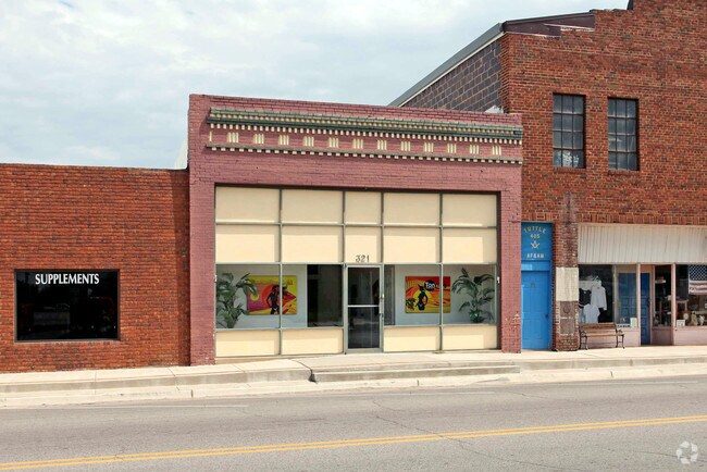
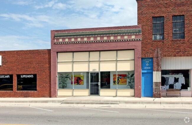
Property Record
321 W Main St, Tuttle, OK 73089

Property Detail
321 W Main St
Oklahoma City, OK
34-10-06-07700 ALL LOT 6 BLOCK 31 OT-TUTTLE
T001-00-031-006-0-000-00
GRADY
Storebuilding
Oklahoma
B and X Area of moderate flood hazard, usually the area between the limits of the 100-year and 500-year floods.
6
2024
0.08 AC
2025
Grady County
000902
Oklahoma City
2,500 SF
NEARBY LISTINGS FOR SALE OR LEASE
-
-
View all Tuttle listings for sale on LoopNet.com
DEMOGRAPHICS near 321 W Main St
1 mile
3 mile
5 mile
2025 Total Population
1,936
4,503
8,312
2030 Population
2,008
4,716
8,760
Pop Growth 2025-2030
+ 3.72%
+ 4.73%
+ 5.39%
Average Age
39
39
40
2025 Total Households
752
1,625
2,990
HH Growth 2025-2030
+ 3.46%
+ 4.62%
+ 5.32%
Median Household Inc
$68,951
$84,826
$98,303
Avg Household Size
2.50
2.70
2.70
2025 Avg HH Vehicles
2.00
3.00
3.00
Median Home Value
$203,571
$260,841
$285,173
Median Year Built
1978
1991
1995
Nearby Places
Map Layers
Map Styles
 Street
 Aerial
Transit
 Traffic
 Biking
Places
Listings with unknown addresses are not visible on the map
- Restaurants
- Banks
- Shops
- Fitness
- Groceries
PUBLIC TRANSPORTATION
AIRPORT
Will Rogers World
Drive
Walk
Distance
Will Rogers World
37 min
22.5 mi
Freight Ports
Tulsa Port Of Catoosa
Drive
Walk
Distance
Tulsa Port Of Catoosa
171 min
151.5 mi
Nearby Properties
Address
Land Use
TOTAL SIZE
Lot Size
Zoning
Address
Land Use
TOTAL SIZE
Lot Size
Zoning
31,301 SF
7.48 AC
Address
Land Use
TOTAL SIZE
Lot Size
Zoning
7,224 SF
1.52 AC
Address
Land Use
TOTAL SIZE
Lot Size
Zoning
4,536 SF
2.63 AC
Address
Land Use
TOTAL SIZE
Lot Size
Zoning
4,200 SF
0.73 AC
Address
Land Use
TOTAL SIZE
Lot Size
Zoning
9,372 SF
1.03 AC
Address
Land Use
TOTAL SIZE
Lot Size
Zoning
4,500 SF
3.25 AC
Address
Land Use
TOTAL SIZE
Lot Size
Zoning
3,213 SF
0.64 AC
Address
Land Use
TOTAL SIZE
Lot Size
Zoning
8,000 SF
0.90 AC
Address
Land Use
TOTAL SIZE
Lot Size
Zoning
12,240 SF
1.16 AC
Address
Land Use
TOTAL SIZE
Lot Size
Zoning
2,880 SF
1.13 AC
Address
Land Use
TOTAL SIZE
Lot Size
Zoning
5,568 SF
2.73 AC
Address
Land Use
TOTAL SIZE
Lot Size
Zoning
4,354 SF
0.32 AC
Address
Land Use
TOTAL SIZE
Lot Size
Zoning
6,270 SF
0.68 AC
Address
Land Use
TOTAL SIZE
Lot Size
Zoning
2,800 SF
1.21 AC
Address
Land Use
TOTAL SIZE
Lot Size
Zoning
7,724 SF
0.50 AC
Address
Land Use
TOTAL SIZE
Lot Size
Zoning
3,310 SF
0.16 AC
Address
Land Use
TOTAL SIZE
Lot Size
Zoning
9,775 SF
0.74 AC
Address
Land Use
TOTAL SIZE
Lot Size
Zoning
5,003 SF
2.85 AC
Address
Land Use
TOTAL SIZE
Lot Size
Zoning
901 SF
1 AC
Address
Land Use
TOTAL SIZE
Lot Size
Zoning
5,100 SF
1.72 AC
Address
Land Use
TOTAL SIZE
Lot Size
Zoning
3,120 SF
0.32 AC
Address
Land Use
TOTAL SIZE
Lot Size
Zoning
4,212 SF
0.16 AC
Address
Land Use
TOTAL SIZE
Lot Size
Zoning
6,466 SF
0.93 AC
The World's #1 Commercial Real Estate Marketplace
Connect with us
© 2026 CoStar Group
The information above has been obtained from sources believed reliable. While we do not doubt its accuracy we have not verified it and make no guarantee, warranty or representation about it. It is your responsibility to independently confirm its accuracy and completeness. Any projections, opinions, assumptions, or estimates used are for example only and do not represent the current or future performance of the property. The value of this transaction to you depends on tax and other factors which should be evaluated by your tax, financial, and legal advisors. You and your advisors should conduct a careful, independent investigation of the property to determine to your satisfaction the suitability of the property for your needs.