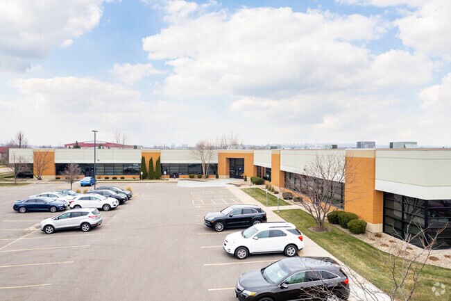
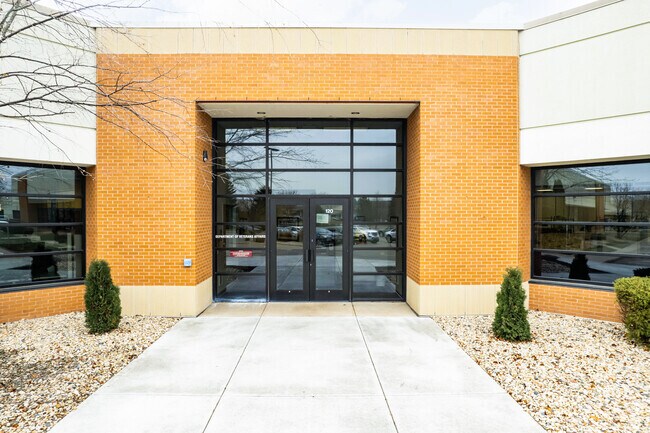
Property Record
3210 Deming Way, Middleton, WI 53562

NEARBY LISTINGS FOR SALE OR LEASE
Property Detail
3210 Deming Way
Madison, WI
Airport Road Business Park
0708-034-5420-2
LOT 1 CSM 12270 CS76/59&62-9/28/2007 F/K/A LOT 1 CSM 11779 CS72/155-158 06-01-06 F/K/A AIRPORT ROAD BUSINESS PARK PRT LOT 25, ALL LOTS 26,27 & 28 & PRT OF LOT 2 9 & ALSO INCL PRT VAC AZALEA ST DESCR AS SEC 3-7-8 PRT OF NW1/4 SE1/4 & PRT SW1/ 4 SE1/4
Commercialnec
Dane
AE
Wisconsin
55025C0382G
1
2024
4.02 AC
2024
Northwest Madison
011101
Milwaukee/Madison
DEMOGRAPHICS near 3210 Deming Way
1 Mile
3 Mile
5 Mile
2024 Total Population
2,061
37,416
89,135
2029 Population
2,175
38,810
92,897
Pop Growth 2024-2029
+ 5.53%
+ 3.73%
+ 4.22%
Average Age
39
41
40
2024 Total Households
792
16,639
41,308
HH Growth 2024-2029
+ 5.56%
+ 3.70%
+ 4.31%
Median Household Inc
$111,753
$98,368
$86,226
Avg Household Size
2.60
2.20
2.10
2024 Avg HH Vehicles
2.00
2.00
2.00
Median Home Value
$459,374
$447,818
$424,920
Median Year Built
2005
1990
1989
Nearby Places
Map Layers
Map Styles
 Street
 Aerial
- Restaurants
- Banks
- Shops
- Fitness
- Groceries
PUBLIC TRANSPORTATION
AIRPORT
Dane County Regional/Truax Field
DRIVE
WALK
Distance
Dane County Regional/Truax Field
23 min
13.5 mi
Freight Ports
Port Milwaukee
DRIVE
WALK
Distance
Port Milwaukee
112 min
90.5 mi
Nearby Properties
Address
Land Use
TOTAL SIZE
Lot Size
Zoning
Address
Land Use
TOTAL SIZE
Lot Size
Zoning
15.61 AC
Address
Land Use
TOTAL SIZE
Lot Size
Zoning
37,909 SF
10.27 AC
SEC
Address
Land Use
TOTAL SIZE
Lot Size
Zoning
203,672 SF
7.34 AC
PD
Address
Land Use
TOTAL SIZE
Lot Size
Zoning
8.48 AC
Address
Land Use
TOTAL SIZE
Lot Size
Zoning
169,563 SF
19.82 AC
SEC
Address
Land Use
TOTAL SIZE
Lot Size
Zoning
10.12 AC
Address
Land Use
TOTAL SIZE
Lot Size
Zoning
5.95 AC
Address
Land Use
TOTAL SIZE
Lot Size
Zoning
11.09 AC
Address
Land Use
TOTAL SIZE
Lot Size
Zoning
326,724 SF
4.23 AC
PD
Address
Land Use
TOTAL SIZE
Lot Size
Zoning
159,686 SF
7.39 AC
SEC
Address
Land Use
TOTAL SIZE
Lot Size
Zoning
4.37 AC
Address
Land Use
TOTAL SIZE
Lot Size
Zoning
Address
Land Use
TOTAL SIZE
Lot Size
Zoning
320,074 SF
9.28 AC
SR-V2
Address
Land Use
TOTAL SIZE
Lot Size
Zoning
37,909 SF
10.27 AC
SEC
Address
Land Use
TOTAL SIZE
Lot Size
Zoning
Address
Land Use
TOTAL SIZE
Lot Size
Zoning
10.01 AC
Address
Land Use
TOTAL SIZE
Lot Size
Zoning
264,603 SF
10.32 AC
PD
Address
Land Use
TOTAL SIZE
Lot Size
Zoning
40.70 AC
Address
Land Use
TOTAL SIZE
Lot Size
Zoning
Address
Land Use
TOTAL SIZE
Lot Size
Zoning
162,786 SF
17.48 AC
PD
Address
Land Use
TOTAL SIZE
Lot Size
Zoning
26.62 AC
Address
Land Use
TOTAL SIZE
Lot Size
Zoning
1.19 AC
Address
Land Use
TOTAL SIZE
Lot Size
Zoning
3.19 AC
Address
Land Use
TOTAL SIZE
Lot Size
Zoning
109,272 SF
10.76 AC
PD
Address
Land Use
TOTAL SIZE
Lot Size
Zoning
10.50 AC
Address
Land Use
TOTAL SIZE
Lot Size
Zoning
179,552 SF
5.10 AC
PD
Address
Land Use
TOTAL SIZE
Lot Size
Zoning
13.43 AC
Address
Land Use
TOTAL SIZE
Lot Size
Zoning
213,857 SF
9.53 AC
SR-V2
Address
Land Use
TOTAL SIZE
Lot Size
Zoning
Address
Land Use
TOTAL SIZE
Lot Size
Zoning
40,887 SF
2.79 AC
PD
The World's #1 Commercial Real Estate Marketplace
Connect with us
© 2025 CoStar Group
The information above has been obtained from sources believed reliable. While we do not doubt its accuracy we have not verified it and make no guarantee, warranty or representation about it. It is your responsibility to independently confirm its accuracy and completeness. Any projections, opinions, assumptions, or estimates used are for example only and do not represent the current or future performance of the property. The value of this transaction to you depends on tax and other factors which should be evaluated by your tax, financial, and legal advisors. You and your advisors should conduct a careful, independent investigation of the property to determine to your satisfaction the suitability of the property for your needs.