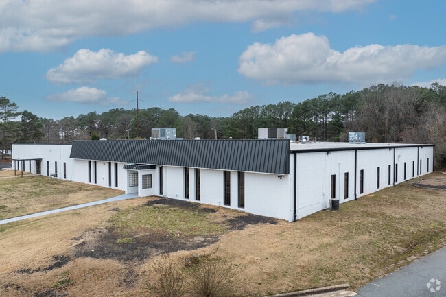
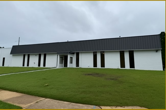
Property Record
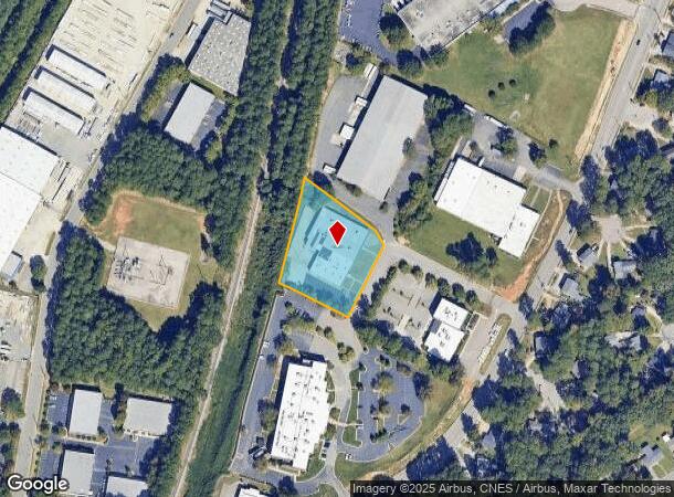
3211 Bramer Dr, Raleigh, NC 27604
NEARBY LISTINGS FOR SALE OR LEASE
Property Detail
3211 Bramer Dr
Raleigh-Cary, NC
Property/Singleton Inv Co & Ad
1715.11-66-5287-000
LO9 PROP OF SINGLETON INVESTMT CO & ADAM
Publicschool
Wake
X
North Carolina
3720171500K
9
2025
1.62 AC
2025
Route 1
052705
Raleigh/Durham
23,624 SF
DEMOGRAPHICS near 3211 Bramer Dr
1 mile
3 mile
5 mile
2024 Total Population
8,375
94,039
251,200
2029 Population
9,057
102,036
273,390
Pop Growth 2024-2029
+ 8.14%
+ 8.50%
+ 8.83%
Average Age
37
38
38
2024 Total Households
3,804
40,721
107,419
HH Growth 2024-2029
+ 8.33%
+ 8.71%
+ 9.16%
Median Household Inc
$62,582
$73,533
$74,420
Avg Household Size
2.10
2.20
2.20
2024 Avg HH Vehicles
2.00
2.00
2.00
Median Home Value
$245,024
$331,835
$355,248
Median Year Built
1983
1984
1989
Nearby Places
Map Layers
Map Styles
 Street
 Aerial
Transit
 Traffic
 Biking
Places
Listings with unknown addresses are not visible on the map
- Restaurants
- Banks
- Shops
- Fitness
- Groceries
PUBLIC TRANSPORTATION
COMMUTER RAIL
Raleigh Union Station (Piedmont - North Carolina by Train (NC Train))
Drive
Walk
Distance
Raleigh Union Station (Piedmont - North Carolina by Train (NC Train))
11 min
5.0 mi
AIRPORT
Raleigh-Durham International
Drive
Walk
Distance
Raleigh-Durham International
27 min
17.0 mi
SALE & LEASE HISTORY
LISTING DATE
SALE/LEASE

Sep 06, 2024
For Lease
Sep 06, 2024
For Sale
Jun 22, 2018
For Sale
Jul 09, 2022
For Sale
Jan 28, 2025
For Sale
Jan 03, 2019
For Sale
Aug 16, 2022
For Lease
Nearby Properties
Address
Land Use
TOTAL SIZE
Lot Size
Zoning
Address
Land Use
TOTAL SIZE
Lot Size
Zoning
420,419 SF
PD
Address
Land Use
TOTAL SIZE
Lot Size
Zoning
1,085,654 SF
16.87 AC
OX-5
Address
Land Use
TOTAL SIZE
Lot Size
Zoning
658,580 SF
3.30 AC
PD
Address
Land Use
TOTAL SIZE
Lot Size
Zoning
747,658 SF
11.12 AC
CX-12
Address
Land Use
TOTAL SIZE
Lot Size
Zoning
465,052 SF
2.65 AC
PD
Address
Land Use
TOTAL SIZE
Lot Size
Zoning
364,025 SF
2.19 AC
PD
Address
Land Use
TOTAL SIZE
Lot Size
Zoning
384,940 SF
PD
Address
Land Use
TOTAL SIZE
Lot Size
Zoning
701,923 SF
64.64 AC
RX-5
Address
Land Use
TOTAL SIZE
Lot Size
Zoning
539,902 SF
1.28 AC
O&I-1
Address
Land Use
TOTAL SIZE
Lot Size
Zoning
354,131 SF
15.23 AC
RX-4
Address
Land Use
TOTAL SIZE
Lot Size
Zoning
544,122 SF
1.49 AC
PD
Address
Land Use
TOTAL SIZE
Lot Size
Zoning
355,931 SF
2.60 AC
PD
Address
Land Use
TOTAL SIZE
Lot Size
Zoning
284,958 SF
3.01 AC
PD
Address
Land Use
TOTAL SIZE
Lot Size
Zoning
289,301 SF
20.67 AC
OX-12
Address
Land Use
TOTAL SIZE
Lot Size
Zoning
282,285 SF
5.29 AC
PD
Address
Land Use
TOTAL SIZE
Lot Size
Zoning
319,136 SF
22.25 AC
OX-12
Address
Land Use
TOTAL SIZE
Lot Size
Zoning
411,423 SF
3.22 AC
CX-5
Address
Land Use
TOTAL SIZE
Lot Size
Zoning
403,782 SF
5.32 AC
RX-7
Address
Land Use
TOTAL SIZE
Lot Size
Zoning
275,812 SF
CX-12
Address
Land Use
TOTAL SIZE
Lot Size
Zoning
193,990 SF
7.16 AC
RX-5
Address
Land Use
TOTAL SIZE
Lot Size
Zoning
438,469 SF
50 AC
R-4
Address
Land Use
TOTAL SIZE
Lot Size
Zoning
186,221 SF
7.10 AC
RX-5
Address
Land Use
TOTAL SIZE
Lot Size
Zoning
373,187 SF
6.61 AC
PD
Address
Land Use
TOTAL SIZE
Lot Size
Zoning
12,972 SF
6.16 AC
CX-12
Address
Land Use
TOTAL SIZE
Lot Size
Zoning
358,520 SF
2.46 AC
CX-7
Address
Land Use
TOTAL SIZE
Lot Size
Zoning
325,835 SF
41.93 AC
R-4
Address
Land Use
TOTAL SIZE
Lot Size
Zoning
211,289 SF
6.87 AC
CX-5
Address
Land Use
TOTAL SIZE
Lot Size
Zoning
233,985 SF
8.60 AC
OX-5
Address
Land Use
TOTAL SIZE
Lot Size
Zoning
189,532 SF
1.53 AC
PD
Address
Land Use
TOTAL SIZE
Lot Size
Zoning
299,388 SF
13.83 AC
CX-4
The World's #1 Commercial Real Estate Marketplace
Connect with us
© 2026 CoStar Group
The information above has been obtained from sources believed reliable. While we do not doubt its accuracy we have not verified it and make no guarantee, warranty or representation about it. It is your responsibility to independently confirm its accuracy and completeness. Any projections, opinions, assumptions, or estimates used are for example only and do not represent the current or future performance of the property. The value of this transaction to you depends on tax and other factors which should be evaluated by your tax, financial, and legal advisors. You and your advisors should conduct a careful, independent investigation of the property to determine to your satisfaction the suitability of the property for your needs.