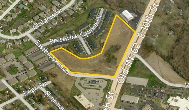
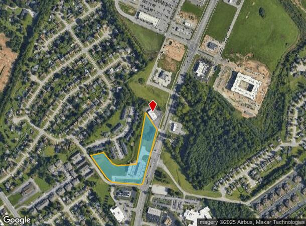
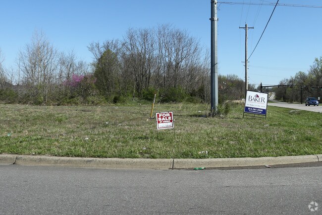
Property Record
3211 E 10Th St, Jeffersonville, IN 47130
NEARBY LISTINGS FOR SALE OR LEASE
Property Detail
3211 E 10Th St
10-19-02-200-815.000-009
GT 22--6.003 AC BY SUR
Conveniencestore
Clark
X
Indiana
18019C0279E
6 AC
2024
South Clark County
2024
Louisville
050603
Louisville-Jefferson County, KY-IN
5,195 SF
DEMOGRAPHICS near 3211 E 10Th St
1 Mile
3 Mile
5 Mile
2024 Total Population
10,898
46,268
107,472
2029 Population
11,586
49,330
112,808
Pop Growth 2024-2029
+ 6.31%
+ 6.62%
+ 4.97%
Average Age
39
40
41
2024 Total Households
4,604
19,203
45,878
HH Growth 2024-2029
+ 6.28%
+ 6.64%
+ 4.93%
Median Household Inc
$65,075
$62,382
$61,853
Avg Household Size
2.30
2.30
2.30
2024 Avg HH Vehicles
2.00
2.00
2.00
Median Home Value
$177,379
$174,649
$190,261
Median Year Built
1993
1986
1976
Nearby Places
Map Layers
Map Styles
 Street
 Aerial
- Restaurants
- Banks
- Shops
- Fitness
- Groceries
PUBLIC TRANSPORTATION
AIRPORT
Louisville Muhammad Ali International
DRIVE
WALK
Distance
Louisville Muhammad Ali International
24 min
13.9 mi
Freight Ports
Port of Toledo
DRIVE
WALK
Distance
Port of Toledo
349 min
302.4 mi
Nearby Properties
Address
Land Use
TOTAL SIZE
Lot Size
Zoning
Address
Land Use
TOTAL SIZE
Lot Size
Zoning
1,102,160 SF
65.70 AC
Address
Land Use
TOTAL SIZE
Lot Size
Zoning
13,240 SF
20.84 AC
Address
Land Use
TOTAL SIZE
Lot Size
Zoning
4,361 SF
18.18 AC
Address
Land Use
TOTAL SIZE
Lot Size
Zoning
620,000 SF
33.95 AC
Address
Land Use
TOTAL SIZE
Lot Size
Zoning
607,500 SF
34.89 AC
Address
Land Use
TOTAL SIZE
Lot Size
Zoning
52.78 AC
Address
Land Use
TOTAL SIZE
Lot Size
Zoning
4,402 SF
9.99 AC
Address
Land Use
TOTAL SIZE
Lot Size
Zoning
79,039 SF
26.39 AC
Address
Land Use
TOTAL SIZE
Lot Size
Zoning
507,456 SF
11.50 AC
Address
Land Use
TOTAL SIZE
Lot Size
Zoning
12.89 AC
Address
Land Use
TOTAL SIZE
Lot Size
Zoning
4,178 SF
10.39 AC
Address
Land Use
TOTAL SIZE
Lot Size
Zoning
Address
Land Use
TOTAL SIZE
Lot Size
Zoning
14,720 SF
13 AC
Address
Land Use
TOTAL SIZE
Lot Size
Zoning
8,752 SF
19.78 AC
Address
Land Use
TOTAL SIZE
Lot Size
Zoning
534,140 SF
33 AC
Address
Land Use
TOTAL SIZE
Lot Size
Zoning
2,208 SF
26.20 AC
Address
Land Use
TOTAL SIZE
Lot Size
Zoning
11,404 SF
19.68 AC
Address
Land Use
TOTAL SIZE
Lot Size
Zoning
136,949 SF
36.89 AC
Address
Land Use
TOTAL SIZE
Lot Size
Zoning
Address
Land Use
TOTAL SIZE
Lot Size
Zoning
256,500 SF
12.87 AC
Address
Land Use
TOTAL SIZE
Lot Size
Zoning
357,419 SF
26.60 AC
Address
Land Use
TOTAL SIZE
Lot Size
Zoning
128,269 SF
10.18 AC
Address
Land Use
TOTAL SIZE
Lot Size
Zoning
3,116 SF
16.22 AC
Address
Land Use
TOTAL SIZE
Lot Size
Zoning
Address
Land Use
TOTAL SIZE
Lot Size
Zoning
17.57 AC
Address
Land Use
TOTAL SIZE
Lot Size
Zoning
17,520 SF
12.62 AC
Address
Land Use
TOTAL SIZE
Lot Size
Zoning
56,775 SF
5.30 AC
Address
Land Use
TOTAL SIZE
Lot Size
Zoning
18,382 SF
47.44 AC
Address
Land Use
TOTAL SIZE
Lot Size
Zoning
541,291 SF
21.07 AC
Address
Land Use
TOTAL SIZE
Lot Size
Zoning
250,025 SF
20.88 AC
The World's #1 Commercial Real Estate Marketplace
Connect with us
© 2025 CoStar Group
The information above has been obtained from sources believed reliable. While we do not doubt its accuracy we have not verified it and make no guarantee, warranty or representation about it. It is your responsibility to independently confirm its accuracy and completeness. Any projections, opinions, assumptions, or estimates used are for example only and do not represent the current or future performance of the property. The value of this transaction to you depends on tax and other factors which should be evaluated by your tax, financial, and legal advisors. You and your advisors should conduct a careful, independent investigation of the property to determine to your satisfaction the suitability of the property for your needs.