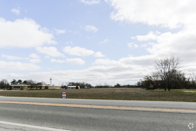
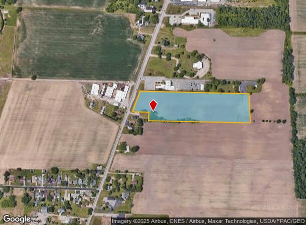
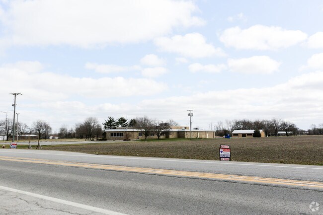
Property Record
3211 Hayes Ave, Sandusky, OH 44870
NEARBY LISTINGS FOR SALE OR LEASE
Property Detail
3211 Hayes Ave
32-01274-003
S3 EOFPIKE &N OF E OTTS LAND EX ETC 10.1641A 3 E SIDE SR 4 PT MITCHELL 1369A TR
Agriculturalland
Erie
X
Ohio
39043C0087D
10.16 AC
2024
Erie County
2024
Cleveland
041300
Sandusky, OH
DEMOGRAPHICS near 3211 Hayes Ave
1 mile
3 mile
5 mile
2024 Total Population
882
31,475
41,446
2029 Population
862
30,866
40,597
Pop Growth 2024-2029
(2.27%)
(1.93%)
(2.05%)
Average Age
43
41
43
2024 Total Households
361
13,269
17,669
HH Growth 2024-2029
(2.49%)
(2.04%)
(2.16%)
Median Household Inc
$53,750
$42,540
$46,784
Avg Household Size
2.40
2.20
2.20
2024 Avg HH Vehicles
2.00
2.00
2.00
Median Home Value
$153,153
$119,930
$142,780
Median Year Built
1963
1956
1960
Nearby Places
Map Layers
Map Styles
 Street
 Aerial
Transit
 Traffic
 Biking
Places
Listings with unknown addresses are not visible on the map
- Restaurants
- Banks
- Shops
- Fitness
- Groceries
PUBLIC TRANSPORTATION
COMMUTER RAIL
Sandusky Amtrak Station (Capitol Limited - Amtrak, Lake Shore Limited - Amtrak)
Drive
Walk
Distance
Sandusky Amtrak Station (Capitol Limited - Amtrak, Lake Shore Limited - Amtrak)
3 min
1.8 mi
Freight Ports
Port of Toledo
Drive
Walk
Distance
Port of Toledo
74 min
58.0 mi
SALE & LEASE HISTORY
LISTING DATE
SALE/LEASE

Mar 24, 2017
For Sale
Nearby Properties
Address
Land Use
TOTAL SIZE
Lot Size
Zoning
Address
Land Use
TOTAL SIZE
Lot Size
Zoning
66,569 SF
10.32 AC
Address
Land Use
TOTAL SIZE
Lot Size
Zoning
9,764 SF
14.87 AC
Address
Land Use
TOTAL SIZE
Lot Size
Zoning
163,634 SF
30.71 AC
Address
Land Use
TOTAL SIZE
Lot Size
Zoning
4,635 SF
84.11 AC
Address
Land Use
TOTAL SIZE
Lot Size
Zoning
19,208 SF
17.59 AC
Address
Land Use
TOTAL SIZE
Lot Size
Zoning
231,326 SF
128.66 AC
Address
Land Use
TOTAL SIZE
Lot Size
Zoning
56,460 SF
4.53 AC
Address
Land Use
TOTAL SIZE
Lot Size
Zoning
73,972 SF
12.23 AC
Address
Land Use
TOTAL SIZE
Lot Size
Zoning
101,567 SF
10.01 AC
Address
Land Use
TOTAL SIZE
Lot Size
Zoning
208,192 SF
24.39 AC
Address
Land Use
TOTAL SIZE
Lot Size
Zoning
26,358 SF
59.54 AC
Address
Land Use
TOTAL SIZE
Lot Size
Zoning
456,985 SF
65.44 AC
Address
Land Use
TOTAL SIZE
Lot Size
Zoning
17.56 AC
Address
Land Use
TOTAL SIZE
Lot Size
Zoning
109,181 SF
8.89 AC
Address
Land Use
TOTAL SIZE
Lot Size
Zoning
29,143 SF
13.73 AC
Address
Land Use
TOTAL SIZE
Lot Size
Zoning
3,623 SF
104.58 AC
Address
Land Use
TOTAL SIZE
Lot Size
Zoning
14,600 SF
1.98 AC
Address
Land Use
TOTAL SIZE
Lot Size
Zoning
46,295 SF
4.31 AC
Address
Land Use
TOTAL SIZE
Lot Size
Zoning
160,380 SF
15.76 AC
Address
Land Use
TOTAL SIZE
Lot Size
Zoning
66,923 SF
43.99 AC
Address
Land Use
TOTAL SIZE
Lot Size
Zoning
68,204 SF
5.36 AC
Address
Land Use
TOTAL SIZE
Lot Size
Zoning
26,644 SF
0.16 AC
Address
Land Use
TOTAL SIZE
Lot Size
Zoning
31,713 SF
9.18 AC
Address
Land Use
TOTAL SIZE
Lot Size
Zoning
36,400 SF
3.87 AC
Address
Land Use
TOTAL SIZE
Lot Size
Zoning
210,186 SF
35 AC
Address
Land Use
TOTAL SIZE
Lot Size
Zoning
3,379 SF
0.15 AC
Address
Land Use
TOTAL SIZE
Lot Size
Zoning
41,105 SF
2.65 AC
Address
Land Use
TOTAL SIZE
Lot Size
Zoning
61,254 SF
9.88 AC
Address
Land Use
TOTAL SIZE
Lot Size
Zoning
5.59 AC
Address
Land Use
TOTAL SIZE
Lot Size
Zoning
71,321 SF
3.60 AC
The World's #1 Commercial Real Estate Marketplace
Connect with us
© 2026 CoStar Group
The information above has been obtained from sources believed reliable. While we do not doubt its accuracy we have not verified it and make no guarantee, warranty or representation about it. It is your responsibility to independently confirm its accuracy and completeness. Any projections, opinions, assumptions, or estimates used are for example only and do not represent the current or future performance of the property. The value of this transaction to you depends on tax and other factors which should be evaluated by your tax, financial, and legal advisors. You and your advisors should conduct a careful, independent investigation of the property to determine to your satisfaction the suitability of the property for your needs.